- Waynesboro, Virginia
-
Waynesboro, Virginia — City — Downtown Waynesboro showing Main Street, as well as the scar on the mountain prior to being seeded. The Wayne Theater (now closed) is visible at the extreme left of the photo. Location of Waynesboro, Virginia
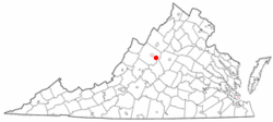
Coordinates: 38°4′12″N 78°53′40″W / 38.07°N 78.89444°WCoordinates: 38°4′12″N 78°53′40″W / 38.07°N 78.89444°W Country United States State Virginia Area – Total 15.4 sq mi (39.8 km2) – Land 15.4 sq mi (39.8 km2) – Water 0.0 sq mi (0.0 km2) Elevation 1,286 ft (392 m) Population (2010) – Total 21,006 – Density 1,364.0/sq mi (527.8/km2) Time zone Eastern (EST) (UTC-5) – Summer (DST) EDT (UTC-4) ZIP code 22980 Area code(s) 540 FIPS code 51-83680[1] GNIS feature ID 1500288[2] Waynesboro, deriving its name from General Anthony Wayne, is an independent city surrounded by Augusta County in the U.S. state of Virginia. The population was 21,006 in 2010.[3][4].
It is located in the Shenandoah Valley, near many important historical markers of the Civil War and Shenandoah National Park. A portion of Interstate 64 falls within the city limits of Waynesboro, and the Blue Ridge Parkway, Skyline Drive, and the Appalachian Trail are less than five miles away. The town is perhaps best known for being the home of P. Buckley Moss and the P. Buckley Moss Museum, which attracts 45,000 visitors annually. A large DuPont plant (now Invista and owned by Koch Industries) and the associated Benger Laboratory where Lycra (spandex) was invented, as well as a large textile mill called Wayn-Tex (now owned by Mohawk Industries), were significant employers for residents through much of the 20th century. Waynesboro is home to the corporate headquarters of Ntelos (a regional wireless and telecommunications company serving Virginia, West Virginia, North Carolina, Tennessee, Kentucky, and Ohio). Tourism, industrial production, and retail remain vital to the Waynesboro economy. The Generals of the Valley Baseball League play there.
Waynesboro is a principal city of the Staunton-Waynesboro micropolitan area, which includes all of Augusta County and the independent cities of Staunton and Waynesboro.
Contents
History
Located in the British Colony of Virginia, before the American Revolution and shortly thereafter independence and statehood for the Commonwealth of Virginia, the areas west of the Appalachian and Blue Ridge Mountains were known as the frontier. Travel over the mountains in a wagon was near impossible, except where nature afforded some gap between them. One such wind gap, Rockfish Gap, is located near Waynesboro, making the area a convenient location for a stop for many who wished to venture west.
The area was commonly referred to as Teasville (or Teesville) early on. There are a couple of theories of why it was called that. First, it was named after the tavern owned by Jacob Teas and his wife. It is believed that many stayed the night at the Teas’ tavern, including George Washington, Thomas Jefferson, and the Marquis de Chastellux. (It is only fair to point out that there are few taverns of this period in which Washington and Jefferson are not claimed to have visited). In a letter from the Marquis de Chastellux, the Marquis describes the tavern as one of the worst in America and affirms that Jefferson had stayed there and told him of the place. Second, it was names after the Tees brothers.
Shortly after U.S. Army General Anthony Wayne's important victory at Battle of Fallen Timbers in 1794 during the Northwest Indian War, the area began to be called Waynesborough. Since many settlers to the area were from Pennsylvania, it is not surprising that they would want their new land named after a hero from their home. Sometime after, it was called Waynesboro.
As early as 1798, the current downtown area was plotted and sold. On January 8, 1801, the town Waynesborough was officially recognized by the state of Virginia, and was incorporated by 1834.
Some of the remaining buildings from this period of its history include the Plumb House (now a museum open for tours seasonally) and the Coiner-Quesenbury House built in 1806, believed to be the first brick house built in the town, which is still standing on Main Street.
Population growth to the town was slow at first. In 1810, the town had a population of 250. By 1860, that number grew to 457. The town maintained a steady stream of visitors, however, due to its position on the Valley Turnpike, which took advantage of connections through Rockfish Gap.
On March 2, 1865, Waynesboro was the site of the last battle of the Civil War for the Confederate Lt. General Jubal A. Early. The Battle of Waynesboro lasted only 20 minutes, and was a final blow for the Confederate Army in the Shenandoah Valley. After losing this battle, Early relinquished the town and the valley to General Philip Sheridan. Some of the buildings from this period still show their scars from this battle.
After the war, the Waynesboro area became the junction of two railroad lines. The Chesapeake and Ohio Railway (running east to west) and the Shenandoah Valley Railroad, which soon became the Norfolk and Western Railway (running north to south). The lines met near Waynesboro, giving the town the nickname as the "Iron Cross".
 Map of Waynesboro as it appeared in 1891
In 1890, land to the east of Waynesboro was plotted and sold. Within that year, the Town of Basic City was incorporated. A rivalry soon developed between the two towns, each attempting to best the other as the more developed area. One important difference between the two was that Waynesboro had been a "dry" area since before the Civil War. This meant that no alcohol could be sold within the town’s borders. Such was not the case in Basic City, where bars were opened for the benefit of Basic’s citizens (as well as any others).
The two towns voted for and approved of consolidation into a single town to be called Waynesboro-Basic in 1923. Due to the duplicitous actions of some of Waynesboro’s town leaders, namely Guy Branamen, the petition given to the state referred to the new town as merely Waynesboro. This became official in 1924, to the great outrage of the people of Basic City, which became one of the "Lost Towns" of Virginia.
Since 1924, Waynesboro has made numerous territorial acquisitions from areas of Augusta County through annexation and officially became an independent city in 1948. In 2005, Waynesboro established a new charter, repealing one in place since 1948.
Geography
Waynesboro is located at 38°4′11″N 78°53′40″W / 38.06972°N 78.89444°W (38.069874, -78.894517)[5]. It is 1,305 feet above sea level.
According to the United States Census Bureau, the city has a total area of 15.4 square miles (40 km2), of which, 15.4 square miles (40 km2) of it is land and 0.04 square miles (0.10 km2) of it (0.13%) is water.
Demographics
As of the census[1] of 2000, there were 19,520 people, 8,332 households, and 5,432 families residing in the city. The population density was 1,270.8 people per square mile (490.7/km²). There were 8,863 housing units at an average density of 577.0 per square mile (222.8/km²). The racial makeup of the city was 86.46% White, 9.96% African American, 0.31% Native American, 0.57% Asian, 0.03% Pacific Islander, 1.09% from other races, and 1.57% from two or more races. Hispanic or Latino of any race were 3.29% of the population.
There were 8,332 households out of which 28.9% had children under the age of 18 living with them, 46.5% were married couples living together, 14.5% had a female householder with no husband present, and 34.8% were non-families. 30.1% of all households were made up of individuals and 11.9% had someone living alone who was 65 years of age or older. The average household size was 2.31 and the average family size was 2.85.
In the city the population was spread out with 23.9% under the age of 18, 7.9% from 18 to 24, 27.4% from 25 to 44, 23.2% from 45 to 64, and 17.6% who were 65 years of age or older. The median age was 39 years. For every 100 females there were 88.1 males. For every 100 females age 18 and over, there were 82.8 males.
The median income for a household in the city was $32,686, and the median income for a family was $40,772. Males had a median income of $30,943 versus $22,185 for females. The per capita income for the city was $17,932. About 11.0% of families and 12.8% of the population were below the poverty line, including 21.5% of those under age 18 and 6.0% of those age 65 or over.
Education
Waynesboro is the home of Fishburne Military School, an all male military boarding school for grades 8-12. It sits on a hill overlooking the downtown area.
The Waynesboro City Public Schools system serves the area.
Media
Waynesboro's local newspaper is The News Virginian.
Two movies have filmed scenes in Waynesboro: Toy Soldiers (1991)[6] and Evan Almighty (2007).[7]
See also
References
- ^ a b "American FactFinder". United States Census Bureau. http://factfinder.census.gov. Retrieved 2008-01-31.
- ^ "US Board on Geographic Names". United States Geological Survey. 2007-10-25. http://geonames.usgs.gov. Retrieved 2008-01-31.
- ^ [1]. 2010 U.S. Census Data: Virginia. Retrieved February 16, 2011
- ^ [2]. Weldon Cooper Center 2010 Census Count Retrieved September 8, 2011
- ^ "US Gazetteer files: 2010, 2000, and 1990". United States Census Bureau. 2011-02-12. http://www.census.gov/geo/www/gazetteer/gazette.html. Retrieved 2011-04-23.
- ^ "Filiming locations for Toy Soldiers", www.imdb.com
- ^ Owens, Michael L. (April 25, 2006). "Welcome to Huntsville". The News Virginian. Archived from the original on February 10, 2008. http://web.archive.org/web/20080210015540/http://www.newsvirginian.com/servlet/Satellite?pagename=WNV/MGArticle/WNV_BasicArticle&c=MGArticle&cid=1137835569845. Retrieved March 14, 2009.
Further reading
- Hawke, George, A History of Waynesboro to 1900, Waynesboro Historical Commission, 1997
- Bowman, Curtis, Waynesboro Days of Yore: Volumes I and II, McClung Companies, Inc, Waynesboro, 1992
External links
Categories:- Cities in Virginia
- Staunton-Waynesboro micropolitan area
- Waynesboro, Virginia


Wikimedia Foundation. 2010.