- Joint Typhoon Warning Center
-

The Joint Typhoon Warning Center (JTWC) is a joint United States Navy – United States Air Force task force located at the Naval Maritime Forecast Center in Pearl Harbor, Hawaii. The JTWC is responsible for the issuing of tropical cyclone warnings in the North West Pacific Ocean, South Pacific Ocean and Indian Ocean for United States Department of Defense interests, as well as U.S. and Micronesian civilian interests within the command's area of responsibility (AOR). The JTWC provides support to all branches of the U.S. Department of Defense and other U.S. government agencies. Their products are intended for the protection of primarily military ships and aircraft as well as military installations jointly operated with other countries around the world.[1]
Contents
History
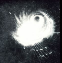 Radar image of Typhoon Cobra
The beginning of the formation of a typhoon warning center in the Pacific occurred in the wake of Typhoon Cobra on December 18, 1944. A small but significant typhoon east of the Philippines, Typhoon Cobra led to the largest naval disaster in United States history with 790 lives lost, and was the worst United States military loss from a tropical cyclone impact since 1889. Due to this typhoon, weather stations were established in Caroline Islands, and eventually in Manila, Iwo Jima, and Okinawa. New weather central offices (for coordinating data) were established at Guam and Leyte.[2] JTWC was originally established in 1959 at Nimitz Hill, Guam combined the efforts of the former naval centers located in Guam, Hawaii, and the Philippines with the Air Force center in Japan.[3] In November 1962, Typhoon Karen destroyed the building housing the Fleet Weather Center/Joint Typhoon Warning Center. It relocated in a more typhoon-proof building in 1965.[4] It was relocated to Pearl Harbor on January 1, 2000 due to the 1995 Base Realignment and Closure (BRAC) round.
Standards and practices
JTWC adheres to the World Meteorological Organization's (WMO) rules for storm names and adheres to acknowledged guidelines for intensity of tropical cyclones and tropical storms, with the exception of using the U.S. standard of measuring sustained winds for 1 min instead of the 10 min span recommended by the WMO (see Saffir-Simpson Hurricane Scale). The JTWC is not one of the WMO designated Regional Specialized Meteorological Centres, nor one of its Tropical Cyclone Warning Centres as its main mission is to support the United States Navy and remainder of the federal government. JTWC monitors, analyzes, and forecasts tropical cyclone formation, development, and movement year round.[5] Its area of responsibility covers more than 90% of the world's tropical cyclone activity.
Staffing
The Center is currently manned by 20 U.S. Air Force and Navy personnel. The JTWC uses several satellite systems and sensors, radar, surface and upper level synoptic data as well as atmospheric models to complete its mission.[1]
See also
- 2011 Pacific typhoon season
- 2011 North Indian Ocean cyclone season
- 2011–12 South-West Indian Ocean cyclone season
- 2011–12 Australian region cyclone season
- 2011–12 South Pacific cyclone season
- National Hurricane Center
- Central Pacific Hurricane Center
- Regional Specialized Meteorological Center
References
- ^ a b Joint Typhoon Warning Center. Joint Typhoon Warning Center Mission Statement. Retrieved on 2006-12-10.
- ^ Naval Historical Center. Typhoons and Hurricanes: Pacific Typhoon, 18 December 1944. Retrieved on 2006-12-10.
- ^ Richard Anstett. Post World War II Era. Retrieved on 2006-12-10.
- ^ Richard Anstett. JTWC Formation, 1958-1959. Retrieved on 2006-12-10.
- ^ Joint Typhoon Warning Center. Joint Typhoon Warning Center Frequently Asked Questions. Retrieved on 2006-12-10.
External links
Categories:- United States Navy organization
- Tropical cyclone meteorology
- 1959 establishments
- Governmental meteorological agencies in the Americas

Wikimedia Foundation. 2010.