- Muladi Upazila
-
Muladi
মুলাদি— Upazila — Location in Bangladesh
 Muladi
Coordinates: 22°54.9′N 90°24.9′E / 22.915°N 90.415°ECoordinates: 22°54.9′N 90°24.9′E / 22.915°N 90.415°E Country  Bangladesh
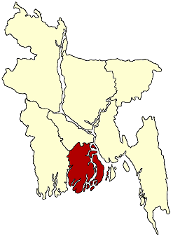
Division Barisal Division District Barisal District Area - Total 261.02 km2 (100.8 sq mi) Population (1991) - Total 171,948 - Density 659/km2 (1,706.8/sq mi) Time zone BST (UTC+6) Website Official Map of the Muladi Upazila Muladi (Bengali: মুলাদি) is an Upazila of Barisal District in the Division of Barisal, Bangladesh.
Contents
Geography
Muladi is located at 22°54′55″N 90°24′54″E / 22.9153°N 90.4150°E . It has 32515 units of house hold and total area 261.02 km².
Demographics
As of the 1991 Bangladesh census, Muladi has a population of 171948. Males constitute are 50.49% of the population, and females 49.51%. This Upazila's eighteen up population is 80369. Muladi has an average literacy rate of 31.4% (7+ years), and the national average of 32.4% literate.[1]
Administrative
Muladi has 7 Unions/Wards, 102 Mauzas/Mahallas, and 108 villages. It's also has a municipal area Around the Main City. There has One Hospital (Muladi Upazilla Hospital) and Two Private Clinic in Municipal Area. There are many Educational institutions in Muladi Upazila. Some of those are: Nazirpur United degree College, Nazirpur, Nazirpur High School, Nazirpur Girls School, Nazirpur Boro Bari Shikhon School-01,Nazirpur, Nazirpur Boro Bari Shikhon School-02,Nazirpur, Ramarpole Aferuddin Memorial High School(founded by Md.Abul Kasem Lal miah Mrida), Ramarpole,Muladi Degree College, Muladi M J high school, Muladi (Mohiuddin Jahangir was a student)'Bold text Muladi Islamia Senior Madrasha, Muladi.' A.B.R. High School, Alimabad ,Jagorani High School, Tayka,
Islamia Shishu Sadan (Orphanage) founded by Faruqe Ahmed at East Nazirpur ]], Banimordon High School(Banimordon),Banimordon Fazil Madrasa(banimordon),Banimordon Central Eidghaw, Joybangla Bazar, Hawladerbari Jame Mosjid.Banimordon.
See also
References
- ^ "Population Census Wing, BBS.". Archived from the original on 2005-03-27. http://web.archive.org/web/20050327072826/http://www.bangladeshgov.org/mop/ndb/arpc91_v1/tables04.htm. Retrieved November 10, 2006.
 Upazilas of the Barisal Division
Capital: Barisal Barguna District 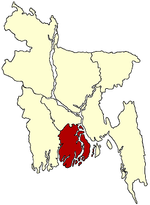
Barisal District Agailjhara · Babuganj · Bakerganj · Banaripara · Gaurnadi · Hizla · Barisal · Mehendiganj · Muladi · WazirpurBhola District Jhalokati District Patuakhali District Pirojpur District Categories:- Upazilas of Barisal District
- Barisal Division geography stubs

Wikimedia Foundation. 2010.