- Borsod-Abaúj-Zemplén County
-
Borsod-Abaúj-Zemplén County 
Coat of arms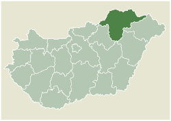
Country Hungary Region Northern Hungary County seat Miskolc Area - Total 7,247 km2 (2,798.1 sq mi) Population - Total 709,634 - Density 97.9/km2 (253.6/sq mi) Borsod-Abaúj-Zemplén (Hungarian pronunciation: [borʃod ɒbɒuːj zɛmpleːn]) is the name of an administrative county (comitatus or megye) in north-eastern Hungary (commonly called "Northern Hungary"), on the border with Slovakia. It shares borders with the Hungarian counties Nógrád, Heves, Hajdú-Bihar and Szabolcs-Szatmár-Bereg. The capital of Borsod-Abaúj-Zemplén county is Miskolc. Of the seven statistical regions of Hungary it belongs to the region Northern Hungary.
Borsod-Abaúj-Zemplén is the second largest county of Hungary both by area (after Bács-Kiskun) and by population (after Pest County).
Contents
Origins and meanings of name
The county bears the name of three historic counties of Hungary, each of them was centered around a castle.
- Borsod is named after the castle it belonged to. The castle was possibly named after its first steward, Bors (in old Hungarian language the -d suffix was a derivation suffix for place names, thus the name "Borsod" means "belonging to Bors".) The name bors itself is of Turkish origin and means "pepper" both in old and modern Hungarian language, though it is not used as a personal name any more. The castle itself was a motte castle, and stood near modern-day Edelény.
- Abaúj is a shortened form of the name of its castle, Abaújvár. The "Aba" part refers to the Aba clan which ruled the area in the middle age, while "új vár" means "new castle". The castle stood near the village of Abaújvár.
- Zemplén is named after its castle too. The name is derived from the Slovak word zem or the Slavic zemlja, meaning earth, soil, ground or country. The castle, like its name indicates, was a motte, its remnants can still be seen near the Slovakian village Zemplín.
Coat of arms and flag
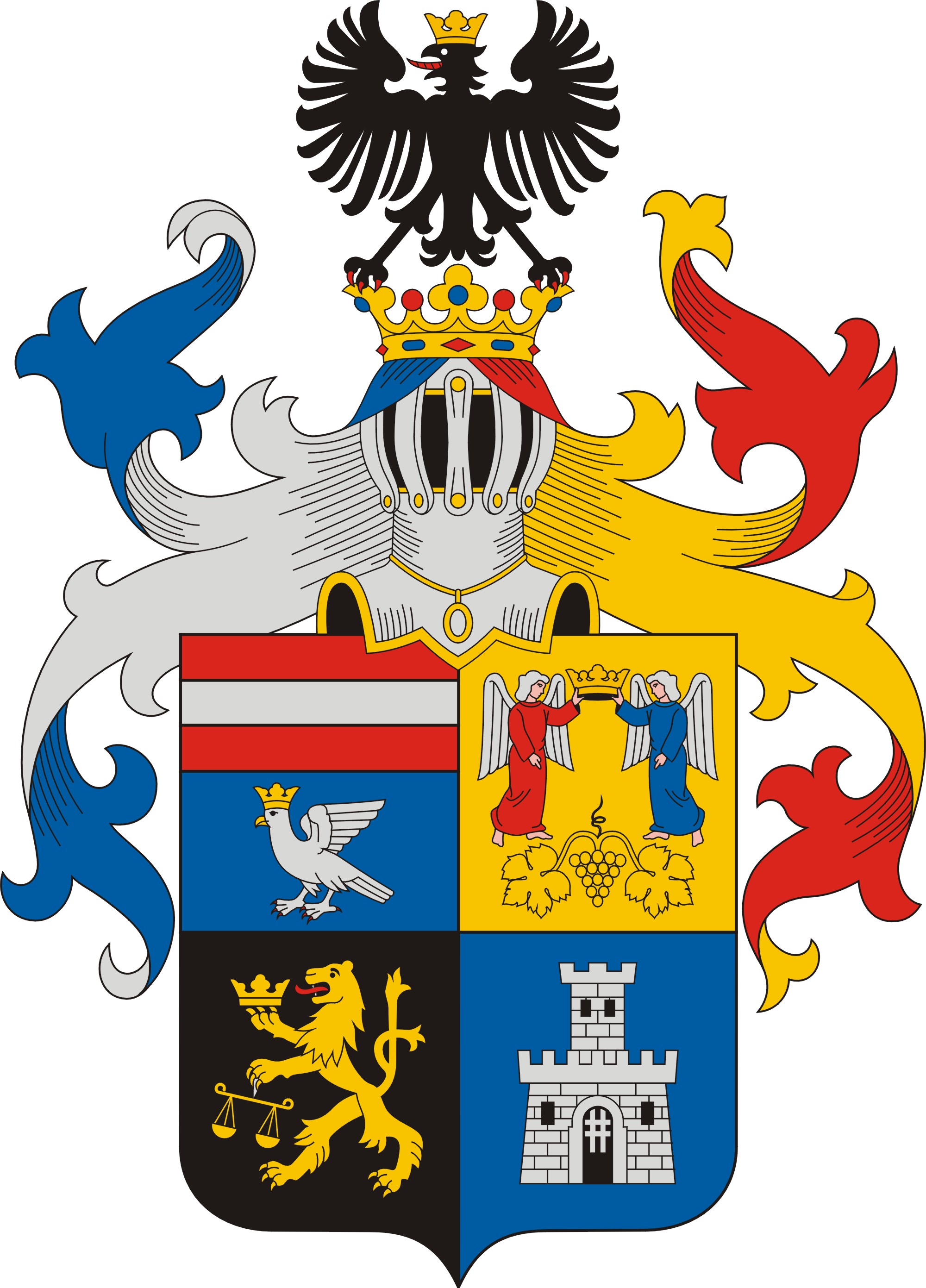
 The coat of arms
The county's coat of arms was created in 1991 from the coats of arms of the former counties now forming parts of Borsod-Abaúj-Zemplén. From left to right: Coat of arms of Abaúj-Torna county. – Coat of arms of Zemplén county. – Coat of arms of Borsod county. – Coat of arms of Gömör / Gömör-Kishont county[1] (with its red background color changed to the same blue as used in the coat of arms of Abaúj).
The flag is vertically divided into two equal sections (red and blue), with the coat of arms on it, and the county's name embroidered with gold thread under the coat of arms. Its ratio is 2:1. The use of both coat of arms and flag is regulated by the county council.[1]
Geography
Borsod-Abaúj-Zemplén is one of the most geographically diverse areas of Hungary. It lies where the Northern Mountains meet the Great Hungarian Plain, thus the northern parts of the county are mountainous – with some of the highest peaks and deepest caves in the country –, the southern parts are flat. The average temperature is lower than that of the country, the average humidity is higher (7–800 mm/year.) The region holds the country's record for lowest temperature: −35 °C (−31 °F), February 16, 1940, the town of Görömböly-Tapolca (now Miskolctapolca.)
Rivers
- Tisza, which forms a natural border between Borsod-Abaúj-Zemplén and Szabolcs-Szatmár-Bereg countries
- Sajó, a tributary to Tisza
- Bodrog, a tributary to Tisza
- Hernád, a tributary to Sajó
Highest points
- Istállós-kő, Bükk Mountains (959 m.)
- Nagy-Milic, Zemplén Mountains (894 m.)
Economy
Due to the emphasis on industrialization during the former Socialist regime and the county's richness in brown coal, Borsod-Abaúj-Zemplén has become one of the leading industrial regions of the country, "the Ruhr Area of Hungary". The most important centres of heavy industry were Miskolc, Ózd, Tiszaújváros and Kazincbarcika. With the fall of the Socialist regime the industry faced a crisis, and Borsod-Abaúj-Zemplén is among the counties that have the highest rate of unemployment and also the lowest rates of GDP per capita in Hungary.
40% of the area is arable land.
History
Borsod-Abaúj-Zemplén county was created after World War II from the pre-1938 counties Borsod-Gömör-Kishont, Abaúj-Torna and Zemplén (see also: 1950 Administrative Reform in Hungary).
From the Conquest until the Turkish occupation (900s–1526)
Before the Conquest of Hungary (late 9th century) the area was inhabited by Slavic tribes. The historical comitatus (Hungarian: vármegye – "castle county", since each of them belonged to a castle) came into existence during the Middle Ages. Borsod county belonged to the Castle of Borsod, Abaúj belonged to the Castle of Újvár (in the modern village of Abaújvár) and Zemplén belonged to the Castle of Zemplén (today in Slovakia.)
At this time the area of Borsod also included the later county Torna, and Abaúj also included the later counties Šariš and Heves. In the 12th century the former Abaúj comitatus was split into Abaúj, Heves and Sáros counties, while Torna was separated from Borsod. For the next hundreds of years the borders remained unchanged.
About two third of the areas of these counties were royal property, the others were ruled by clans, for example the Miskóc clan (after whom the city of Miskolc was named.) The area was inhabited mostly by castle serfs and foreign settlers (Pechenegs, Walloons, Czechs and Germans.) By the 12th century more and more areas were owned by noble families and the Church. Most of Borsod was ruled by the Bors-Miskóc clan, while Abaúj was the estate of the Aba clan.
By the 14th century most of the area was owned by oligarchs. King Charles Robert strengthened his rule by curbing the power of these oligarchs. One of his largest enemies, Amadé of the Aba clan was the de facto ruler of Northern Hungary. Charles Robert defeated Amadé in the Battle of Rozgony in 1312, and regained power over Northern Hungary.
The differences between towns and villages became important during the Anjou age of Hungary. In Borsod and Abaúj the Free Royal Town of Kassa (today's Košice, Slovakia) and Miskolc emerged as the most important towns. The Castle of Diósgyőr had its prime under Louis the Great, it was one of the favourite residences of the royal family.
In the 16th century wine growing gained more importance. Today Tokaj-Hegyalja in Zemplén is one of the most important and famous wine districts of Hungary, home of the famous Tokay wine (named after the town Tokaj, the centre of the wine district.)
From the Turkish occupation until the First World War (1526–1914)
After the battle of Mohács, as the Turks occupied more and more of the Southern territories of Hungary, the area of Borsod-Abaúj-Zemplén, as the northernmost part of the country, became an important area. After the Turkish occupation ended, and Hungary became part of the Habsburg empire, the area – because of its distance from Austria – was the main base of the resistance, and held this status until the Ausgleich ("Compromise"), when Hungary, formerly a mere province of the Empire, became an equal partner with Austria (1867). The family of Francis II Rákóczi (leader of the Revolution against Habsburg rule in the early 18th century) had estates here, and the revolution itself was organised from here.
The region also had cultural importance. The Reformation began its spreading in Hungary in this area, and the first Protestant college was opened in Sárospatak. Many of the important persons of the Age of Enlightenment grew up in this region, for example the important politicians Lajos Kossuth, Bertalan Szemere and László Pálóczy, and the language reformer Ferenc Kazinczy.
During the 18th century several towns bought their freedom from their feudal landowners. New guilds were formed, manufactures were built, mines were opened, glassworks and forges were built. Miskolc began to catch up with Kassa and take over the role as the leading city of the region, and because of this Borsod was the fastest developing county of the three counties. Lots of foreign settlers arrived, Slovakians, Greeks, Germans, Russians – even today there are whole villages with significant number of them. According to the census of 1787 Borsod, Abaúj and Zemplén had almost 500.000 inhabitants.
After the Ausgleich Northern Hungary – just like the other parts of the country – experienced an era of prosperity and fast development. New factories, railway lines were built, the population grew. In 1882 Abaúj county was merged with Torna, and was renamed Abaúj-Torna.
From 1914 to today
After World War I and the treaty of Trianon Hungary restored its northern parts to Czechoslovakia. Abaúj-Torna had to give up 48% of its area, 72% of Zemplén became part of Czechoslovakia, only Borsod remained fully within Hungary. The neighboring county of Gömör-Kishont retained 7.5% of its area, and remaining parts were merged with Borsod. The county seats were Miskolc (Borsod-Gömör-Kishont), Szikszó (Abaúj-Torna) and Sátoraljaújhely (Zemplén).
Under the First Vienna Award, arbitrated by Nazi Germany and Fascist Italy in direct consequence of Munich Dictate and dismemberment of Czechoslovakia, Hungary again established its control over Slovak territories. During World War II Kassa was the capital of Abaúj-Torna. After Allied Victory in Europe, the pre-1938 borders were reinstated. The administration of the country needed to be reverted to pre-war status quo, since most of the land grabs proved temporary. In 1950 the Hungarian parts of the former counties Borsod-Gömör-Kishont, Abaúj-Torna and Zemplén were united, forming the county of Borsod-Abaúj-Zemplén, with Miskolc being the county capital.
During the Socialist era the region was developed into the centre of heavy industry. Whole new towns came into existence in place of small villages (Tiszaújváros, Kazincbarcika), the industrial character of existing cities became more important (Miskolc, Ózd.) Urbanization was rapid, workers from all over the country were arriving in these cities and towns, and the population of Miskolc reached its highest level in the 1980s (around 211.000.) The end of the Socialist era and the recession of the 1990s hit hard, the unemployment rate is one of the highest of the country, and the local governments try to get over the crisis by strengthening the touristic potential. This seems to be a good idea, since Borsod-Abaúj-Zemplén is a geographically diverse area with rich natural and cultural treasures.
Regional structure
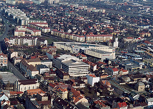 Aerial view of Miskolc
Borsod-Abaúj-Zemplén is the county of extremes: it is the home of the country's third largest city and second largest agglomeration, where one fourth of the county' population resides, on the other hand, the county is full of hamlets with population under 200. Borsod-Abaúj-Zemplén has 28 cities/towns (as of July 2009) and over 300 villages. With a total of 355 cities, towns and villages this county has the most municipalities in Hungary. Approximately half of the population lives in cities/towns.
See also List of towns in Hungary for more information on municipalities and administration of Hungary.
City with county rights
- Miskolc (county seat)
Cities/towns
(ordered by population, according to 2007 data)
- Ózd (37,040)
- Kazincbarcika (30,709)
- Mezőkövesd (17,216)
- Tiszaújváros (16,927)
- Sátoraljaújhely (16,882)
- Sárospatak (13,663)
- Sajószentpéter (12,758)
- Edelény (10,771)
- Szerencs (9,675)
- Putnok (7,263)
- Felsőzsolca (7,155)
- Encs (6,502)
- Mezőcsát (6,394)
- Alsózsolca (6,186)
- Szikszó (5,868)
- Tokaj (5,757)
- Emőd (5,300)
- Nyékládháza (4,993)
- Szendrő (4,286)
- Mezőkeresztes (4,275)
- Borsodnádasd (3,291)
- Abaújszántó (3,281)
- Cigánd (3,009)
- Sajóbábony (2,978)
- Rudabánya (2,781)
- Gönc (2,120)
- Pálháza (1,097)
Villages
Tourist sights
See also: Miskolc#Tourist sights- Castles
- Castle of Boldogkő
- Castle Cserépvár
- Castle of Dédes
- Castle of Diósgyőr
- Castle of Füzér
- Castle of Sárospatak
- Castle of Szerencs
- Nature
- Dripstone cave of Aggtelek
- Bükk National Park
- Lillafüred
Gallery
-
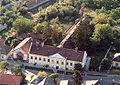
Erdőbénye – Mansion
-
Fáj – Mansion
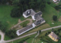
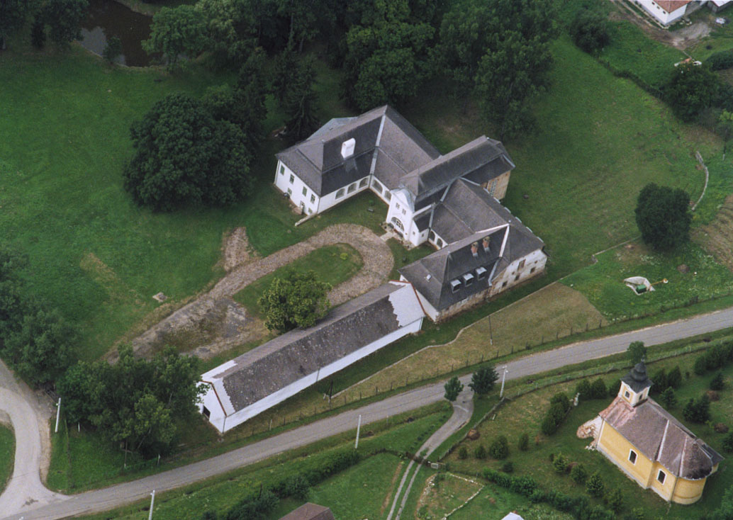
-
Aerial view: Girincs – Mansion
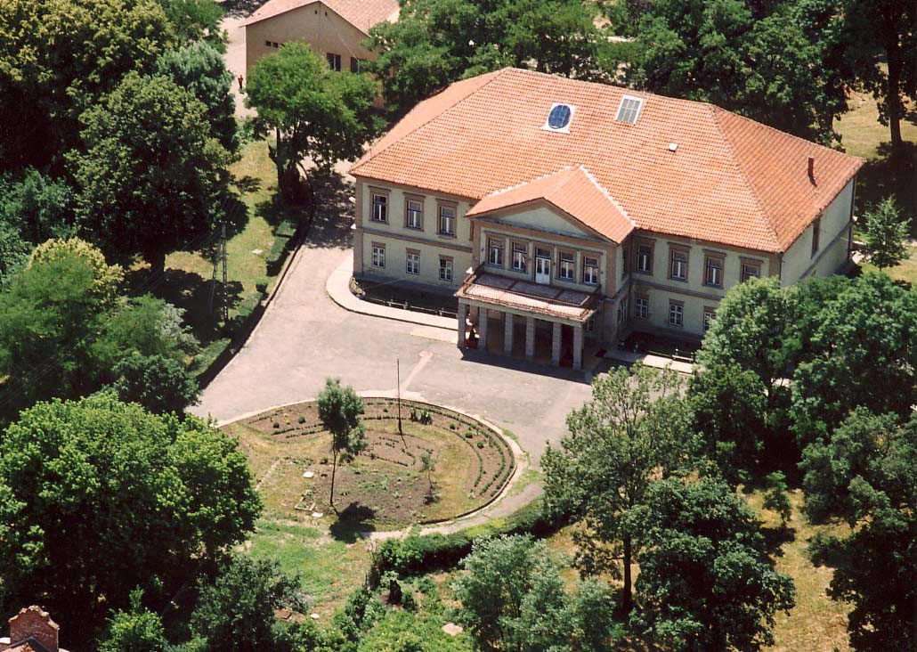
-
Golop – Mansion
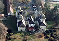
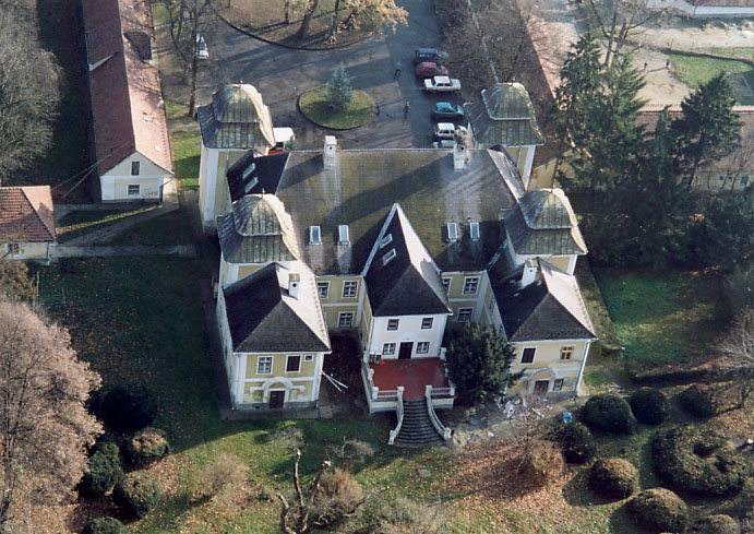
-
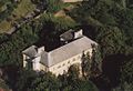
Aerial view: Hejce – Mansion
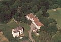
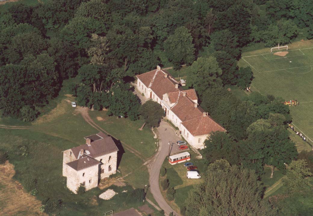
-

Kurityán – Mansion
-
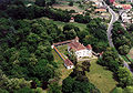
Pácin – Mansion
Sources
External links
Borsod-Abaúj-Zemplén County County seat: Miskolc Cities and towns Abaújszántó · Alsózsolca · Borsodnádasd · Cigánd · Edelény · Emőd · Encs · Felsőzsolca · Gönc · Kazincbarcika · Mezőcsát · Mezőkeresztes · Mezőkövesd · Nyékládháza · Ózd · Pálháza · Putnok · Rudabánya · Sajóbábony · Sajószentpéter · Sárospatak · Sátoraljaújhely · Szendrő · Szerencs · Szikszó · Tiszaújváros · Tokaj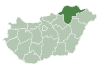
Villages Abaújalpár · Abaújkér · Abaújlak · Abaújszolnok · Abaújvár · Abod · Aggtelek · Alacska · Alsóberecki · Alsódobsza · Alsógagy · Alsóregmec · Alsószuha · Alsótelekes · Alsóvadász · Arka · Arló · Arnót · Aszaló · Ároktő · Baktakék · Balajt · Baskó · Bánhorváti · Bánréve · Becskeháza · Bekecs · Berente · Beret · Berzék · Bodroghalom · Bodroghalász · Bodrogkeresztúr · Bodrogkisfalud · Bodrogolaszi · Bogács · Boldogkőújfalu · Boldogkőváralja · Boldva · Borsodbóta · Borsodgeszt · Borsodivánka · Borsodszentgyörgy · Borsodszirák · Bódvalenke · Bódvarákó · Bódvaszilas · Bózsva · Bőcs · Bükkaranyos · Bükkábrány · Bükkmogyorósd · Bükkszentkereszt · Bükkzsérc · Büttös · Csenyéte · Cserépfalu · Cserépváralja · Csernely · Csincse · Csobaj · Csobád · Csokvaomány · Damak · Dámóc · Debréte · Dédestapolcsány · Detek · Domaháza · Dövény · Dubicsány · Egerlövő · Égerszög · Erdőbénye · Erdőhorváti · Fáj · Fancsal · Farkaslyuk · Felsőberecki · Felsődobsza · Felsőgagy · Felsőkelecsény · Felsőnyárád · Felsőregmec · Felsőtelekes · Felsővadász · Filkeháza · Fony · Forró · Fulókércs · Füzér · Füzérkajata · Füzérkomlós · Füzérradvány · Gadna · Gagyapáti · Gagybátor · Gagyvendégi · Galvács · Garadna · Gelej · Gesztely · Girincs · Golop · Gömörszőlős · Göncruszka · Györgytarló · Halmaj · Hangács · Hangony · Harsány · Háromhuta · Hegymeg · Hejce · Hejőbába · Hejőkeresztúr · Hejőkürt · Hejőpapi · Hejőszalonta · Hercegkút · Hernádbűd · Hernádcéce · Hernádkak · Hernádkércs · Hernádnémeti · Hernádpetri · Hernádszentandrás · Hernádszurdok · Hernádvécse · Hét · Hidasnémeti · Hidvégardó · Hollóháza · Homrogd · Igrici · Imola · Ináncs · Irota · Izsófalva · Jákfalva · Járdánháza · Jósvafő · Kács · Karcsa · Karos · Kánó · Kány · Kázsmárk · Kelemér · Kenézlő · Keresztéte · Kesznyéten · Kéked · Királd · Kiscsécs · Kisgyőr · Kishuta · Kiskinizs · Kisrozvágy · Kissikátor · Kistokaj · Komjáti · Komlóska · Kondó · Korlát · Kovácsvágás · Köröm · Krasznokvajda · Kupa · Kurityán · Lak · Lácacséke · Ládbesenyő · Legyesbénye · Léh · Lénárddaróc · Litka · Mád · Makkoshotyka · Mályi · Martonyi · Mályinka · Megyaszó · Meszes · Mezőnagymihály · Mezőnyárád · Mezőzombor · Méra · Mikóháza · Mogyoróska · Monaj · Monok · Muhi · Múcsony · Nagybarca · Nagycsécs · Nagyhuta · Nagykinizs · Nagyrozvágy · Négyes · Nekézseny · Nemesbikk · Novajidrány · Nyésta · Nyíri · Nyomár · Olaszliszka · Onga · Ormosbánya · Oszlár · Ónod · Pamlény · Parasznya · Pácin · Pányok · Pere · Perecse · Perkupa · Prügy · Pusztafalu · Pusztaradvány · Radostyán · Ragály · Rakaca · Rakacaszend · Rásonysápberencs · Rátka · Regéc · Répáshuta · Révleányvár · Ricse · Rudolftelep · Sajóecseg · Sajógalgóc · Sajóhidvég · Sajóivánka · Sajókápolna · Sajókaza · Sajókeresztúr · Sajólád · Sajólászlófalva · Sajómercse · Sajónémeti · Sajóörös · Sajópálfala · Sajópetri · Sajópüspöki · Sajósenye · Sajószöged · Sajóvámos · Sajóvelezd · Sály · Sárazsadány · Sáta · Selyeb · Semjén · Serényfalva · Sima · Sóstófalva · Szakácsi · Szakáld · Szalaszend · Szalonna · Szászfa · Szegi · Szegilong · Szemere · Szendrőlád · Szentistván · Szentistvánbaksa · Szin · Szinpetri · Szirmabesenyő · Szomolya · Szögliget · Szőlősardó · Szuhafő · Szuhakálló · Szuhogy · Taktabáj · Taktaharkány · Taktakenéz · Taktaszada · Tarcal · Tard · Tállya · Telkibánya · Teresztenye · Tibolddaróc · Tiszabábolna · Tiszacsermely · Tiszadorogma · Tiszakeszi · Tiszaladány · Tiszalúc · Tiszapalkonya · Tiszatardos · Tiszatarján · Tiszavalk · Tolcsva · Tomor · Tornabarakony · Tornakápolna · Tornanádaska · Tornaszentandrás · Tornaszentjakab · Tornyosnémeti · Trizs · Újcsanálos · Uppony · Vadna · Vajdácska · Varbó · Varbóc · Vatta · Vágáshuta · Vámosújfalu · Vilmány · Vilyvitány · Viss · Viszló · Vizsoly · Zalkod · Zádorfalva · Zemplénagárd · Ziliz · Zsujta · ZubogyOther topics History · Geography · Government · Economy · Culture · TourismCounties of Hungary Counties Bács-Kiskun · Baranya · Békés · Borsod-Abaúj-Zemplén · Csongrád · Fejér · Győr-Moson-Sopron · Hajdú-Bihar · Heves · Jász-Nagykun-Szolnok · Komárom-Esztergom · Nógrád · Pest · Somogy · Szabolcs-Szatmár-Bereg · Tolna · Vas · Veszprém · Zala
Urban counties Békéscsaba · Budapest (capital) · Debrecen · Dunaújváros · Eger · Érd · Győr · Hódmezővásárhely · Kaposvár · Kecskemét · Miskolc · Nagykanizsa · Nyíregyháza · Pécs · Salgótarján · Sopron · Szeged · Székesfehérvár · Szekszárd · Szolnok · Szombathely · Tatabánya · Veszprém · ZalaegerszegNUTS regions of Hungary NUTS 1 NUTS 2 NUTS 3 Bács-Kiskun · Baranya · Békés · Borsod-Abaúj-Zemplén · Budapest · Csongrád · Fejér · Győr-Moson-Sopron · Hajdú-Bihar · Heves · Jász-Nagykun-Szolnok · Komárom-Esztergom · Nógrád · Pest · Somogy · Szabolcs-Szatmár-Bereg · Tolna · Vas · Veszprém · ZalaCategories:


Wikimedia Foundation. 2010.