- Oregon Route 251
-
Oregon Route 251
Route information Maintained by ODOT Length: 0.76 mi (1.22 km) Existed: 2002 – present Major junctions West end: Port Orford Heads State Park East end:  US 101 in Port Orford
Highway system Oregon highways
Routes • Highways←  OR 250
OR 255  →
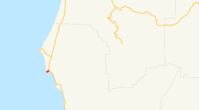
→Oregon Route 251 is an Oregon state highway running from Port Orford Heads State Park to Port Orford. OR 251 is known as the Port Orford Highway No. 251 (see Oregon highways and routes). It is 0.76 miles (1.22 km) long and runs east–west, entirely within Curry County and mostly within the Port Orford city limits.
OR 251 was established in 2002 as part of Oregon's project to assign route numbers to highways that previously were not assigned, and, as of August 2008, was unsigned.
Contents
Route description
OR 251 begins at the eastern boundary of Port Orford Heads State Park and heads east to Port Orford, ending at an intersection with US 101.
History
OR 251 was assigned to the Port Orford Highway in 2002.
Major intersections
Milepost City Intersection 0.00 Near Port Orford Begin Route 0.76 Port Orford US 101 See also
References
- Oregon Department of Transportation, Descriptions of US and Oregon Routes, http://www.oregon.gov/ODOT/HWY/TRAFFIC/TEOS_Publications/PDF/Descriptions_of_US_and_Oregon_Routes.pdf, page 28.
- Oregon Department of Transportation, Port Orford Highway No. 251, ftp://ftp.odot.state.or.us/tdb/trandata/maps/slchart_pdfs_1980_to_2002/Hwy251_2001.pdf
Categories:- State routes in Oregon
- Transportation in Curry County, Oregon


Wikimedia Foundation. 2010.