- Rob Roy, Indiana
Infobox Settlement
official_name = Rob Roy
settlement_type = Town
motto =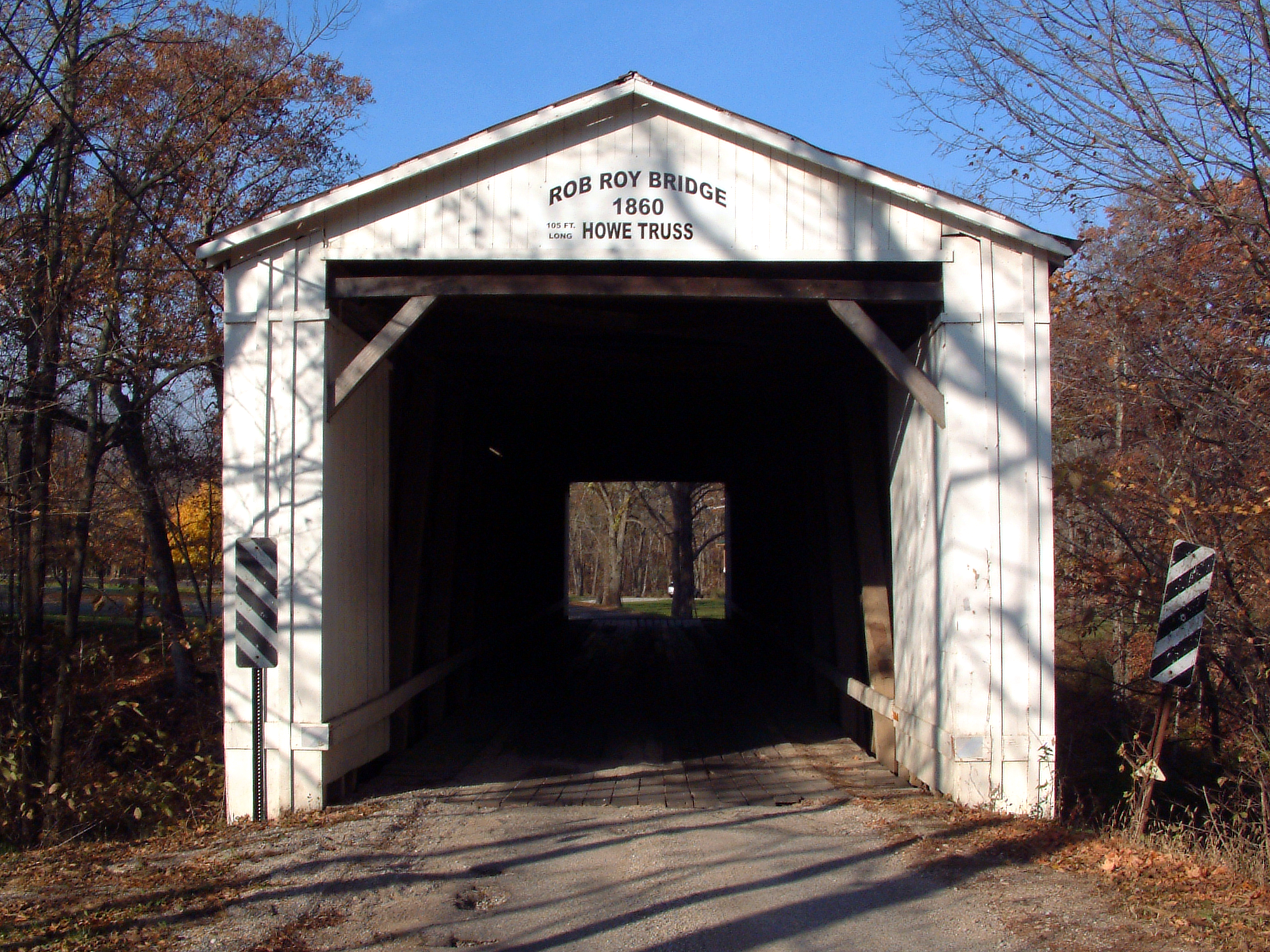
imagesize =
image_caption = Rob Roy's covered bridge.
mapsize =
map_caption =
mapsize1 =
map_caption1 =
image_dot_
dot_mapsize =
dot_map_caption =
dot_x =
dot_y =
pushpin_
pushpin_label_position =
pushpin_map_caption =
pushpin_mapsize =
subdivision_type = Country
subdivision_name =United States
subdivision_type1 = State
subdivision_name1 =Indiana
subdivision_type2 = County
subdivision_name2 = Fountain
subdivision_type3 = Township
subdivision_name3 = Shawnee
established_title =
established_date =
area_total_km2 =
area_land_km2 =
population_as_of =
population_footnotes =
population_note =
population_total =
timezone =
utc_offset =
timezone_DST =
utc_offset_DST =
latd = 40
latm = 14
lats = 12
latNS = N
longd = 87
longm = 14
longs = 36
longEW = W
elevation_footnotes = GR|3
elevation_ft = 659
founder =
named_for = Rob Roy
postal_code_type =ZIP code
postal_code = 47918
area_code =
blank_name = FIPS code
blank_info = 18-65178GR|2
blank1_name = GNIS feature ID
blank1_info = [http://geonames.usgs.gov/pls/gnispublic/f?p=gnispq:3:::NO::P3_FID:449720 449720]
website =
footnotes =Rob Roy is an unincorporated town in Shawnee Township, Fountain County,
Indiana .History
Rob Roy was named after the Scottish outlaw
Robert Roy MacGregor by local John I. Foster, a lover of literature who was especially fond ofWalter Scott 's novels. Foster, described as an inventor and a worker of iron, lived in Rob Roy for six or seven years and founded a Methodist church there.The town was platted around 1826 and contained 48 lots, with a further addition on the east side by Hiram Jones in 1829. A writer in 1833 described Rob Roy as a small interior village with few inhabitants but increasing in improvement and population; by 1836 it had "five dry goods stores and four groceries, a hotel, three physicians, and was in the center of a very active settlement." The passage of the Chicago and Block Coal Railway through the town also stimulated growth, but competition with nearby Attica (which was on the
Wabash and Erie Canal ) eventually led to Rob Roy's demise. [cite book
last = Beckwith
first = H. W.
title = History of Fountain County
year = 1881
publisher = H. H. Hill and N. Iddings
location = Chicago
pages = pp. 342-343
chapter = Shawnee Township ] [cite book
editor = Thomas A. Clifton
title = Past and Present of Fountain and Warren Counties, Indiana
year = 1913
publisher = B. F. Bowen & Co.
location = Indianapolis
pages =
chapter = ]The town today consists only of a small gathering of homes.
Geography
Rob Roy is located at coor dms|40|14|12|N|87|14|36|W|city, approximately three miles south of
Attica alongU.S. Route 41 . Big Shawnee Creek, spanned by acovered bridge , snakes along the north side of town and Little Shawnee Creek flows along the south. Theconfluence of the two is half a mile to the west.References

Wikimedia Foundation. 2010.