- Shire of Kingaroy
Infobox Australian Place | type = lga
name = Shire of Kingaroy
state = qld
imagesize= 135
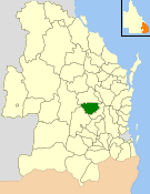
caption = Location withinQueensland
pop = 12,285
pop_footnotes = (2006 census) [Census 2006 AUS | id = LGA34350 | name = Kingaroy (S) (Local Government Area) | accessdate=2008-03-18|quick = on]
area = 2420.3
est = 1912
seat = Kingaroy
region =South Burnett

logosize = 101
url = http://www.kingaroy.qld.gov.au/
near-nw = Wondai
near-n = Wondai
near-ne = Murgon
near-e = Murgon
near-w = Chinchilla
near-sw = Wambo
near-s = Wambo
near-se = NanangoThe Shire of Kingaroy was a Local Government Area located in the
South Burnett region ofQueensland ,Australia , about convert|100|km|mi|0 northwest of the capital,Brisbane . The shire covered an area of convert|2420.3|km2|sqmi|1, and existed as a local government entity from 1912 until 2008, when it amalgamated with several other councils in the South Burnett area to become theSouth Burnett Regional Council .The shire's name derives from the Wakka Wakka Aboriginal words "king dhu'roi", meaning "ant hungry". While land use was dominantly pastoral in the area's early European history, dairying, beef, small crops and in particular peanut farming became mainstays of Kingaroy's economy.
History
Kingaroy was originally part of the Barambah (later Nanango) Divisional Board, which was created on 11 November 1879 under the "Divisional Boards Act 1879". With the passage of the "Local Authorities Act 1902", Nanango became a shire council on 31 March 1903.
The town of Kingaroy started to grow after the arrival of the railway in 1904, and on 12 January 1912, the Shire of Kingaroy was proclaimed.
On 15 March 2008, under the "Local Government (Reform Implementation) Act 2007" passed by the
Parliament of Queensland on 10 August 2007, the Shire of Kingaroy merged with the Shires of Murgon, Nanango and Wondai to form theSouth Burnett Regional Council .Towns and Localities
* Kingaroy
* Coolabunia
* Goodger
* Inverlaw
* Kumbia
* Memerambi
* Taabinga
* WooroolinPopulation
References
Wikimedia Foundation. 2010.