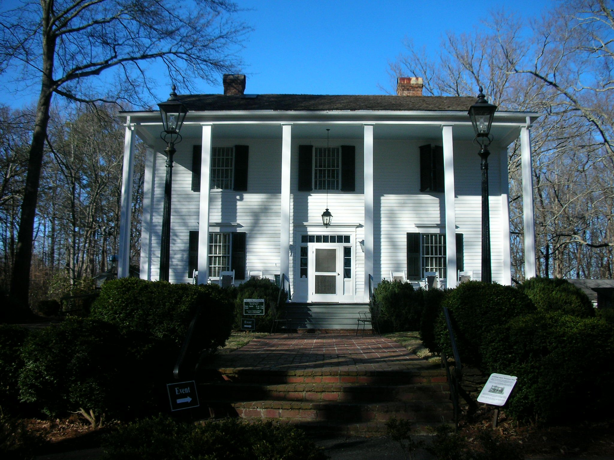
Archibald Smith Plantation Home
- Archibald Smith Plantation Home
Infobox_nrhp | name = Archibald Smith Plantation Home
caption =
locator_x =
locator_y =
location = Roswell, Fulton County, Georgia, USA
nearest_city =
lat_degrees =
lat_minutes =
lat_seconds =
lat_direction =
long_degrees =
long_minutes =
long_seconds =
long_direction =
built = 1845
added = August 30, 2006
governing_body =
architect= Gentry, Denny
refnum=06000740 [cite web|url=http://www.nr.nps.gov/|title=National Register Information System|date=2007-01-23|work=National Register of Historic Places|publisher=National Park Service] ]
The Archibald Smith Plantation Home is a plantation in Roswell, Georgia built in 1845. The home was built by Archibald Smith and housed three generations of his family. Arthur and Mary Smith restored the home in 1940.
The City of Roswell purchased the plantation and all its existing artifacts from the Smith family for US$125,000 and opened the facility for public display. In addition to the home, the grounds include a guest house, slave quarters, separate kitchen facility, carriage house, barn and water well. The plantation was added to the National Register of Historic Places in 2006. [ [http://www.ajc.com/metro/content/metro/northfulton/stories/2006/11/25/1126nfxsmithouse.html" 150 Years of History", Atlanta Journal-Constitution, November 26,2006, ZH1] ]
References
External links
* [http://www.archibaldsmithplantation.org/ Official Archibald Smith Plantation Home website]
Wikimedia Foundation.
2010.
Look at other dictionaries:
List of Registered Historic Places in Georgia, E-G — NOTOC Registered Historic Places in the U.S. state of Georgia.:: Georgia NRHP date for lists =Early County= * Blakely ** Blakely Court Square Historic District ** Early County Courthouse ** James And Clara Butler House ** Kolomoki Mounds * Hilton … Wikipedia
Roswell, Georgia — Infobox Settlement official name = Roswell, Georgia other name = native name = nickname = Roswell, GA settlement type = City motto = imagesize = image caption = flag size = image seal size = image shield = shield size = image blank emblem = blank … Wikipedia
Chapeltoun — Coordinates: 55°39′56″N 4°33′17″W / 55.66557°N 4.55484°W / 55.66557; 4.55484 … Wikipedia
United Kingdom — a kingdom in NW Europe, consisting of Great Britain and Northern Ireland: formerly comprising Great Britain and Ireland 1801 1922. 58,610,182; 94,242 sq. mi. (244,100 sq. km). Cap.: London. Abbr.: U.K. Official name, United Kingdom of Great… … Universalium
Eglinton Country Park — is a park located in the grounds of the old Eglinton Castle estate, Irvine, on the outskirts of Kilwinning, North Ayrshire, Scotland (map reference NS 3227 4220). Eglinton Park is situated in the parish of Kilwinning, part of the former district… … Wikipedia
United States — a republic in the N Western Hemisphere comprising 48 conterminous states, the District of Columbia, and Alaska in North America, and Hawaii in the N Pacific. 267,954,767; conterminous United States, 3,022,387 sq. mi. (7,827,982 sq. km); with… … Universalium
Robert E. Lee — This article is about the Confederate general. For other uses, see Robert E. Lee (disambiguation). Robert Edward Lee … Wikipedia
American literature — Introduction the body of written works produced in the English language in the United States. Like other national literatures, American literature was shaped by the history of the country that produced it. For almost a century and a… … Universalium
Clan MacAulay — This article is about the Clan MacAulay. For the unrelated clan from the Isle of Lewis, see Macaulay of Lewis Clan MacAulay Crest badge … Wikipedia
Nevis — For other uses, see Nevis (disambiguation). Nevis … Wikipedia