- Marchwood
-
This article is about the village in the UK. For the CDP in the USA, see Lionville-Marchwood, Pennsylvania.
Coordinates: 50°53′24″N 1°27′14″W / 50.890°N 1.454°W
Marchwood 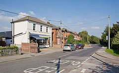
Main Road, Marchwood
 Marchwood
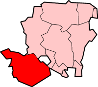
Marchwood shown within HampshirePopulation 5,586 [1] OS grid reference SU385102 Parish Marchwood District New Forest Shire county Hampshire Region South East Country England Sovereign state United Kingdom Post town SOUTHAMPTON Postcode district SO40 Dialling code 023 Police Hampshire Fire Hampshire Ambulance South Central EU Parliament South East England UK Parliament New Forest East List of places: UK • England • Hampshire  St. John's church, Marchwood

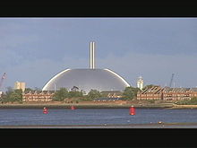 Marchwood incinerator dome
Marchwood is a village and civil parish located in Hampshire, United Kingdom. It lies between Totton and Hythe on the western shore of Southampton Water, next to the New Forest. The population of the village in the 2001 census was 5,586.[1]
Contents
History
Marchwood has seen human activity since Roman times. The Roman road from the Calshot/Lepe area passed through here on its way to Nursling (Onna as it was called).[2] Roman coins have been found at Bury Farm.[2]
The name "Marchwood" is most probably from the Old English "merecewudu" meaning "smallage wood" ("smallage" is a term for wild celery).[3] It is mentioned in the Domesday Book of 1086 as "Merceode", when the manor was held by Alwin, whose father Wulfgeat held the manor before 1066.[4]
The manor of Marchwood eventually became known as Marchwood Romsey.[5] John de Romsey held the vill of Marchwood in 1316. He was succeeded by Sir Walter Romsey of Rockbourne, who died in 1403–4 holding land in Marchwood.[5] The manor then passed in the same way as the manor of Romsey Horseys until the death of Thomas Horsey in 1477.[5]
John Romsey of Tatchbury died in 1494 holding the manor from John Horsey, as did his son, another John Romsey who died in 1503.[5] His son William Romsey sold the manor to Henry White. The manor passed from Robert White to his son William in 1564–5.[5] In 1587 William White sold the manor to Nicholas Venables. William Rickman died in possession of the manor in 1599, leaving his daughter Katherine wife of David Urry his heir.[5] A hundred years later David Urry, described as of St. James, Westminster, sold the manor to Gilbert Serle of Leghorn, and it subsequently passed to Sir William Oglander. The manor afterwards passed into the Saunders family.[5]
One other manor close to Marchwood was called Bury (also Newton Bury). It occurs in a deed of the 13th century as the "manor of Eling called Burylond." In the 16th century it was absorbed into Colbury manor, and it is now represented by Bury Farm just north of Marchwood.
Marchwood was at one time in the parish of Eling, and is situated in that part of the ancient parish which lies low at the mouth of the River Test, southeast of Eling village.[5] Cracknore, in Marchwood, is said to be the landing place of the ferry from Southampton long before the Hythe Ferry.[2] There was an important beacon site here at Beacon Hill, receiving and sending messages to both ends of the Isle of Wight.[2] Marchwood became a separate ecclesiastical parish in 1843, and a civil parish in 1894.[5] The church was built and endowed by Horatio Francis Kingsford Holloway in 1843.[5] By the beginning of the 20th century there were Government gunpowder magazines and a Metropolitan police barracks in Marchwood.[5]
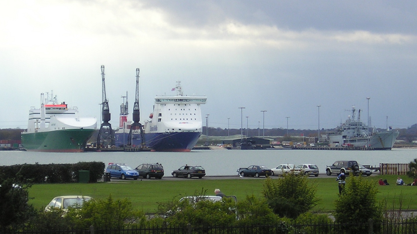
Marchwood Military Port was built here during World War II which played a vital role in the Normandy Landings.[6] The Royal Navy Ordnance Depot was where the famous Mulberry harbours were made.[2] The port continues to service Britain's overseas military interests.[6]
Industry
Despite being a village, Marchwood is the home of a refuse incinerator (and the remains of a previous incinerator), a sewage works, a large military port and a natural gas fuelled combined cycle power station [7] replacing an older station which was dismantled during the 1980s. The 842 megawatt facility is one of the most efficient generators of electricity in the UK at 58% fuel efficiency. Until privatisation, Marchwood was home to one of the three principal research facilities of the Central Electricity Generating Board (CEGB), concentrating on heavy plant - the other facilities were at Leatherhead and at Berkeley.
Facilities
The village has two schools, an infant school situated in Twiggs Lane and a junior school in the village centre. The nearest secondary school is Applemore College in Dibden Purlieu.
There are several shops in the village centre, including a branch of Co-op, a bakery, two take-aways, a pharmacy and hairdresser, as well as 3 pubs and a snooker hall.
Transport
 Marchwood railway station and level crossing gates, c.1996.
Marchwood is most easily accessed by road via the A326 road (Marchwood Bypass) which runs from the M27 motorway, past Totton, Marchwood and Hythe, as far as the village of Holbury. One bus route serves the village, going to Southampton via Totton in one direction and to Calshot and Fawley in the other. Marchwood railway station opened beside Main Road on 20 July 1925 but the station was closed by the Beeching Axe on 14 February 1966 and has remained closed since.[8] As of 2010, a set of manual level crossing gates are still used on Main Road.
Religion
Marchwood has four Christian churches. The Parish Church of St. John's; The Gospel Church; New Forest Community Church and Fijian church, which meets in the army estate, mainly for those from Fiji posted in the military houses and barracks. The churches are active in the community: The New Forest Community Church run a local coffee shop in the village centre, the "sweet soul cafe"; The Gospel Church runs a Holistic Spiritual Life Guidance surgery, and various youth and children's groups; and the Parish church has strong links with the local schools.
Sport
Marchwood is home to Southampton F.C.'s training ground. There is also Lloyds recreation ground which is home to a host of football clubs, as well as two tennis courts.
Twin settlements
It is twinned with the village of Saint-Contest, near Caen, Normandy, France.
References
- ^ a b "2001 Census Neighbourhood Statistics - Civil Parishes in the New Forest". www.neighbourhood.statistics.gov.uk. http://www.neighbourhood.statistics.gov.uk/dissemination/viewFullDataset.do;jsessionid=ac1f930c30d592f3f49c79b64fa1b9b4aa5a4f597a47?instanceSelection=03070&productId=779&$ph=60_61&datasetInstanceId=3070&startColumn=1&numberOfColumns=4&containerAreaId=790410. Retrieved 2011-07-10.
- ^ a b c d e Hampshire Treasures, Volume 5 (New Forest), Page 215 - Marchwood
- ^ Marchwood, Old Hampshire Gazetteer
- ^ Domesday Map - Marchwood
- ^ a b c d e f g h i j k Victoria County History, (1912), A History of the County of Hampshire: Volume 5, Eling
- ^ a b Marchwood: An unknown hero, BBC News, 16 April, 1999
- ^ Marchwood Power Limited
- ^ "Disused Stations". Subterranea Britannica. http://www.subbrit.org.uk/sb-sites/stations/m/marchwood.
External links
- Marchwood Parish Council
- Marchwood Fete
- Marchwood in the Domesday Book
- BBC News - Marchwood: An unknown hero
- Marchwood Guides
Towns, villages and hamlets in the New Forest District of Hampshire, England 
Allum Green | Applemore | Ashlett | Ashley | Ashurst | Bartley | Barton on Sea | Bashley | Beaulieu | Bisterne | Blashford | Blissford | Bolderwood | Boldre | Bramshaw | Bransgore | Breamore | Brockenhurst | Brook | Brookheath | Bucklers Hard | Burgate | Burley | Bull Hill | Cadnam | Calshot | Colbury | Copythorne | Crow | Damerham | Denny Lodge | Dibden | Dibden Purlieu | Downton | East Boldre | East End | East Hill | East Martin | East Mills | Emery Down | Ellingham | Everton | Exbury | Fawley | Fordingbridge | Fritham | Frogham | Furze Hill | Godshill | Gorley Lynch | Hale | Hale Park | Hale Purlieu | Hangersley | Harbridge | Hightown | Highwood | Hordle | Hungerford | Hyde | Hythe | Ibsley | Keyhaven | Lepe | Linbrook | Linford | Linwood | Lopshill | Lower Daggons | Lymington | Lyndhurst | Marchwood | Martin | Milford on Sea | Minstead | Mockbeggar | Netley Marsh | New Milton | Norley Wood | North Gorley | Ossemsley | Pennington | Picket Hill | Picket Post | Pilley | Portmore | Poulner | Ringwood | Rockbourne | Rockford | Sandford | Sandleheath | Shobley | Sopley | South Baddesley | South Gorley | Stuckton | Sway | Tinkers Cross | Tiptoe | Totton and Eling | Walhampton | Whitsbury | Whitsbury Common | Whitsbury Cross | Woodgreen | Woodlands
Categories:- New Forest
- Villages in Hampshire


Wikimedia Foundation. 2010.