- Cornard Tye
-
Coordinates: 52°02′13″N 0°46′26″E / 52.037°N 0.774°E
Cornard Tye 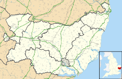
 Cornard Tye
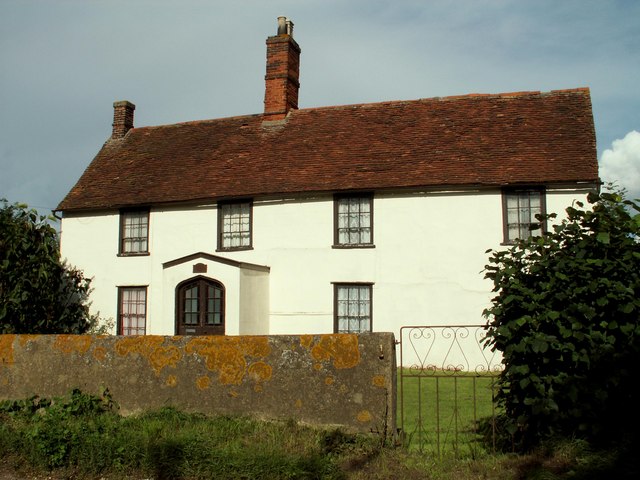
Cornard Tye shown within SuffolkOS grid reference TL904412 District Babergh Shire county Suffolk Region East Country England Sovereign state United Kingdom EU Parliament East of England List of places: UK • England • Suffolk  Farmhouse near Cornard Tye
Cornard Tye is a hamlet in Suffolk, England. Located off the A134 road between Sudbury and Colchester, it is part of the civil parish of Great Cornard and district of Babergh.
Babergh Towns Sudbury • HadleighCivil Parishes Acton · Aldham · Alpheton · Arwarton · Assington · Belstead · Bentley · Bildeston · Boxford · Boxted · Brantham · Brent Eleigh · Brettenham · Bures St Mary · Burstall · Capel St Mary · Chattisham · Chelmondiston · Chelsworth · Chilton · Cockfield · Copdock and Washbrook · East Bergholt · Edwardstone · Elmsett · Freston · Glemsford · Great Cornard · Great Waldingfield · Groton · Hadleigh (town) · Harkstead · Hartest · Higham · Hintlesham · Hitcham · Holbrook · Holton St Mary · Kersey · Kettlebaston · Lavenham · Lawshall · Layham · Leavenheath · Lindsey · Little Cornard · Little Waldingfield · Long Melford · Milden · Monks Eleigh · Nayland with Wissington · Nedging with Naughton · Newton · Pinewood · Polstead · Preston St Mary · Raydon · Semer · Shelley · Shimpling · Shotley · Somerton · Sproughton · Stanstead · Stoke by Nayland · Stratford St Mary · Stutton · Sudbury (town) · Tattingstone · Thorpe Morieux · Wattisham · Wenham Magna · Wenham Parva · Whatfield · Wherstead ·
WoolverstoneOther settlements Ash Street · Bower House Tye · Bridge Street · Broad Street · Burstallhill · Calais Street · Castling's Heath · Chelsworth Common · Cock Street · Cornard Tye · Cuckoo Tye · Dorking Tye · Drakestone Green · East End · Gosling Green · Hadleigh Heath · Honey Tye · Horner's Green · Humble Green · Kersey Tye · Kersey Upland · Lindsey Tye · Lower Holbrook · Lower Raydon · Mill Green · Naughton · Nayland · Nedging · Nedging Tye · Newman's Green · Parliament Heath · Polstead Heath · Priory Green · Rooksey Green · Rose Green, Assington · Rose Green, Lindsey · Round Maple · Sackers Green · Scotland Street · Smithwood Green · Swingleton Green · Sherbourne Street · Shop Corner · Stackyard Green · Stone Street · Tattingstone White Horse · Thorington Street · Upper Somerton · Washmere Green · Whelp Street · Whitestreet Green · Wicker Street Green · William's Green · Wissington · Washbrook · Washbrook Street · White Street Green · Withermarsh Green · Workhouse GreenBuildings: Abbas Hall · Flatford Mill · Kentwell Hall · Melford Hall · Milden Castle · St James's Chapel · Wattisham Strict Baptist Chapel · Willy Lott's Cottage · Woolverstone HallCategories:- Villages in Suffolk
- Babergh
- Suffolk geography stubs

Wikimedia Foundation. 2010.