- Meir, Staffordshire
-
For other uses, see Meir (disambiguation).
Coordinates: 52°58′40″N 2°06′18″W / 52.9779°N 2.1051°W
Meir Park 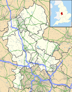
 Meir Park
Meir Park shown within StaffordshireOS grid reference SJ927427 Unitary authority Stoke-on-Trent Ceremonial county Staffordshire Region West Midlands Country England Sovereign state United Kingdom Post town Stoke-on-Trent Postcode district ST3 Dialling code 01782 Police Staffordshire Fire Staffordshire Ambulance West Midlands EU Parliament West Midlands UK Parliament Stoke-on-Trent South List of places: UK • England • Staffordshire Meir Park is a suburb in Stoke-on-Trent, Staffordshire situated between Lightwood and Longton.[1][2] Meir Park estate extends from Meir uphill to the Blythe Bridge village hall, which is actually located in Meir Heath.
Contents
Meir Aerodrome
Meir Aerodrome closed in the early 1970s[3] and the site has now become the Meir Park housing estate. The earlier parts have mainly aviation-associated street names. The last official flight was on 16 August 1973 when Fred Holdcroft flew a Piper Tri-Pacer carrying a Sentinel journalist to Manchester.[4] The last unofficial flight "a year or two" later by Eric Clutton was in a home-made folding machine called FRED (Flying Runabout Experimental Design) which the pilot towed home behind his car.[5][6] The light planes used to be parked on the grass alongside the A50 road, opposite the Airport Garage, which remains. Staffordshire Potteries had a factory (now demolished) beside the aerodrome.
Schools
- Crescent Primary School
- Longton High School
- Meir Heath Primary School
- Sandon High School
- St Augustine's R.C. Primary School
- Grange Primary School
Transport
Meir Park is situated along the A50. At the centre sits the crossroads with the A520. Once a notorious traffic jam site, a new tunnel was built which takes the A50 underneath. The twin tunnels are walled with ceramic panels which were reported to have cost about £1000 each when they began to come loose through rusting of their attachments after a few years[citation needed].
Meir was served by a railway station from 1894 to 1966.
Nearest Places
- Barlaston
- Blythe Bridge
- Lightwood
- Longton
- Trentham
References
- ^ Cartlidge, Nicholas Jon (1996). A Meir Half Century. Photographs and news both church and secular from the years 1889 to 1939 covering the Meir and its near neighbours. Leek: Churnet Valley Books. ISBN 1897949154.
- ^ Cartlidge, Nicholas (2004). Meir Today, Gone Tomorrow. An affectionate portrait from within living memory. Leek: Churnet Valley Books. ISBN 1904546226.
- ^ Lycett-Smith, Roger (1998). Airfield Focus 34: Stoke on Trent (Meir). Peterborough: GMS Enterprises. ISBN 1870384687.
- ^ Holdcroft, Geoff (9 May 2006). "My father made last flight from Meir". The Sentinel.
- ^ Cartlidge, Nicholas (15 May 2006). "FRED deserves flight accolade". The Sentinel.
- ^ Clutton, Eric (2003). An Aeroplane called FRED. Tullahoma, Tennessee.
Categories:- Areas of Stoke-on-Trent
- Staffordshire geography stubs

Wikimedia Foundation. 2010.