- Mount Evans Scenic Byway
-
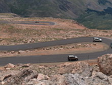 The Mount Evans Scenic Byway approaching the summit
The Mount Evans Scenic Byway begins at the junction of Interstate 70 and State Highway 103 near Idaho Springs, Colorado and continues on State Highway 5 through the Mount Evans Wilderness where it ends near the summit of Mount Evans. The byway is 28 miles (45 km) in length and gains over 7,000 feet (2,100 m) of elevation. Achieving a final elevation of 14,130 feet (4,310 m), this is the highest paved road in North America.
The road was originally planned by the Denver Mountain Parks system to link Summit Lake Park and Echo Lake Park to their lower altitude parks in the foothills. As originally planned, the road ran from Bergen Park near Evergreen to Echo Lake, and then to the summit, while the road from Echo Lake down into Chicago Creek Canyon was a secondary branch. From the start, the road was planned in terms of the scenic vistas along the way.[1] The route was set by Frederick Law Olmsted, Jr., and for a while, between 1915 and 1920, it was to be the primary access road for a proposed National Park comprising much of what is now the Mount Evans Wilderness Area.[2]
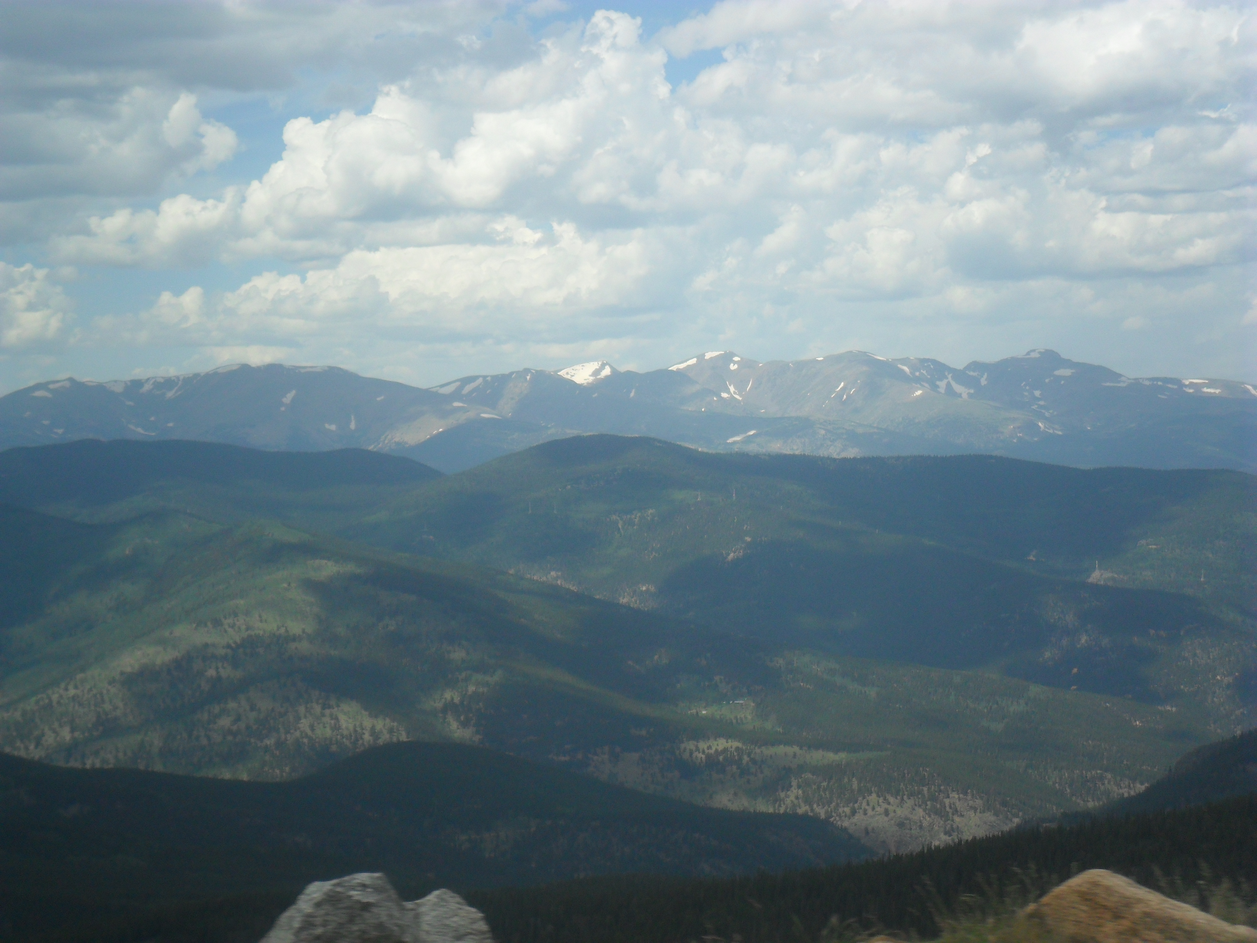
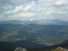 View from Mount Evans Scenic Byway looking north
There is a park fee charged to gain access to the upper portion of the byway at the entrance to Highway 5. This portion of the byway is often narrow, with sudden dropoffs that have no guardrails. It is typically only accessible from Memorial Day weekend through Labor Day, although the amount of access and specific dates vary depending on the weather and road conditions.
This route was designated a Forest Service Byway on July 1, 1993 by the US Forest Service and has also been designated a Colorado Scenic Byway by the Colorado Department of Transportation.
See also
References
- ^ J. E. Murphy, A Motor Road on the Skyline of America, Popular Mechanics Vol XXXI,(1919); page 280.
- ^ William Wyckoff, Creating Colorado: The Making of a Western American Landscape, 1860-1940, Yale University, 1999; pages 85-86
External links
- Mount Evans Scenic Byway (byways.org)
- Colorado Scenic Byways - Mount Evans
- MountEvans.com Scenic Byway
Protected Areas of the State of Colorado Federal National ParksNational MonumentsNational Recreation AreasNational Historic SitesNational Historic TrailsOld Spanish Trail · Pony Express Trail · Santa Fe TrailNational Scenic TrailContinental Divide TrailArapaho · Grand Mesa · Gunnison · Pike · Rio Grande · Roosevelt · Routt · San Isabel · San Juan · Uncompahgre · White RiverNational WildernessBlack Canyon of the Gunnison · Black Ridge Canyons · Buffalo Peaks · Byers Peak · Cache La Poudre · Collegiate Peaks · Comanche Peak · Dominguez · Eagles Nest · Flat Tops · Fossil Ridge · Great Sand Dunes · Greenhorn Mountain · Gunnison Gorge · Holy Cross · Hunter-Fryingpan · Indian Peaks · James Peak · La Garita · Lizard Head · Lost Creek · Maroon Bells-Snowmass · Mesa Verde · Mount Evans · Mount Massive · Mount Sneffels · Mount Zirkel · Neota · Never Summer · Platte River · Powderhorn · Ptarmigan Peak · Raggeds · Rawah · Sangre de Cristo · Sarvis Creek · South San Juan · Spanish Peaks · Uncompahgre · Vasquez Peak · Weminuche · West ElkNational Conservation AreasGunnison Gorge · McInnis CanyonsNational Wildlife RefugesAlamosa · Arapaho · Baca · Browns Park · Monte Vista · Rocky Flats · Rocky Mountain Arsenal · Two PondsState Arkansas Headwaters · Barr Lake · Bonny Lake · Boyd Lake · Castlewood Canyon · Chatfield · Cherry Creek · Cheyenne Mountain · Crawford · Eldorado Canyon · Eleven Mile · Golden Gate Canyon · Harvey Gap · Highline Lake · Jackson Lake · James M. Robb - Colorado River · John Martin Reservoir · Lake Pueblo · Lathrop · Lone Mesa · Lory · Mancos · Mueller · Navajo · North Sterling · Paonia · Pearl Lake · Ridgway · Rifle Falls · Rifle Gap · Roxborough · San Luis · Spinney Mountain · St. Vrain · Stagecoach · State Forest · Staunton · Steamboat Lake · Sweitzer Lake · Sylvan Lake · Trinidad Lake · Vega · Yampa RiverByers-Evans House · Colorado History Museum · El Pueblo · Fort Garland · Fort Vasquez · Georgetown Loop · Healy House Museum and Dexter Cabin · Pearce-McAllister Cottage · Pike Stockade · Trinidad History Museum · Ute Indian MuseumOther Beaver Meadows · Burlington Carousel · Black Hawk · Central City · Colorado Chautauqua · Cripple Creek · Durango-Silverton Railroad · Georgetown · Granada · Leadville · Lindenmeier Site · Lowry Ruin · Mesa Verde · Pikes Peak · Pike's Stockade · Raton Pass · Shenandoah-Dives Mill · Silver Plume · Silverton · Telluride · U.S. Air Force Academy Cadet AreaGarden of the Gods · Garden Park Fossil Area · Indian Springs Trace Fossil · Lost Creek Scenic Area · Morrison Fossil Area · Raton Mesa · Roxborough Park · Russell Lakes · Sand Creek · Slumgullion Earthflow · Spanish Peaks · Summit LakeAmerican Discovery Trail · Colorado Trail · Continental Divide Trail · Great Divide Trail · Kokopelli's Trail · Paradox Trail · Tabeguache TrailAlpine Loop · Cache la Poudre-North Park · Colorado River Headwaters · Dinosaur Diamond · Flat Tops · Frontier Pathways · Gold Belt · Grand Mesa · Guanella Pass · Highway of Legends · Lariat Loop · Los Caminos Antiguos · Mount Evans · Pawnee Pioneer · Peak to Peak · San Juan Skyway · Santa Fe Trail · Silver Thread · South Platte River Trail · Top of the Rockies · Trail of the Ancients · Trail Ridge · Unaweep/Tabeguache · West Elk LoopColorado Department of Natural Resources (web) Categories:- Transportation in Clear Creek County, Colorado
- Colorado Scenic Byways
- Visitor attractions in Clear Creek County, Colorado
- Forest Service Byways
- Colorado stubs

Wikimedia Foundation. 2010.