- Yalata, South Australia
Infobox Australian Place | type = town
name = Yalata
state = sa
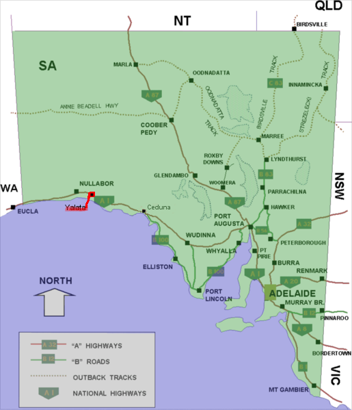
caption = Location of Yalata (red) on theEyre Highway in South Australia
lga = Aboriginal Council of Yalata, Ceduna DC
postcode =
pop = 100 [ [http://www.censusdata.abs.gov.au/ABSNavigation/prenav/LocationSearch?locationLastSearchTerm=Yalata&locationSearchTerm=Yalata&newarea=SSC45436&submitbutton=View+QuickStats+%3E&mapdisplay=on&collection=Census&period=2006&areacode=SSC45436&geography=&method=Place+of+Usual+Residence&productlabel=&producttype=QuickStats&topic=&navmapdisplayed=true&javascript=true&breadcrumb=PL&topholder=0&leftholder=0¤taction=104&action=401&textversion=false&subaction=1 Australian Bureau of Statistics (25 October 2007)] . Yalata (Urban Centre/Locality). "2006 Census Quickstats". Retrieved on2008 -05-25 ]
est = 1952
elevation = 90
maxtemp = 37.1
mintemp = 5.0
rainfall = 250
stategov = Flinders
fedgov = Grey
dist1 = 200
dir1 = west
location1= Ceduna
dist2 = 292
location2= Eucla
dist3 = 281
location3= WA-SA borderYalata (coord|31.480183|S|131.842241|E|region:AU-SA_type:city(100)) is an Aboriginal community located 200 kilometres west of Ceduna on the Great Australian Bight in South Australia.
History
The community consists mainly of
Anangu who lived in the spinifex country far to the north around Ooldea prior to their forcible removal to Yalata in 1952. In the 1950s areas aroundMaralinga and Emu were used for Atomic Testing by the British Government of the day. Around this time theAustralian Government resumed muchAnangu land to be used for theWoomera Rocket testing Range. As a result Anangu were moved to Ooldea in the first instance then later moved to the Yalata site. TheMaralinga Tjarutja native title land was handed back to the Anangu under legislation passed by both houses of the South Australian Parliament in December 1984 and proclaimed in January 1985. The Yalata Aboriginal lands cover 4,580 km² and span approximately 150 km of the Eyre Highway. InlandAnangu resettled on the land in 1995 and forming a community at Oak Valley (Maralinga). Regular movement ofAnangu between Yalata and Oak Valley occurs.Environment
The Atlas of South Australia describes Yalata area as:
sandy plain with deep sand and parabolic dunes. The vegetative cover is open mallee scrub with a mixed understory of chenopod shrubs and grasses and low open woodland with a chenopod shrub understory.
Demography
Anangu regard themselves as a Southern
Anangu people and speak a Southern dialect of thePitjantjatjara language. [cite web|url=http://www.yalata.org/|title=Yalata Land Management|accessdate=2006-05-18]The ABS 2006 Yearbook indicates that
Pitjantjatjara is spoken as the primary language in 58% of homes in Yalata [ [http://www.censusdata.abs.gov.au/ABSNavigation/prenav/ViewData?producttype=QuickStats&subaction=-1&areacode=SSC45436&action=401&collection=census&textversion=true&breadcrumb=LP&period=2006&navmapdisplayed=true& ABS 2006 Yearbook] "Retrieved on June 5th, 2008"] .82% of residents identify their main religion as Lutheran [ [http://www.censusdata.abs.gov.au/ABSNavigation/prenav/ViewData?producttype=QuickStats&subaction=-1&areacode=SSC45436&action=401&collection=census&textversion=true&breadcrumb=LP&period=2006&navmapdisplayed=true& ABS 2006 Yearbook] "Retrieved on June 5th, 2008"] .
Facilities
Yalata Roadhouse, 200 km west of Ceduna, was operated by Yalata Aboriginal Community Incorporated. There is also a caravan park to assist tourists passing through or visiting the
Great Australian Bight for fishing orwhale watching . [cite web |url=http://www.nullarbornet.com.au/towns/yalata.html |title=Yalata |publisher=Nullarbor Net |accessdate=2006-05-21] The roadhouse was closed in February 2006 [cite web |url=http://www.abc.net.au/news/australia/sa/port/200602/s1575583.htm |title=Lease issues close roadhouse |publisher=ABC |accessdate=2007-04-28] , and has no sign of being reopened.The lands of the Yalata bear their own name. A portion of these lands in South Australia's remote west, comprises Yalata, one of the four local government areas of South Australia classified as an Aboriginal Council (AC).
On
21 August 2007 , theAdelaide Advertiser reported that fire had overnight destroyed the shed-structure police station and associated home, with damage costing approximately $500,000 AUD in damage. [ [http://www.news.com.au/adelaidenow/story/0,22606,22280940-5006301,00.html "Fire destroys police station", Adelaide Advertiser, August 21, 2007] "Retrieved on August 21, 2007"]Governance
Yalata is governed at the local level by the Aboriginal Council of
Yalata , one of the four local government bodies in South Australia classified as Aboriginal Councils (AC). At the state and federal levels, Yalata lies in theelectoral district of Flinders and at thedivision of Grey , respectively.References
External links
* [http://www.lga.sa.gov.au/site/page.cfm?c=4199 Yalata Community]
* [http://www.atlas.sa.gov.au/go/resources/environments-of-south-australia/7/6/4 Atlas of South Australia]
Wikimedia Foundation. 2010.