- Oconee State Park
-
Oconee State Park 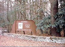
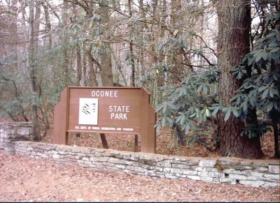
A picture of the sign at the entrance to the parkNearest city Mountain Rest, SC Coordinates 34°51′59.2″N 83°6′14.9″W / 34.866444°N 83.104139°WCoordinates: 34°51′59.2″N 83°6′14.9″W / 34.866444°N 83.104139°W Area 1,165 acres (4.7 km2) Created 1935[1] Camp sites Regular campsites, RV Campsites, and a set of campsites that require a hike in but are beside a lake Hiking trails Foothills Trail, western trailhead
Oconee Passage of the Palmetto TrailOther information Fishing lakes offer bream and bass
Chattooga and Chauga Rivers are in close proximity.[2]Oconee State Park is a state park located in the Blue Ridge Mountain region of South Carolina. This 1,165 acres (4.7 km2) park has several recreational opportunities to choose from. They include cabins, camping, fishing and boating in the two small lakes located on the park grounds, hiking on eight nature/hiking trails, and several picnic and meeting facilities.
The southern end of the Foothills Trail and the western end of the Oconee Passage of the Palmetto Trail are in Oconee State Park.
History
Oconee State Park was created by the Civilian Conservation Corps (CCC) in the 1930s. This park was created during the Great Depression when Franklin D. Roosevelt put men to work in civilian works projects. Some of the park buildings existing today were made by the CCC.[2]
References
External links
Piedmont Andrew Jackson · Baker Creek · Calhoun Falls · Chester · Croft · Dreher Island · Hamilton Branch · Hickory Knob · Kings Mountain · Landsford Canal · Lake Greenwood · Musgrove Mill · Rose Hill Plantation · Sadlers CreekSandhills Aiken State · Barnwell · Cheraw · Goodale · H. Cooper Black Jr. · Lake Wateree · Lee · Poinsett · Redcliffe Plantation · Santee · SesquicentennialCoastal Plain Charles Towne Landing · Colleton · Colonial Dorchester · Edisto Beach · Fort Frederick · Givhans Ferry · Hampton Plantation · Huntington Beach · Hunting Island · Lake Warren · Little Pee Dee · Myrtle Beach · Rivers Bridge · Woods BayFederal Charles Pinckney National Historic Site • Fort Sumter National Monument • Ninety Six National Historic SiteNational TrailsCape Romain • Carolina Sandhills • Ernest F. Hollings ACE Basin • Pinckney Island • Santee • Savannah • Tybee • WaccamawACE Basin • North Inlet-Winyah BayCape Romain • Congaree • Ellicott Rock • Hell Hole Bay • Little Wambaw Swamp • Wambaw Creek • Wambaw Swamp
State Andrew Jackson • Baker Creek • Barnwell • Caesars Head • Cheraw • Chester • Colleton • Devils Fork • Edisto Beach • Givhans Ferry • Goodale • Hickory Knob • Hunting Island • Huntington Beach • Jones Gap • Kings Mountain • Lake Warren • Landsford Canal • Lee • Little Pee Dee • Myrtle Beach • Oconee • Paris Mountain • Poinsett • Santee • Sesquicentennial • Table RockCharles Towne Landing • Colonial Dorchester • Hampton Plantation • Musgrove Mill • Oconee Station • Redcliffe Plantation • Rivers Bridge • Rose Hill PlantationAiken State Natural Area • Calhoun Falls State Recreation Area • Croft State Natural Area • Dreher Island State Recreation Area • Hamilton Branch State Recreation Area • Keowee-Toxaway State Natural Area • Lake Greenwood State Recreation Area • Lake Hartwell State Recreation Area • Lake Wateree State Recreation Area • Lee State Natural Area • Sadlers Creek State Recreation Area • Woods Bay State Natural AreaHarbison • Manchester • Poe Creek • Sand Hills • Wee TeeWildlife Management AreasBear Island Wildlife Management Area • Belfast Wildlife Management Area • Bonneau Ferry Wildlife Management Area • Campbell's Crossroads Wildlife Management Area • Crackerneck Wildlife Preserve • Donnelley Wildlife Management Area • Draper Wildlife Management Area • Edisto River Wildlife Management Area • Fant's Grove Wildlife Management Area • Gray Court Wildlife Management Area • Hickory Top Wildlife Management Area • James Ross Wildlife Reservation • Jim Timmerman Natural Resources Area • Keowee Wildlife Management Area • Mason Wildlife Preserve • McBee Wildlife Management Area • McConnells Tract Wildlife Management • Palachucola Wildlife Management Area • Pee Dee Wildlife Management Area • Samworth Wildlife Management Area • Santee-Delta Wildlife Management Area • Thurmond Wildlife Management Area • Turkey Creek Wildlife Management Area • Turtle Island Wildlife Management Area • Webb Wildlife Center/Preserve • Woodbury Wildlife Management Area • Worth Mountain Wildlife Management AreaCategories:- South Carolina state parks
- Protected areas of Oconee County, South Carolina
- Civilian Conservation Corps in South Carolina
Wikimedia Foundation. 2010.