- Shippea Hill railway station
-
Shippea Hill 
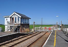
Shippea Hill railway station in 2010 Location Place Shippea Hill Local authority East Cambridgeshire Operations Station code SPP Managed by National Express East Anglia Number of platforms 2 Live arrivals/departures and station information
from National Rail EnquiriesAnnual rail passenger usage 2004/05 *  37
372005/06 *  26
262006/07 * 6062007/08 * 8452008/09 * 8682009/10 * 942History 1845 Opened (Mildenhall Road) 1885 Renamed (Burnt Fen) 1904 Renamed (Shippea Hill) National Rail - UK railway stations A B C D E F G H I J K L M N O P Q R S T U V W X Y Z * Annual passenger usage based on sales of tickets in stated financial year(s) which end or originate at Shippea Hill from Office of Rail Regulation statistics. Please note: methodology may vary year on year. Shippea Hill is a railway station in the county of Cambridgeshire, England. It was opened in 1845 as Mildenhall Road. In 1885, its name was changed to Burnt Fen, and finally in about 1904 to Shippea Hill.[1]
Shippea Hill is situated on the line between Ely and Norwich. According to 2003 Strategic Rail Authority figures, Shippea Hill was (and remains) one of the least-used railway stations in Great Britain with at one point just eleven passengers a year.[2] Passenger figures saw an increase on the 2004–05 report with 37 tickets being sold that either originated or exited the network at Shippea Hill. A surprising rally saw passenger usage increase seventyfold in 2007-2008 from the low of 2004.
Situated some distance away from any substantial settlement (although not many miles from Mildenhall) in a totally flat fen landscape, Shippea Hill in fact has no hill.
Despite not being within walking distance of any large settlement, most of the station's car park was closed and sold off after the Privatisation of British Rail.
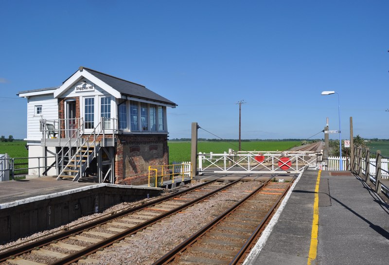
The level crossing adjacent to Shippea Hill Railway Station is not automated; the gates are opened and closed manually by Network Rail staff.
Contents
History
The station became infamous on 3 December 1976 when, at about 16.00, a passenger train collided with a lorry carrying carrots on an unmanned level crossing. The engine driver Robert (Bob) Hitcham was killed and several passengers were injured.
Services
Shippea Hill is currently served by one train per day Monday-Friday and two trains per day on Saturday.
Eastbound services go to Norwich and operate at 07:23 Monday-Saturday. Westbound services go to Cambridge and operate at 19:28 on Saturday only.
All services stop on request only, and there is no Sunday Service.
Despite the sparse service, Shippea Hill has seen a substantial increase in the number of passengers and is no longer one of the least used stations on the national network.
Preceding station  National Rail
Following station National Express East Anglia Monday-Saturday onlyReferences
External links
- Train times and station information for Shippea Hill railway station from National Rail
Coordinates: 52°25′48″N 0°24′47″E / 52.430°N 0.413°E
Railway accidents in 1976 Location and date Shippea Hill, England (3 December)
1975
 1977Categories:
- Railway stations in Cambridgeshire
- Archaeological sites in Cambridgeshire
- Former Great Eastern Railway stations
- Railway stations served by National Express East Anglia
- DfT Category F2 stations
- Level crossing accidents in the United Kingdom
- Railway accidents in 1976
- 1976 road accidents
- 1976 in England
- Railway accidents in England
- Road accidents in England
Wikimedia Foundation. 2010.