- Kamerik
Dutch town locator maps
mun_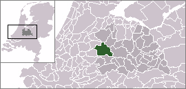
town_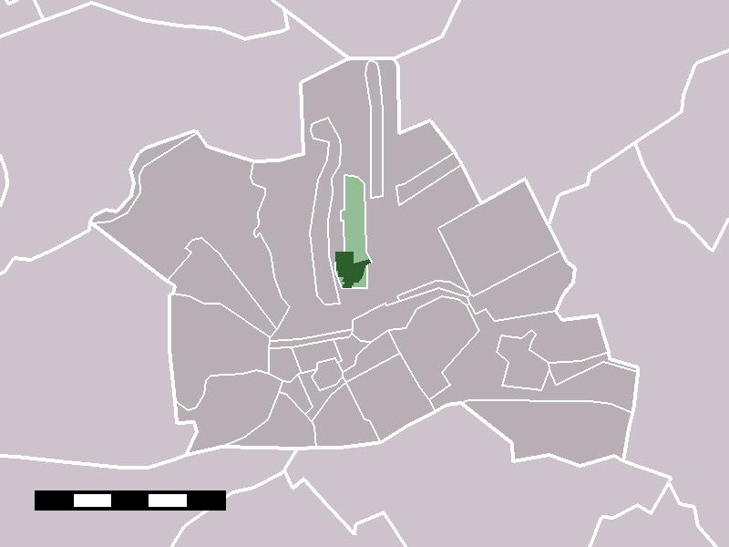
caption = The village of Kamerik (dark green) and the statistical district "Kamerik and Kanis" (light green) in the municipality of Woerden.Kamerik (coord|52|7|N|4|54|E|type:city(2421)) is a town in the Dutch province of Utrecht. It is a part of the municipality of
Woerden , and lies about 3 km north of Woerden.In 2001, the town of Kamerik had 2421 inhabitants. The built-up area of the town was 0.43 km², and contained 877 residences.Statistics Netherlands (CBS), "Bevolkingskernen in Nederland 2001" [http://www.cbs.nl/nl-NL/menu/themas/milieu-natuur-ruimte/ruimte/publicaties/cartografie-geografie/geografische-data/2001-bevolkingskernen-in-nederland.htm] . Statistics are for the continuous built-up area.] The statistical district "Kamerik and
Kanis ", which includes two villages and the surrounding countryside, has a population of around 3050.Statistics Netherlands (CBS), "Statline: Kerncijfers wijken en buurten 2003-2005" [http://statline.cbs.nl/] . As ofJanuary 1 ,2005 .] This does not include the separate villages ofKamerik-Mijzijde andOud-Kamerik .Until it was merged with Woerden in 1989, Kamerik was a separate municipality. Between 1818 and 1857, it was split into two municipalities:
Kamerik-Mijzijde on the west side, andKamerik-Houtdijken on the east. [Ad van der Meer and Onno Boonstra, "Repertorium van Nederlandse gemeenten", KNAW, 2006. [http://www.knaw.nl/cfdata/publicaties/detail.cfm?boeken__ordernr=20061061] ]References
Wikimedia Foundation. 2010.