- Maryland Route 286
-
Maryland Route 286
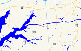
Route information Maintained by MDSHA Length: 2.09 mi[1] (3.36 km) Major junctions West end:  MD 537 in Chesapeake City
East end:  DE 286 at the Delaware state line
Location Counties: Cecil Highway system Maryland highway system
Interstate • US • State • Minor • Former • Turnpikes←  MD 285
MD 287  →
→Maryland Route 286 (MD 286) is a state highway in the U.S. state of Maryland. Known for most of its length as Bethel Road, the state highway runs 2.09 miles (3.36 km) from George Street, which is one of the segments of unsigned Maryland Route 537, east within Chesapeake City to the Delaware state line, where the highway continues east as Delaware Route 286 (DE 286). MD 286 roughly parallels the south side of the Chesapeake and Delaware Canal in southern Cecil County. MD 286 was constructed around 1930. The state highway originally served the lost community of Bethel near the state line, but was rerouted to the Delaware state line in the early 1960s due to expansion of the canal.
Contents
Route description
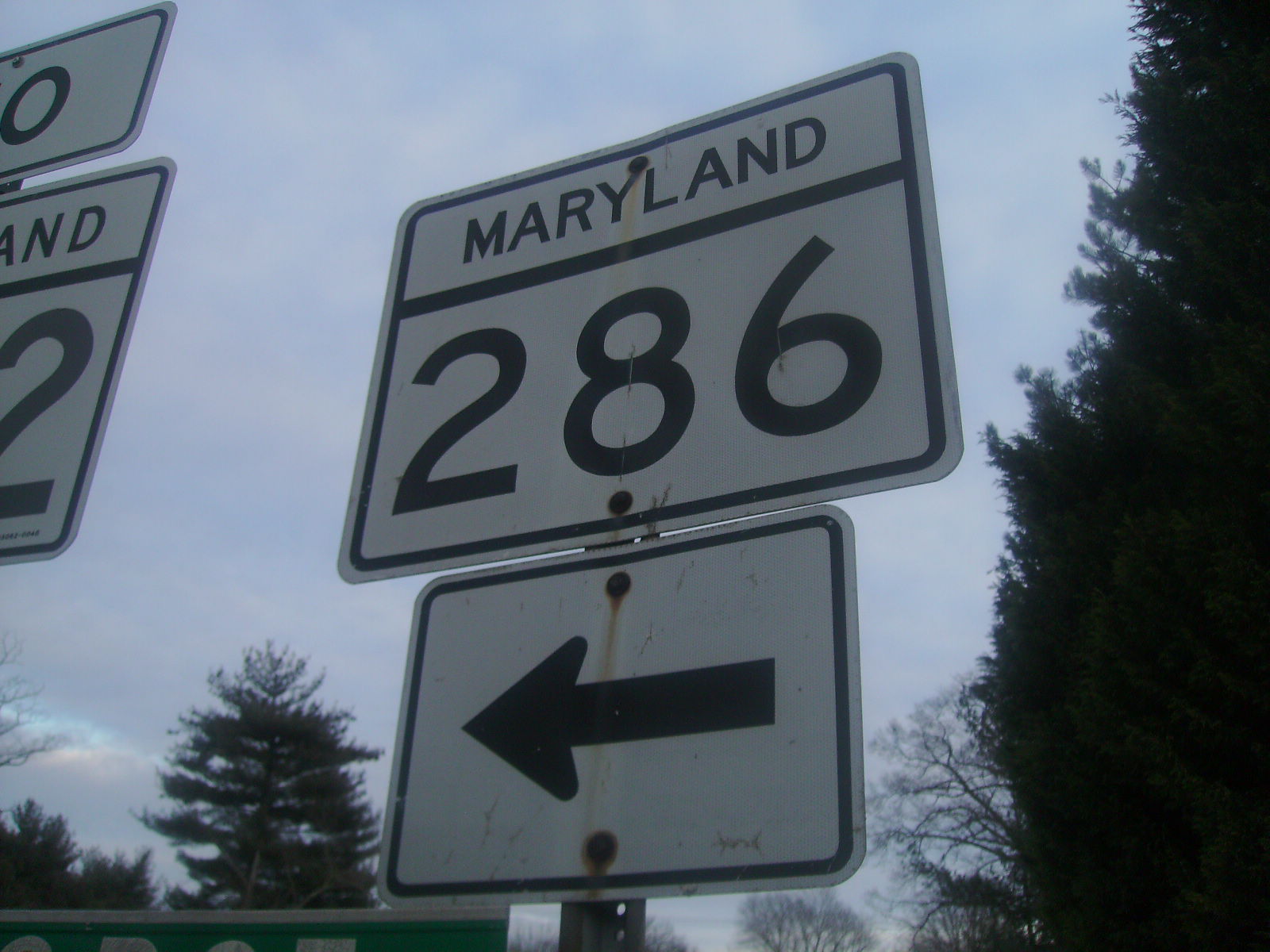
 Shield for MD 286 in Chesapeake City
MD 286 begins at an intersection with George Street (unsigned MD 537C) on the south side of Chesapeake City. The state highway heads east as two-lane 2nd Street through the South Chesapeake City Historic District. At Bohemia Avenue, MD 286 becomes Bethel Road and curves around the Back Creek Mooring Basin. After crossing Back Creek, the state highway makes a right-angle turn at the entrance to the Chesapeake and Delaware Canal Museum. MD 286 leaves the town limits of Chesapeake City and passes through a forested area along the south boundary of the Canal Wildlife Management Area. Shortly after the intersection with Bethel Cemetery Road, the old alignment of MD 286, the state highway reaches its eastern terminus at the Delaware state line. The highway continues east as DE 286 (Bethel Church Road).[1][2]
History
MD 286 originally connected Chesapeake City with Bethel, a small community on the south side of the Chesapeake and Delaware Canal just west of the state line. The state highway was paved from George Street, which is the original alignment of U.S. Route 213 (now MD 213), east along Bethel Road and then north along what is now Bethel Cemetery Road in 1930.[3] MD 286 was disconnected from US 213 when the Chesapeake City Bridge was completed in 1948 and George Street was designated MD 537C. Bethel was evacuated shortly before the Chesapeake and Delaware Canal was expanded in the 1960s. As a result, MD 286 was removed from Bethel Cemetery Road and extended east to the state line in 1961.[4] Bethel Church Road from the state line east to DE 15 was designated DE 286 around 1994.[5]
Junction list
The entire route is in Chesapeake City in Cecil County.
Mile[1] Destinations Notes 0.00 George Street / 2nd Street west Western terminus; George Street is unsigned MD 537C 1.84 Bethel Cemetery Road north / Old Telegraph Road south Bethel Cemetery Road is old alignment of MD 286 2.09 DE 286 east (Bethel Church Road)Eastern terminus; Delaware state line 1.000 mi = 1.609 km; 1.000 km = 0.621 mi References
- ^ a b c "Highway Location Reference: Cecil County" (PDF). Maryland State Highway Administration. 2009. http://www.marylandroads.com/Location/2009_CECIL.pdf. Retrieved 2010-10-13.
- ^ Google, Inc. Google Maps – Maryland Route 286 (Map). Cartography by Google, Inc. http://maps.google.com/maps?f=d&source=s_d&saddr=George+St&daddr=MD-286+E%2FBethel+Rd&hl=en&geocode=FaIjWwId4i57-w%3BFXYJWwIdkLd7-w&mra=ls&sll=39.525561,-75.775366&sspn=0.030388,0.077162&ie=UTF8&t=h&z=15. Retrieved 2010-10-13.
- ^ Maryland Geological Survey. Map of Maryland Showing State Road System: State Aid Roads and Improved County Road Connections (Map) (1930 ed.).
- ^ Maryland State Roads Commission. Maryland: Official Highway Map (Map) (1961 ed.).
- ^ Delaware Department of Transportation (PDF). Delaware Official Highway Map (Map) (1994 ed.). http://www.deldot.gov/archaeology/historic_pres/historic_highway_maps/pdf/cd_068.pdf. Retrieved 2010-10-13.
External links
Roads in Cecil County, Maryland State highways 
U.S. Highways Interstate Highways Categories:- State highways in Maryland
- Roads in Cecil County, Maryland


Wikimedia Foundation. 2010.