- Massachusetts Route 203
-
"Morton Street" redirects here. For the MBTA station, see Morton Street (MBTA station).
Route 203
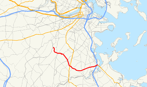
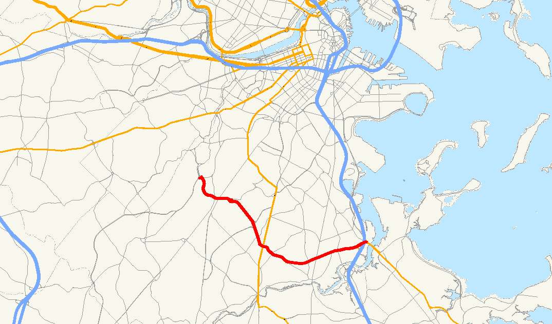
Route information Length: 5.18 mi[1] (8.34 km) Existed: early 1970s – present Major junctions West end: Centre Street in Jamaica Plain  Route 28, Blue Hill Avenue in Mattapan
East end: 


 I-93/US 1/Route 3/Route 3A in Dorchester
Highway system Massachusetts State Highway Routes
←  US 202
Route 213  →
→Route 203 is a 5.5-mile (8.9 km) state-numbered route in Boston, Massachusetts, United States, running from old U.S. Route 1 in Jamaica Plain east to Interstate 93/U.S. Route 1/Route 3 and Route 3A at Neponset. It runs along the Arborway, Morton Street and Gallivan Boulevard, all parkways formerly part of the Metropolitan District Commission system of parks and roads.
Maintenance
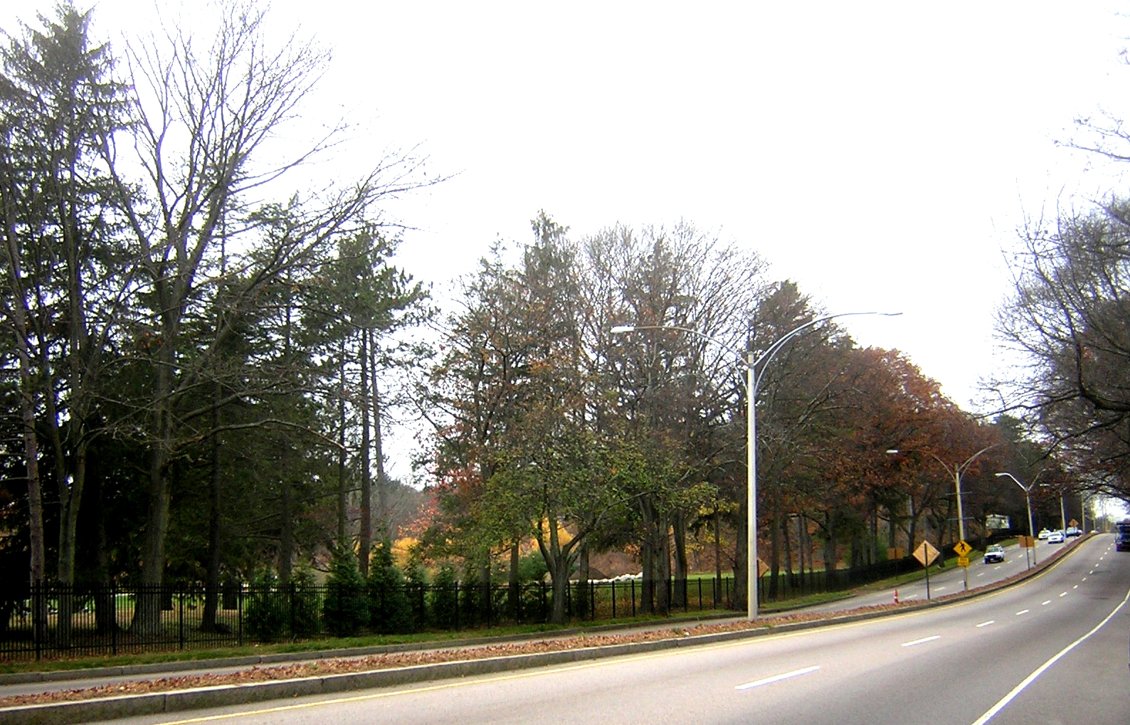
 Morton Street
Prior to the creation of the Massachusetts Department of Transportation (MassDOT) in 2009, the route was owned and maintained by the Department of Conservation and Recreation (DCR, previously the Metropolitan District Commission). On November 1, 2009, the Msgr. William Casey Highway overpass in Jamaica Plain, Morton Street in Mattapan and Gallivan Boulevard in Dorchester were transferred to MassDOT, while the Arborway continued under DCR.[2][3]
History
For more details on this topic, see Southern Artery.Route 203 was formed in the early 1970s as part of a large Boston-area renumbering. Most of the route had been part of Route 3, which came south along The Jamaicaway with U.S. Route 1 and split to the east along present Route 203. Route 3 turned south at Granite Avenue to join the Southeast Expressway in Milton, and Route 3A began where Route 3 turned. With the renumbering, Route 3 was kept on the Southeast Expressway into downtown, Route 3A was truncated to its current end, and the former Route 3 and Route 3A became Route 203. While the former routes had been signed north–south, the new route was signed east–west.
The only other change has been the removal of U.S. Route 1 from the west end of Route 203; it no longer ends at a numbered route at its west end.
References
- ^ Executive Office of Transportation, Office of Transportation Planning - 2005 Road Inventory
- ^ "Chapter 25 of the Acts of 2009 (Section 177)". The 186th General Court of The Commonwealth of Massachusetts. http://www.mass.gov/legis/laws/seslaw09/sl090025.htm. Retrieved 2009-11-05.
- ^ Pazzanese, Christina (September 12, 2009). "A big concern on two major parkways". The Boston Globe. http://www.boston.com/news/local/massachusetts/articles/2009/09/12/a_big_concern_on_two_major_parkways/. Retrieved 2009-11-05.
Streets Arborway · Atlantic Avenue · Beacon Street · Bennington Street · Bowdoin Street · Boylston Street · Brookline Avenue · Charles Street · Commonwealth Avenue · Congress Street · Court Street · Dorchester Avenue · Fenway · Gallivan Boulevard · Hanover Street · Huntington Avenue · Jamaicaway · Massachusetts Avenue · Melnea Cass Boulevard · Milk Street · Morrissey Boulevard · Morton Street · New Chardon Street · Newbury Street · North Street · Park Street · Riverway · School Street · State Street · Storrow Drive · Summer Street · Tremont Street · Union Street · Washington Street · Winter Street · Yawkey Way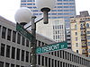
Squares, Circles,
Crossings and
CornersAndrew Square · Brigham Circle · Central Square · Chester Square · City Square · Cleveland Circle · Codman Square · Copley Square · Day Square · Dewey Square · Dock Square · Downtown Crossing · Dudley Square · Egleston Square · Fields Corner · Haymarket Square · Hyde Square · Jackson Square · Kenmore Square · Louisburg Square · Maverick Square · Packard's Corner · Park Square · Peabody Square · Post Office Square · Roxbury Crossing · Sullivan Square · Thompson Square · Union Square · Uphams CornerSee also: Neighborhoods in Boston · Transportation in Boston U.S. National Register of Historic Places Topics Lists by states Alabama • Alaska • Arizona • Arkansas • California • Colorado • Connecticut • Delaware • Florida • Georgia • Hawaii • Idaho • Illinois • Indiana • Iowa • Kansas • Kentucky • Louisiana • Maine • Maryland • Massachusetts • Michigan • Minnesota • Mississippi • Missouri • Montana • Nebraska • Nevada • New Hampshire • New Jersey • New Mexico • New York • North Carolina • North Dakota • Ohio • Oklahoma • Oregon • Pennsylvania • Rhode Island • South Carolina • South Dakota • Tennessee • Texas • Utah • Vermont • Virginia • Washington • West Virginia • Wisconsin • WyomingLists by territories Lists by associated states Other  Category:National Register of Historic Places •
  Portal:National Register of Historic Places
This article about a National Register of Historic Places listing in Suffolk County, Massachusetts is a stub. You can help Wikipedia by expanding it.