- Ogilvie Aerodrome
-
Ogilve Aerodrome IATA: FS4 – ICAO: none – TC LID: CFS4 Summary Airport type Public Operator Government of Yukon Location Ogilvie River, Yukon Elevation AMSL 1,640 ft / 500 m Coordinates 65°40′N 138°07′W / 65.667°N 138.117°WCoordinates: 65°40′N 138°07′W / 65.667°N 138.117°W Map Location in Yukon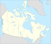
 CFS4
CFS4Runways Direction Length Surface ft m 01/19 2,500 762 Gravel Source: Canada Flight Supplement[1] Ogilve Aerodrome formerly Ogilvie River Aerodrome (IATA: FS4, TC LID: CFS4) is a registered aerodrome located near Ogilvie River in the Yukon, Canada and has a 50 ft (15 m) wide runway that receives no maintenance. During the late 60's early 70's the Canadian Forces used this strip as a place to offload equipment and supplies in the construction of the steel bridge over the Oglive River which was carried out by 3 Field Squadron Canadian Engineers stationed at CFB Chilliwack in British Columbia.
References
- ^ Canada Flight Supplement. Effective 0901Z 20 October 2011 to 0901Z 15 December 2011
Airports in Canada By name A–B · C–D · E–G · H–K · L–M · N–Q · R–S · T–ZBy location indicator CA · CB · CC · CD · CE · CF · CG · CH · CI · CJ · CK · CL · CM · CN · CO · CP · CR · CS · CT · CV · CW · CY · CZBy province/territory National Airports System Calgary · Charlottetown · Edmonton · Fredericton · Gander · Halifax · Iqaluit · Kelowna · London · Moncton · Montréal-Mirabel · Montréal-Trudeau · Ottawa · Prince George · Québec · Regina · Saint John · St. John's · Saskatoon · Thunder Bay · Toronto · Vancouver · Victoria · Whitehorse · Winnipeg · YellowknifeRelated List of airports by ICAO code: C · List of defunct airports in Canada · List of heliports in Canada · List of international airports in Canada · National Airports System · Operation Yellow RibbonCategories:- Airports in Yukon
- Canadian airport stubs
- Yukon geography stubs

Wikimedia Foundation. 2010.