- Gerringong railway station, New South Wales
Cityrail Station alt|station_name=Gerringong|
servicearea=South Coast Line|servicearea_color=#South Coast line colour|servicearea_textcolor=white
code=GOG|town=Gerringong|street=Grey St|distance=128.56|altitude=18|traintype=Intercity|platforms=1|tracks=1|platform_arr=1 Side|stationtype=Ground|gates=No|connect=None|disabled=Yes (Assisted)
facilities= [http://www.cityrail.info/facilities/facilities.jsp?n=107&giveOutput=true&facility= Link]Gerringong Railway Station is a
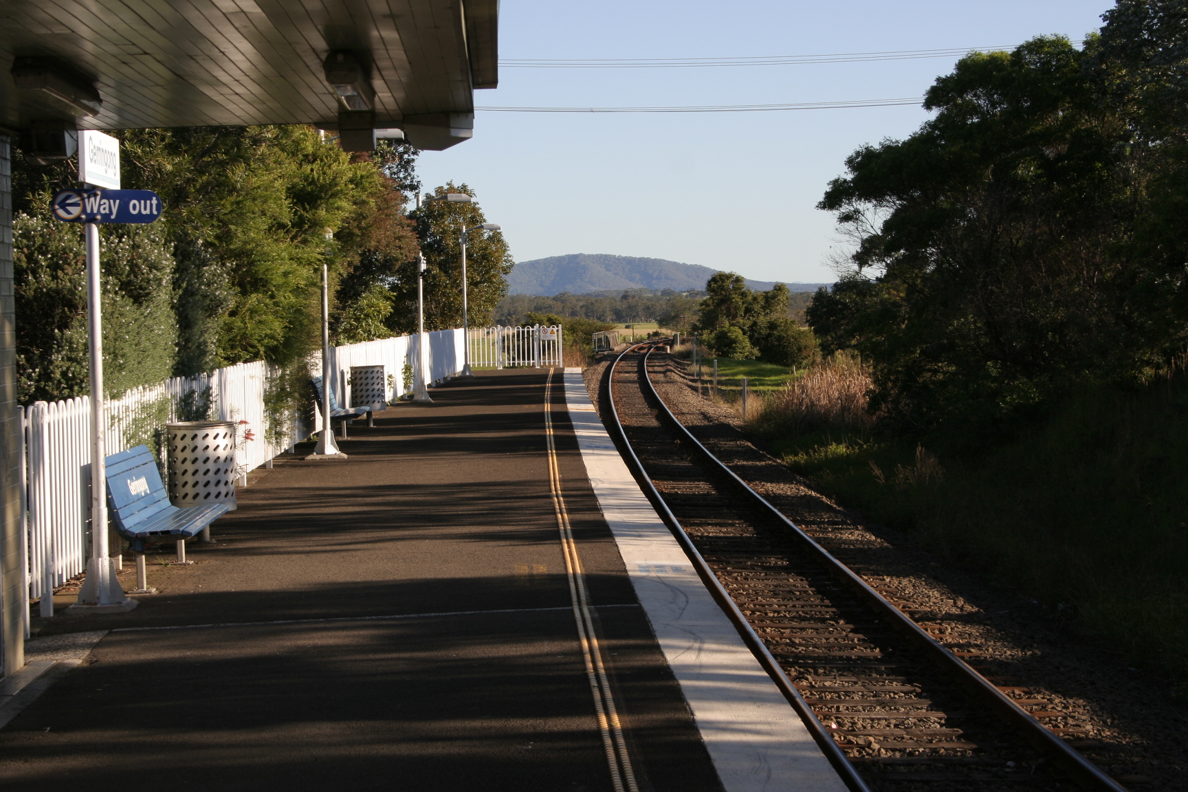
side platform ed regionalrailway station in the town of Gerringong, which is located in theIllawarra region ofNew South Wales ,Australia . Managed by Railcorp and run by its subsidiaryCityRail , the station is located on the intercity South Coast Line. [Rail Corporation New South Wales , " [http://www.cityrail.info/networkmaps/network_map.pdf "CityRail: Network Maps: Downloadable Network Map"] " (PDF). Accessed26 June ,2007 .] The station is located on Grey St, on the edge of Gerringong village, next to thePrinces Highway and the southern exit road from the town. [Location is at coord|150.817539|-34.744989|display=inline with postcode 2534.]Platforms/Service
Platform 1:
*South Coast line colour>South Coast Line - intercity services to Kiama; intercity services to Bomaderry (Nowra).Accessibility
Gerringong station has a side platform with near street level access. It therefore has close to
Easy Access for wheelchairs.Shunting
Gerringong used to have a siding for the Dairy Company, which consisted of a single lead trailing to Sydney bound trains. This meant that it was easy to shunt to pick up loaded wagons bound for Sydney, but not easy to leave empty wagons from Sydney.
A special method was therefore used to shunt the siding in the Nowra bound direction. The train would stop before the
turnout to the siding and both ends of the milk wagon(s) were uncoupled. The train would rush forward, giving the milk wagons a momentary tug, and as soon as the front part of the train had cleared the turnout, the turnout would be changed into the siding and the milk wagons would coast into the siding where the guard would apply the brakes at the appropriate time. The locomotive would then reverse to pick up the remainder of the train ["Milk, Gerringong and Shunting Facing Turnouts" Parker, Bruce Australian Railway Historical Society Bulletin, October, 1996 pp291-294] .ee also
*
References
Neighbouring stations
Wikimedia Foundation. 2010.