- Monongahela River
-
For other uses, see Monongahela (disambiguation).
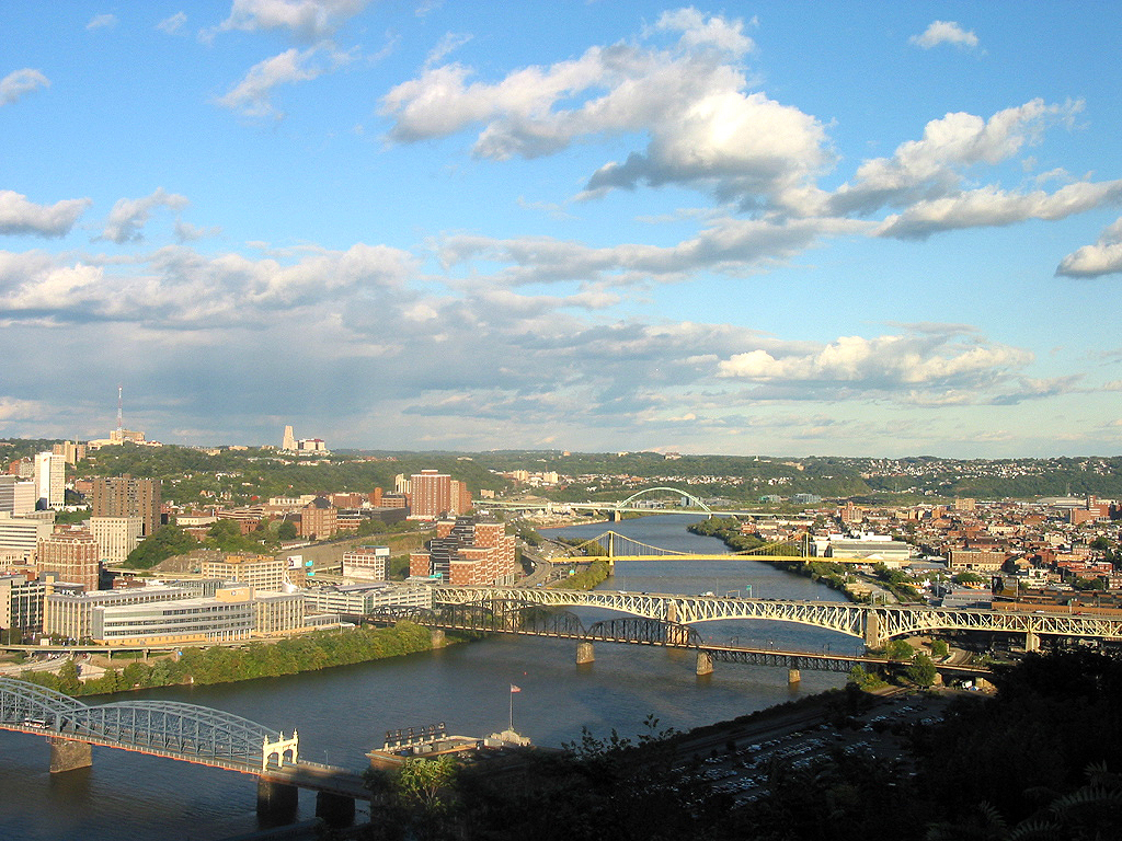
Monongahela River  The Monongahela River in Pittsburgh passing the South Side on the right and Uptown/The Bluff on the left just before entering Downtown Pittsburgh
Country United States States Pennsylvania, West Virginia Counties Marion WV, Monongalia WV, Greene PA, Fayette PA, Washington PA, Westmoreland PA, Allegheny PA Tributaries - right Cheat River, Youghiogheny River Source Tygart Valley River - location Pocahontas County, West Virginia - elevation 4,540 ft (1,384 m) [1] - coordinates 38°28′06″N 79°58′51″W / 38.46833°N 79.98083°W [2] Secondary source West Fork River - location Upshur County, West Virginia - elevation 1,309 ft (399 m) [3] - coordinates 38°51′08″N 80°21′32″W / 38.85222°N 80.35889°W [4] Source confluence - location Fairmont, West Virginia - elevation 863 ft (263 m) [4] - coordinates 39°27′53″N 80°09′10″W / 39.46472°N 80.15278°W [5] Mouth Ohio River - location Pittsburgh, Pennsylvania - elevation 709 ft (216 m) [5] - coordinates 40°26′30″N 80°00′58″W / 40.44167°N 80.01611°W [5] Length 130 mi (209 km) [6] Basin 7,340 sq mi (19,011 km2) [7] Discharge for Braddock, PA - average 12,650 cu ft/s (358 m3/s) [8] - max 81,100 cu ft/s (2,296 m3/s) - min 2,900 cu ft/s (82 m3/s) Discharge elsewhere (average) - Masontown, PA 8,433 cu ft/s (239 m3/s) [9]  Map of the Monongahela River basin, with the Monongahela River highlighted
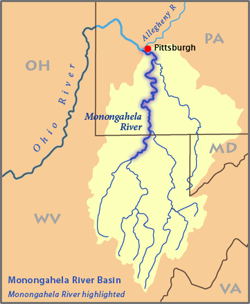
The Monongahela River (
 /məˌnɒŋɡəˈheɪlə/; also known locally as the Mon /ˈmɒn/) is a 130-mile-long (210 km)[6] river on the Allegheny Plateau in north-central West Virginia and southwestern Pennsylvania in the United States. The Monongahela joins with the Allegheny River to form the Ohio River at Pittsburgh.
Contents
Etymology
The word Monongalia is a Latinized version of the Native American word Monongahela, which means "falling banks", in reference to the geological instability of the river's banks. Moravian missionary David Zeisberger gave this account of the naming: "In the Indian tongue the name of this river was Mechmenawungihilla (alternatively spelled Menawngihella), which signifies a high bank, which is ever washed out and therefore collapses."[10]
The Lenape Language Project renders the word as Mënaonkihëla (pronounced [mənaoŋɡihəla]), translated "where banks cave in or erode",[11] from the verbs mënaonkihële "the dirt caves off" (such as the bank of a river or creek, or in a landslide)[12] and mënaonke (pronounced [mənaoŋɡe]), "it has a loose bank" (where one might fall in).[13]
Monongalia County and the town of Monongah in West Virginia, and Monongahela in Pennsylvania are named after the river.
Variant names
According to the Geographic Names Information System, the Monongahela River has also been known historically as:[5]
- Malangueulé[14]
- Manaungahela River
- Me-nan-gi-hil-li
- Meh-non-au-au-ge-hel-al
- Mehmannaunringgehlau
- Mehmannauwinggehla
- Mo-hon-ga-ly River
- Mo-hon-galy River
- Mo-hon-gey-e-la River
- Mo-hong-gey-e-la River
- Mohungahala River
- Mohunghala River
- Monaung River
- Monaungahela River
- Monna River
- Monnyahela River
- Monona River
- Mononga River
- Monongahalia River
- Monongahaly River
- Monongaheley River
- Monongahelia River
- Monongalia River
- Monongalo River
- Mononguhela River
- Mononyahela River
- Muddy River
Geography
The Monongahela is formed by the confluence of the West Fork River and its "East Fork" — the Tygart Valley River — at Fairmont, West Virginia. The river is navigable its entire length with a series of locks and dams that maintain a minimum depth of 9 feet (2.7 m) to accommodate coal-laden barges. In Pennsylvania, the Monongahela is met by two major tributaries: the Cheat River, which joins at Point Marion, and the Youghiogheny River, which joins at McKeesport.
History
The Monongahela River valley was the site of a famous, if small, battle that was one of the first in the French and Indian War (Braddock Expedition). It resulted in a sharp defeat for British and Colonial forces against those of the French and their Native American allies.
The Monongahela Valley was the site of the Whiskey Rebellion in 1794.
In 1817, the Pennsylvania legislature authorized the Monongahela Navigation Company to build 16 dams with bypass locks to create a river transportation system between Pittsburgh and West Virginia. Originally planned to run as far south as the Cheat River, the system was extended to Fairmont, and bituminous coal from West Virginia was the chief product transported downstream. After a canal tunnel through Grant's Hill in Pittsburgh was completed in 1832, boats could travel between the Monongahela River and the Western Division Canal of Pennsylvania's principal east-west canal and railroad system, the Main Line of Public Works. In 1897, the federal government took possession of the Monongahela Navigation through condemnation proceedings. Later, the dam-lock combinations were increased in size and reduced in number.[15] In 2006, the navigation system, operated by the U.S. Army Corps of Engineers, had nine dam-locks along 128.7 miles (207.1 km) of waterway.[16] The locks overcame a change in elevation of about 147 feet (44.8 m).[15]
Briefly linked to the Monongahela Navigation was the Youghiogheny Navigation, a slack water system of 18.5 miles (29.8 km) between McKeesport and West Newton. It had two dam-locks overcoming a change in elevation of about 27 feet (8.2 m). Opening in 1850, it was destroyed by a flood in 1865.[15]
During the 19th century, the Monongahela was heavily used by industry, and several U.S. Steel plants, including the Homestead Works, site of the Homestead Strike of 1892, were built along its banks. Following the killing of several workers in the course of the strike, anarchist Emma Goldman wrote: "Words had lost their meaning in the face of the innocent blood spilled on the banks of the Monongahela."
Two ships in the United States Navy have been named Monongahela for the river.
The river was the site of a famous airplane crash that has become the subject of numerous urban legends and conspiracy theories. Early in the morning of January 31, 1956, a B-25 bomber en route from Nellis Air Force Base in Nevada to Olmsted Air Force Base in Pennsylvania crashed into the river near the Glenwood Bridge in Homestead, Pennsylvania. All six crewmen survived the crash, but two later succumbed to exposure and drowned. Despite the relative shallowness of the water, the aircraft was never recovered. [1]
Popular culture references
- William Attaway's novel Blood on the Forge (1941) is set, in part, on the Monongahela River.
- The Monongahela River was immortalized in the spoken introduction to actor/comedian Guy Marks' parody hit "Loving You Has Made Me Bananas" of 1968.
- The Monongahela is mentioned in the choruses of The Oak Ridge Boys' 1988 song "Gonna Take a Lot of River (Mississippi, Monongahela, Ohio)", along with the Mississippi and the Ohio.
- The Monongahela Valley is referenced in the Bruce Springsteen song "Youngstown" on his 1995 album The Ghost of Tom Joad.
- "Monongahela" is uttered in 1995 on the television show Seinfeld as one of Kramer's famous random expressions. The episode is the 23rd of the 6th season, "The Face Painter". The reference occurs around the 4th-5th minute of the show.
- The Monongahela River was mentioned a number of times in the late 1990s series Remember WENN, which was set in Pittsburgh, particularly in the season 3 episode "And How" when the world premier of the fictional film Drums Along the Monongahela is taking place in that city.[17]
- It is also credited (incorrectly) by Michael Douglas in the 2000 film Wonder Boys for washing away his unsaved book manuscript after Robert Downey Jr. crashes his car into a bowling alley. (This scene actually took place northwest of the Monongahela River along the Ohio River in Rochester, Pennsylvania.)
- Montana Diaz Herrera/Sally Lerner (Ayda Field) of the 2007–2008 television show Back to You has trouble pronouncing the name "Monongahela" when she has to mention it in her weather forecast.
- It is featured in the downloadable content pack for Fallout 3, The Pitt, albeit with highly irradiated waters.
- "Flames Along the Monongahela" was a track on Peter Lang's album Lycurgus.
Photo gallery
-

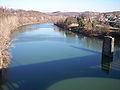
The South Tenth Street Bridge over the Monongahela River in Pittsburgh in 2005
-
The Monongahela River in Fairmont, West Virginia in 2006
-

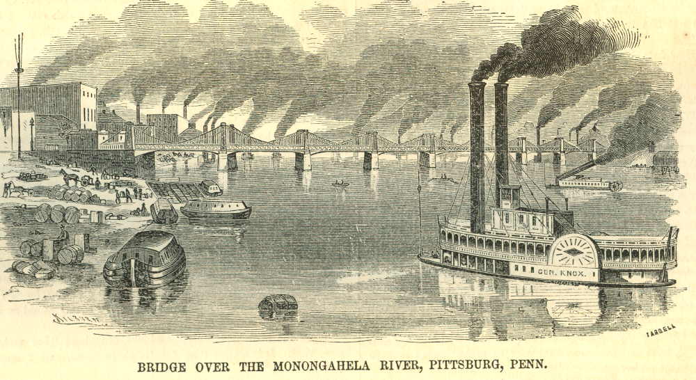
Monongahela River Scene, 1857[18]
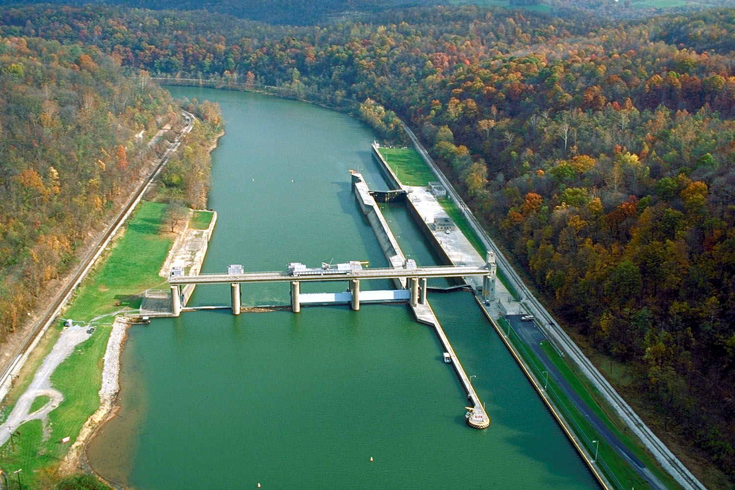
-

Opekiska Lock and Dam on the Monongahela River near Fairmont, West Virginia at river mile 115
See also
- List of crossings of the Monongahela River
- List of rivers of Pennsylvania
- List of rivers of West Virginia
- Geography of Pennsylvania
Notes and references
- ^ Google Earth elevation for GNIS source coordinates. Retrieved on March 12, 2007.
- ^ Geographic Names Information System. "Geographic Names Information System entry for Tygart Valley River (Feature ID #1553309)". http://geonames.usgs.gov/pls/gnispublic/f?p=gnispq:3:::NO::P3_FID:1553309. Retrieved 2007-03-12.
- ^ Geographic Names Information System. "Geographic Names Information System entry for Straight Fork (headwaters tributary of West Fork River) (Feature ID #1547564)". http://geonames.usgs.gov/pls/gnispublic/f?p=gnispq:3:::NO::P3_FID:1547564. Retrieved 2007-03-12.
- ^ a b Geographic Names Information System. "Geographic Names Information System entry for West Fork River (Feature ID #1548931)". http://geonames.usgs.gov/pls/gnispublic/f?p=gnispq:3:::NO::P3_FID:1548931. Retrieved 2007-03-12.
- ^ a b c d Geographic Names Information System. "Geographic Names Information System entry for Monongahela River (Feature ID #1209053)". http://geonames.usgs.gov/pls/gnispublic/f?p=gnispq:3:::NO::P3_FID:1209053. Retrieved 2007-03-12.
- ^ a b U.S. Geological Survey. National Hydrography Dataset high-resolution flowline data. The National Map, accessed August 15, 2011
- ^ Gillespie, William H. (2006). "Monongahela River". In Ken Sullivan (ed.). The West Virginia Encyclopedia. Charleston, W.Va.: West Virginia Humanities Council. pp. 492. ISBN 0-9778498-0-5.
- ^ United States Geological Survey; USGS 03085000 Monongahela River at Braddock, PA; retrieved Sep 29, 2010.
- ^ United States Geological Survey; USGS 03072655 Monongahela River near Masontown, PA; retrieved September 29, 20010.
- ^ Zeisberger, David, David Zeisberger's History of the Northern American Indians in 18th Century Ohio, New York and Pennsylvania, pg 43; Wennawoods Publishing, 1999, ISBN 1-889037-17-6
- ^ "Lenape Talking Dictionary". http://www.talk-lenape.org/detail.php?id=4599. Retrieved 2010-12-10.
- ^ "Lenape Talking Dictionary". http://www.talk-lenape.org/detail.php?id=4600. Retrieved 2010-12-10.
- ^ "Lenape Talking Dictionary". http://www.talk-lenape.org/detail.php?id=4598. Retrieved 2010-12-10.
- ^ John Gilmary Shea. Relations diverses sur la bataille du Malangueulé : gagné le 9 juillet, 1755, par les François sous M. de Beaujeu, commandant du fort du Quesne sur les Anglois sous M. Braddock, général en chef des troupes angloises. Nouvelle York : De la Presse Cramoisy, 1860. OCLC 15760312.
- ^ a b c Shank, William H. (1986). The Amazing Pennsylvania Canals, 150th Anniversary Edition. York, Pennsylvania: American Canal and Transportation Center. p. 76. ISBN 0-933788-37-1.
- ^ "Navigation". U.S. Army Corps of Engineers. 2006. http://www.lrp.usace.army.mil/nav/nav.htm. Retrieved 2007-11-27.
- ^ http://www.rememberwenn.org/wennsea3.htm#3-14
- ^ Ballou's Pictorial, issue of 21 Feb 1857
Bibliography
- Callahan, James Morton and Bernard Lee Butcher (1912), Genealogical and Personal History of the Upper Monongahela Valley, West Virginia, New York: Lewis Historical Publishing Company.
- Core, Earl L. (1984), "The Monongalia River," in: Bartlett, Richard A. (ed), Rolling Rivers: An Encyclopedia of America's Rivers. New York: McGraw-Hill. ISBN 0070039100. pp 149–52.
- Core, Earl L. (1974-84), The Monongalia Story: A Bicentennial History, Parsons, W.Va.: McClain Printing Co., 5 volumes; an extensive, well-documented natural & human history of the Monongahela River basin.
- Volume I: Prelude (1974)
- Volume II: The Pioneers (1976)
- Volume III: Discord (1979)
- Volume IV: Industrialization (1984)
- Volume V: Sophistication (1984)
External links
- U.S. Geological Survey: PA stream gaging stations
 "Monongahela". The New Student's Reference Work. Chicago: F. E. Compton and Co. 1914.
Categories:- Monongahela River
- Tributaries of the Ohio River
- Rivers of Pennsylvania
- Rivers of West Virginia
- Geography of Allegheny County, Pennsylvania
- Geography of Washington County, Pennsylvania
- Geography of Westmoreland County, Pennsylvania
- Geography of Fayette County, Pennsylvania
- Geography of Greene County, Pennsylvania
- Geography of Monongalia County, West Virginia
- Geography of Marion County, West Virginia


Wikimedia Foundation. 2010.