- Northeast Glacier
-
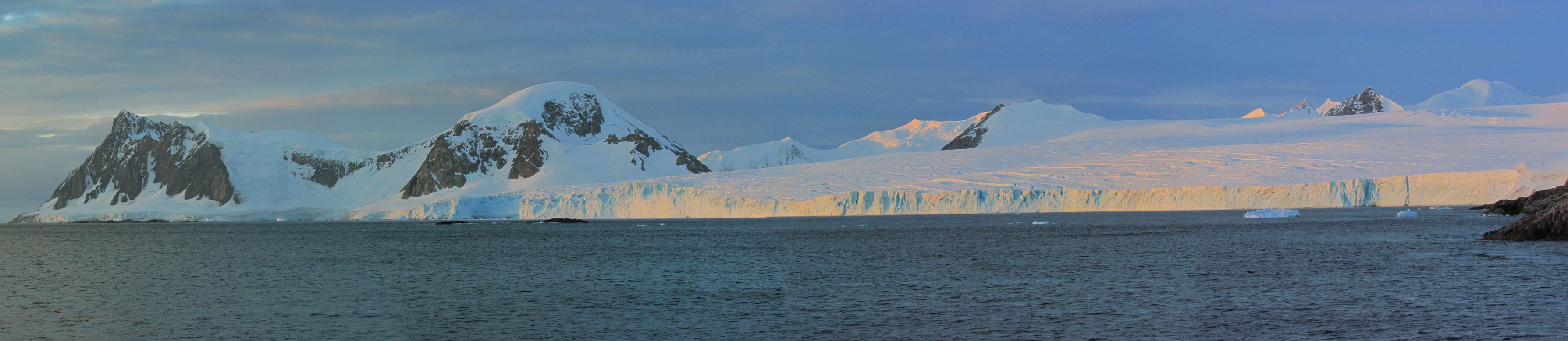
 Northeast Glacier as seen from San Martín Base
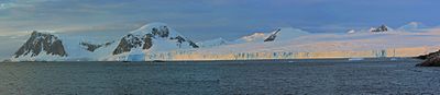
Northeast Glacier is a steep, heavily crevassed glacier, 13 miles (21 km) long and 5 miles (8 km) wide at its mouth, which flows from McLeod Hill westward and then southwestwards into Marguerite Bay between the Debenham Islands and Roman Four Promontory, on the west coast of Graham Land. Northeast Glacier was first surveyed in 1936 by the British Graham Land Expedition (BGLE) under John Riddoch Rymill. Northeast Glacier was resurveyed in 1940 by members of the United States Antarctic Service (USAS), who first used this glacier as a sledging route, and so named by them because it lies at the northeast side of their base at Stonington Island.
See also
- List of glaciers in the Antarctic
 This article incorporates public domain material from the United States Geological Survey document "Northeast Glacier" (content from the Geographic Names Information System).
Coordinates: 68°09′S 66°58′W / 68.15°S 66.967°W

This Fallières Coast location article is a stub. You can help Wikipedia by expanding it.