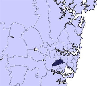
- City of Canterbury, New South Wales
Infobox Australian Place | type = lga
name = City of Canterbury
state = nsw
caption =
pop = 135,573
density = 4000
area = 34
est =
seat = Campsie
mayor = Robert Furolo (ALP)
region = Metropolitan Sydney
logo =
url = http://www.canterbury.nsw.gov.au/
stategov = Canterbury, Lakemba, Oatley
fedgov = Watson, Banks, Blaxland, Grayndler
near-nw =Municipality of Strathfield
near-n =Burwood Council
near-ne =Municipality of Ashfield
near-e =Marrickville Council
near-w =City of Bankstown
near-sw =City of Bankstown
near-s =City of Hurstville
near-se =Municipality of Kogarah The City of Canterbury, previously the Municipality of Canterbury, is a Local Government Area in
Sydney ,New South Wales ,Australia . It lies southwest of the central business district and forms part of the Greater Sydney metropolitan area.Canterbury is primarily residential and light industrial in character. The city is home to over 130 nationalities, with a majority of its residents being born overseas. Hence Canterbury calls itself "the City of Cultural Diversity."
uburbs in the local government area
Suburbs in the City of Canterbury are:
*Ashbury
*Belfield
*Belmore
*Campsie
*Canterbury
*Clemton Park
*Croydon Park
*Earlwood
*Hurlstone Park
*Kingsgrove
*Lakemba
*Narwee
*Punchbowl
*Riverwood
*Roselands
*Undercliffe
*Wiley ParkLocalities in the City of Canterbury are:
*Harcourt
*McCallums HillPhysical Characteristics
The city area is roughly enclosed by three waterways. The original village of Canterbury Vale was situated on the
Cooks River . The upper parts of the river define the northern limits of the city. A major tributary,Wolli Creek forms part of the southern border of the city. The western limit of the city is defined bySalt Pan Creek . The short canal, Cup and Saucer Creek flows within the city area.Physically the land is slightly hilly, although it is regarded as part of the Cumberland Plain. The underlying rock is
sandstone .City Council
The city is divided into three Wards called East, Central and West. Each ward elects three councillors to the city council. The
mayor of Canterbury is elected separately by the whole city and also serves as a councillor. Ordinarily, the council meets monthly on a Thursday evening at 7.30pm.Attractions
* Canterbury Park Racecourse features a 1,578 metre track and attracts thousands to its
horse racing carnivals.
* Belmore Oval is home to theCanterbury Bulldogs , a team in theNational Rugby League .
* Roselands Shopping Centre was the first building of its type in Australia.
* Lakemba Mosque. The mosque was built for the large number of Lebanese-Muslim's during the 1970's. It finished construction in 1977.Notable citizens
The following notable people were born or lived in the area:
*Prime MinisterJohn Howard
*ActorAlex Dimitriades
*BoxersAnthony Mundine andTony Mundine Road Transport
The South Western Motorway passes through the city, with exits at Belmore Road, Kingsgrove Road,
King Georges Road and Bexley Road. The section west ofKing Georges Road was finished in1993 and the remainder completed in2002 . The Motorway connects Sydney to the South West of the state,Canberra and Victoria.King Georges Road is part of major arterial ring system. The route connects the north of Sydney withWollongong and the South Coast.Canterbury Road is another arterial route, 11 kilometres long. The road connects the inner west suburbs of Sydney with Bankstown and suburbs further to the south-west, however its role in the metropolitan system was largely superseded by the completion of the Motorway.
The city is responsible for a network of secondary roads and minor roads, constructed of
bitumen with concrete guttering. This network is complete and rarely extended.Rail Transport
The area is served by the Bankstown line of the CityRail network. The line was opened in 1895 and electrified in 1926. Additional tracks were laid for goods traffic. Within the city are the stations of Hurlstone Park, Canterbury, Campsie, Belmore, Lakemba, Wiley Park and Punchbowl. An eighth station, Narwee, is on the East Hills line.
ister cities
Canterbury is home to the largest Korean born population in Australia and maintains a sister city relationship with Eunpyong-gu, a municipal district within
Seoul ,South Korea . The relationship is commemorated by a special Friendship Garden in Loft Gardens, Campsie.History
Indigenous Australians lived in this area for thousand of years. In 1770, the land along theCooks River was explored by officers fromHM Bark Endeavour .In 1793, the area's first land grant was made to the
Chaplain of theFirst Fleet , the ReverendRichard Johnson , and given the name Canterbury Vale. (Main article: History of the Suburb of Canterbury). Residential development began picking up in the area during the 1880s. A leading developer at this time wasFrederick Jamison Gibbes , a Member of Parliament for the seat ofNewtown , who was also involved in property ventures inRockdale and in his electorate.A
railway was completed in 1895 encouraging further suburban development which led to the area becoming heavily populated.After much petitioning of the State Government by local residents, the Municipality of Canterbury was proclaimed on 17th March 1879. A Town Hall was opened in 1889 in Canterbury. However, over time, Campsie became a more important centre and the city administration moved there in 1962.
External links
* [http://www.canterbury.nsw.gov.au/ Canterbury City Council website]
* [http://www.canterbury.nsw.gov.au/www/html/369-local-history-and-heritage.asp History of Canterbury City]
* [http://www.canterbury.nsw.gov.au/www/html/35-maps-of-our-city.asp Map of suburbs in Canterbury City]
* [http://www.canterbury.nsw.gov.au/www/html/40-festivals-arts-and-culture.asp Festivals, Arts and Culture in the City of Canterbury]
* [http://www.canterbury.nsw.gov.au/www/html/37-demographics-and-interesting-statistics.asp Demographics and Interesting Statistics]
* [http://www.abs.gov.au/ausstats/abs@census.nsf/Lookup2001Census/4D4DAA420E971E02CA256BBE00838C5B 2001 Census Information]
Wikimedia Foundation. 2010.