- Cherry Tree railway station
-
Cherry Tree 
Location Place Cherry Tree Local authority Blackburn with Darwen Operations Station code CYT Managed by Northern Rail Number of platforms 2 Live arrivals/departures and station information
from National Rail EnquiriesAnnual rail passenger usage 2004/05 * 21,308 2005/06 *  20,061
2006/07 *  22,836
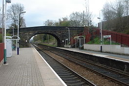
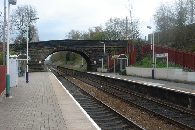
2007/08 * 24,5862008/09 * 25,0682009/10 * 28,556History Opened 1846 National Rail - UK railway stations A B C D E F G H I J K L M N O P Q R S T U V W X Y Z * Annual passenger usage based on sales of tickets in stated financial year(s) which end or originate at Cherry Tree from Office of Rail Regulation statistics. Please note: methodology may vary year on year. Cherry Tree railway station serves Cherry Tree, a suburb of Blackburn. The station is 3 km (1.9 mi) west of Blackburn railway station in East Lancashire. It is within the boundaries of the Blackburn with Darwen unitary authority. It is managed by Northern Rail, who also provide all the passenger services calling there.
The station is a two platforms stop situated on the A674 road for Blackburn. The former branch line to Chorley and Wigan diverged a short distance to the west of the station, but this closed to passengers on 4 January 1960 and completely in 1966.[1]
Services
Monday to Saturdays, there is an hourly service from Cherry Tree towards Preston and Blackpool South, westbound and Blackburn, Burnley Central and Colne, eastbound. There is a two-hourly service in each direction on Sundays.
References
- ^ Marshall, J (1981) Forgotten Railways: North-West England, David & Charles (Publishers) Ltd, Newton Abbott. ISBN 0-7153-8003-6; p.155
External links
- Train times and station information for Cherry Tree railway station from National Rail
Preceding station  National Rail
Following station Pleasington Northern Rail
East Lancashire LineMill Hill Disused railways Feniscowles L&YR / LNWR joint
Lancashire Union RailwayMill Hill Railway stations in Lancashire West Coast Main Line Kirkby Branch Line Manchester to Southport Line Merseyrail Northern Line Ormskirk Branch Line Blackpool Branch Lines Manchester to Preston Line Ribble Valley Line East Lancashire Line Preston • Lostock Hall • Bamber Bridge • Pleasington • Cherry Tree • Mill Hill • Blackburn • Rishton • Church and Oswaldtwistle • Accrington • Huncoat • Hapton • Rose Grove • Burnley Barracks • Burnley Central • Brierfield • Nelson • ColneCaldervale Line Leeds to Morecambe Line Furness Line Heritage Railways Irwell Vale • Rawtenstall • Riversway • Strand Road CrossingCategories:- Railway stations in Blackburn
- Former Lancashire and Yorkshire Railway stations
- Railway stations opened in 1846
- Railway stations served by Northern Rail
- DfT Category F2 stations
Wikimedia Foundation. 2010.