- Mariental, Namibia
-
Mariental 
SealNickname(s): Stofbakkies Motto: Luceat et crescat Location in Namibia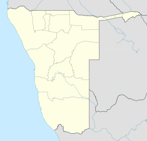
 Mariental
Coordinates: 24°38′S 17°58′E / 24.633°S 17.967°E Country  Namibia
Region Hardap Region Elevation 3,576 ft (1,090 m) Population (2001)[1] - Total 9,836 Time zone West African Time (UTC+1) - Summer (DST) Central African Time (UTC+2) Mariental is a town of 10,000 inhabitants in south-central Namibia, lying on the B1 national road 145 miles (232 km) north of Keetmanshoop and 170 miles (274 km) southeast of Windhoek. It lies at an elevation of 3,576 feet (1,090 metres). Mariental is connected to the TransNamib railway line from Windhoek to Keetmanshoop. The town and the surrounding area are in a hot, arid region.[2] Mariental is the administrative capital of the Hardap Region in an area which has long been a centre for the Nama people. It lies near the Hardap Dam, the largest reservoir in Namibia.
Contents
History
Named by local Rhenish (German Lutheran) missionaries, The town was founded in 1912 as a railway stop between Windhoek and Keetmanshoop and named after Maria, the wife of the first colonial settler of the area, Herman Brandt. It was proclaimed a town in 1920 and a municipality in 1946. Mariental is home to a large number of Nama-speaking people, descendants of the early Khoi inhabitants of Namibia. The people of Mariental are known for their big smiles and hospitality.
The Fish River which flows in a southerly direction past the town caused severe flooding in the western side of the town on a number of occasions, most recently after persistent rain during February 2006 when the Hardap Dam's sluices had to be opened and severe flooding occurred on the weekend of 25-26 February 2006.
Since Hardap Dam was built in 1962 floods also have taken place in 1972 and twice in 2000 with previous floods (before the dam was built) recorded in 1923 and 1934.
Geography
Climate
Mariental has a desert climate (BWh, according to the Köppen climate classification), with hot summers and cool winters (with mild days and chilly nights). The average annual precipitation is 194 mm (8 in).
Mariental Climate chart (explanation) J F M A M J J A S O N D 3735205934204432181529132268223402330255129973113133416143519Average max. and min. temperatures in °C Precipitation totals in mm Source: World Climate Guide Imperial conversion J F M A M J J A S O N D 1.595682.393681.790640.684550.179460.173390733707741084480.388550.593610.69566Average max. and min. temperatures in °F Precipitation totals in inches Economy
The nearby Hardap Dam is the largest reservoir in Namibia and provides water for irrigation, making possible to cultivate animal fodder, as well as corn, fruits and vegetables. The town is surrounded by flourishing commercial farms which, due to the low annual rainfall in the area focus on game farming as well as sheep and ostrich farming which along with cattle farming remain popular in the region. Export grapes, cotton lucern and diary farming is also sustained by irrigation from the Hardap Dam.
A local ostrich abattoir used to cater for this increasingly important industry, but recently went bankrupt, and what survives of the karakul trade in the south is centered around Mariental. Sitting astride the main route into the Kalahari and Namib Deserts, Mariental also services the needs of farmers in these areas. Mariental also boasts some of the best safari and hunting experiences in Namibia at lodges like Lapa Lange and Anib Lodge. Available game include springbuck, blesbuck, giraffe, ostrich, leopard, zebra, kudu, gemsbuck, hartebeest, eland, blue- and black wildebeest.
Hardap dam
Main article: Hardap DamThe Hardap Dam[3]. on the Fish River 22km northwest of Mariental is the biggest dam in Namibia with a water surface of about 25 sqkms, a capacity of 320 million m3 and an 86.2 metre long dam wall. The dam has been developed as a popular watersport and holiday resort for tourists, campers, water-skiers and anglers. The dam is Namibia’s first large earth-fill dam and supplies water to the area
References
- ^ Republic of Namibia 2001 Population and Housing Census (Basic Analysis with Highlights ed.). Windhoek: Central Bureau of Statistics, National Planning Commission. July 2003. p. 21. ISBN 0869766147.
- ^ http://www.britannica.com/EBchecked/topic/365141/Mariental
- ^ www.namibia-1on1.com/mariental.html
Categories:- Namibia geography stubs
- Cities in Namibia
- Regional capitals in Namibia
- Hardap Region

Wikimedia Foundation. 2010.