- North Kanpur
-
North Kanpur
North Kanpur
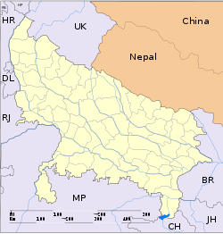
— city — Coordinates 19°15′N 73°08′E / 19.25°N 73.13°ECoordinates: 19°15′N 73°08′E / 19.25°N 73.13°E Country India State Uttar Pradesh District(s) Kanpur Nearest city Kanpur Parliamentary constituency North Kanpur Assembly constituency Kalyanpur,Rawatpur,Arya Nagar,Swaroop Nagar Civic agency North Kanpur Police Population 1,000,000 Literacy 80% Time zone IST (UTC+05:30) Codes-
• Pincode • 208001 • Vehicle • UP-78
North Kanpur is a zone within the city limits of kanpur in Uttar Pradesh, India. This zone is highly populated and the CBD (Central Business District) is located here. All imporatant commercial Establishments, GPO, District Hospital and the Cawnpore Kotwali is located here. This zone is the hub of all commercial, social and political activities of kanpur since British era.
Contents
Location
As the name suggests, North Kanpur covers the northern most zone of the city. Old Kanpur is also located here. North Kanpur can be easily accessed via road, and rail. Its proximity to the river Ganges makes it easily accessible. The Mall road acts as the life line of the city.
Educational Institutes
It hosts several educational institutions, 1. National Sugar Institute 2. The world famous technoloical institute IIT Kanpur campus 3. The Kanpur University 4. Chandrashekhar Azad University for Agriculture 5. Christ Church College 6. Methodist High School
and numerous other institutions of the National and International repute.
Connectivity
This zone has one of the largest vegetable markets in the city due its proximity to the rural areas and nearby districts of western Uttar Pradesh. The suburb lies on the historic Grand Trunk Road commonly known as G.T.Road towards Delhi which is situated 415 km away. The Kanpur-Kasganj-Aligarh-Bhiwani Railway line runs just parallel to the G.T.Road in Kalyanpur.
The suburb is well connected with rest of the city by road as well as railways.The industrial area of Panki lies 5 km south of Kalyanpur and is well connected with Kalyanpur.
The pilgrimage village of Bithoor, 12 km away, connects to the GT road here. Bithoor is connected with Kalyanpur with 2 roads. Formerly the Metre gauge line ran through Kalyanpur and was connected to Brahmavarta Station in Bithoor. But due to conversion of the metre gauge railway line to broad gauge line under Unigauge the railway route to Bithoor was subsequently closed and the Brahvarta station now remains deserted. There were vital demands from the public to restart the railway route connecting Kanpur Central railway station to Brahmavarta,Bithoor though the matter remains reserved. The Government is planning new townships in Kalyanpur suburb and many real estates are coming up in the suburb.
Civic Administration
North Kanpur has a Supritendent of Police and many Police Stations with Police Headquarters.
Education
The world famous IIT is situated in North Kanpur.It also has Kanpur University, Chandrashekhar Azad Agriculture University and many colleges like Christ Church College, DPS, DAV College, Dr Virendra Swaroop College, Halim Muslim Degree College etc.
Financial Sector
North Kanpur is a financial sector of UP as it contains Marchant's chamber of Uttar Pradesh and UP Stock Exchange.Many Residential and commercial buildings are situated here. Prestigious Regional offices of Reserve Bank of India, State Bank of India, LIC & Standard Chartered bank etc are located here.
Places of Interest
- Gora Graveyard
- Bithoor
- Moti Jheel
- Allen Forest Zoo
- Shri Radhakrishnan Temple (JK Temple)
- Malls and Shopping Complexes
- Green Park Stadium
- Navin Market
- Jama Masjid (Patkapur)
- Panki Industrial City
- Kanpur Sanghralay(Museum)
References
Kanpur topics History History of Kanpur · Siege of Cawnpore · Second Battle of Cawnpore · Rebellion of 1857 · War of Indian Independence of 1857 · Development of Industries · Cultural History · Kanpur Bolshevik Conspiracy Case · Kanpur Conspiracy Case
Places of worship
and tourist spotsAnandeshwar Temple · J. K. Temple · Sai Darbar · Panki Hanuman Mandir · Jain Glass Temple · Kherepati Temple · Bhitargaon Temple · Bara-Devi Mandir · Kanpur Memorial Church · Allen Forest Zoo · Moti Jheel · Bithoor · Jajmau · Nawabganj Bird Sanctuary · Kanpur Sangrahalaya · Ganga Barrage · Z Square Mall · Rave 3Ghats Public parks Phool Bagh · Nana Rao ParkCompanies Artificial Limbs Manufacturing Corporation of India · British India Corporation · Rupani Footwear · Dainik Jagran · Inext · Lohia Machinery Limited · Panki Thermal Power StationEducation Universities Medical colleges Ganesh Shankar Vidyarthi Memorial Medical College, Pt. Jawahar Lal Nehru State Homoeopathic Medical CollegeTechnological institutes Private technological
institutesPranveer Singh Institute of Technology · Maharana Pratap Engineering College · Kanpur Institute of Technology · List of engineering colleges in KanpurLocalities North West Kanpur Central Kanpur Kakadeo · Geeta Nagar · Pandu Nagar · Sarvodya Nagar · Sharda Nagar · Shastri NagarEast Kanpur Jajmau · Lal BanglaWest Kanpur South Kanpur Unsorted Bithoor · Armapur Estate · Chakeri · Shyam Nagar · Cantt · Jaurali · Tatya Tope Nagar · Hanspuram · Keshavpuram · Ravidas Puram Shivaji NagarLeft Bank Shuklaganj · Gangotri TownshipHotels Hotel Landmark · Hotel Megadoot · Hotel Gaurav · Hotel Bliss · Kanha Continental · Kanha International
Economy and transport UP Stock Exchange · Kanpur Electricity Supply Company Ltd.(KESCo) · Auto rickshaw · Kanpur Metropolitan Bus Service · Kanpur Airport · IIT Kanpur Airport · Kanpur Civil Airport · Kanpur Central · Kanpur Anwarganj · Govindpuri · Kalianpur · Kanpur Metro · Trams · Lucknow-Kanpur Suburban Railway · Kanpur Lucknow Roadways Service · Kanpur over-bridge
Sports Other topics Eminent people associated with Kanpur · Kanpur (Lok Sabha constituency) · List of cities in India · Category:People from Kanpur · Renamed places in Kanpur · Lajpat Bhawan
Categories:- Kanpur
- Neighbourhoods of Kanpur
- Cities and towns in Kanpur district
-
Wikimedia Foundation. 2010.


