- Non Din Daeng District
-
Non Din Daeng
โนนดินแดง— Amphoe — Amphoe location in Buriram Province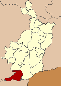
Coordinates: 14°18′57″N 102°44′37″E / 14.31583°N 102.74361°ECoordinates: 14°18′57″N 102°44′37″E / 14.31583°N 102.74361°E Country  Thailand
Province Buriram Seat Non Din Daeng Tambon Muban Amphoe established Area – Total 448.0 km2 (173 sq mi) Population (2005) – Total 26,073 – Density 58.2/km2 (150.7/sq mi) Time zone THA (UTC+7) Postal code 31260 Geocode 3120 Non Din Daeng (Thai: โนนดินแดง) is the southwesternmost district (Amphoe) of Buriram Province, northeastern Thailand.
Contents
Geography
Neighboring districts are (from the north clockwise) Pakham, Lahan Sai of Buriram Province, Ta Phraya, Watthana Nakhon of Sa Kaeo Province and Soeng Sang of Nakhon Ratchasima Province. The Sankambeng Range mountainous area is located in the southern section of this district.
History
The minor district (King Amphoe) Non Din Daeng was created on May 31 1993, when three tambon were split off from Lahan Sai district.[1] It was upgraded to a full district on December 5 1996.[2]
Administration
The district is subdivided into 3 subdistricts (tambon), which are further subdivided into 45 villages (muban). Non Din Daeng is a township (thesaban tambon) which covers parts of tambon Non Din Daeng and Sompoi. There are also 3 Tambon administrative organizations (TAO).
No. Name Thai name Villages Inh. 1. Non Din Daeng โนนดินแดง 25 11,991 2. Som Poi ส้มป่อย 7 4,393 3. Lam Nang Rong ลำนางรอง 13 9,689 References
- ^ "ประกาศกระทรวงมหาดไทย เรื่อง แบ่งเขตท้องที่อำเภอละหานทราย จังหวัดบุรีรัมย์ ตั้งเป็นกิ่งอำเภอโนนดินแดง" (in Thai). Royal Gazette 110 (74 ง): 20. June 8 1993. http://www.ratchakitcha.soc.go.th/DATA/PDF/2536/D/074/20.PDF.
- ^ "พระราชกฤษฎีกาตั้งอำเภอเหนือคลอง อำเภอนายายอาม อำเภอท่าตะเกียบ อำเภอขุนตาล อำเภอแม่ฟ้าหลวง อำเภอแม่ลาว อำเภอรัษฎา อำเภอพุทธมณฑล อำเภอวังน้ำเขียว อำเภอเจาะไอร้อง อำเภอชำนิ อำเภอโนนดินแดง อำเภอปางมะผ้า อำเภอสนธิ อำเภอหนองม่วง อำเภอเบญจลักษ์ อำเภอโพนนาแก้ว อำเภอบุ่งคล้า อำเภอดอนมดแดง และอำเภอลืออำนาจ พ.ศ. ๒๕๓๙" (in Thai). Royal Gazette 113 (62 ก): 5–8. November 20 1996. http://www.ratchakitcha.soc.go.th/DATA/PDF/2539/A/062/5.PDF.
External links
Categories:- Amphoe of Buriram
- Isan geography stubs

Wikimedia Foundation. 2010.