- Nang Rong District
-
Nang Rong
นางรอง— Amphoe — Amphoe location in Buriram Province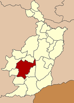
Coordinates: 14°37′42″N 102°47′36″E / 14.62833°N 102.79333°ECoordinates: 14°37′42″N 102°47′36″E / 14.62833°N 102.79333°E Country  Thailand
Province Buriram Seat Tambon Muban Amphoe established Area – Total 769.8 km2 (297.2 sq mi) Population (2005) – Total 108,143 – Density 151.6/km2 (392.6/sq mi) Time zone THA (UTC+7) Postal code 31110 Geocode 3104 Nang Rong (Thai: นางรอง) is a district (Amphoe) of Buriram Province, northeastern Thailand.
Geography
Neighboring districts are (from the northeast clockwise) Chamni, Mueang Buriram, Prakhon Chai, Chaloem Phra Kiat, Lahan Sai, Pakham, Non Suwan and Nong Ki of Buriram Province. It is the closest major town to the Phanom Rung Historical Park, and 11th Century religious site. Nang Rong is connected to Bangkok mainly by bus, with buses arriving and departing hourly during the day.
Administration
The district is subdivided into 15 subdistricts (tambon), which are further subdivided into 204 villages (muban). Nang Rong is a township (thesaban tambon) which covers parts of tambon Nang Rong and Thanon Hak. There are also 15 Tambon administrative organizations (TAO).
No. Name Thai name Villages Inh. 1. Nang Rong นางรอง 30 22,934 3. Sadao สะเดา 17 9,624 5. Chum Saeng ชุมแสง 14 5,418 6. Nong Bot หนองโบสถ์ 14 7,196 8. Nong Kong หนองกง 11 6,199 13. Thanon Hak ถนนหัก 13 10,073 14. Nong Sai หนองไทร 14 6,494 15. Kan Lueang ก้านเหลือง 10 4,573 16. Ban Sing บ้านสิงห์ 14 5,503 17. Lam Sai Yong ลำไทรโยง 14 5,525 18. Sap Phraya ทรัพย์พระยา 13 6,924 24. Nong Yai Phim หนองยายพิมพ์ 10 4,568 25. Hua Thanon หัวถนน 11 4,613 26. Thung Saeng Thong ทุ่งแสงทอง 7 3,099 27. Nong Sano หนองโสน 12 5,400 Missing numbers are tambon which now form the districts Non Suwan and Chamni, as well as parts of Chaloem Phra Kiat.
Mueang Buriram · Khu Mueang · Krasang · Nang Rong · Nong Ki · Lahan Sai · Prakhon Chai · Ban Kruat · Phutthaisong · Lam Plai Mat · Satuek · Pakham · Na Pho · Nong Hong · Phlapphla Chai · Huai Rat · Non Suwan · Chamni · Ban Mai Chaiyaphot · Non Din Daeng · Ban Dan · Khaen Dong · Chaloem Phra Kiat
Categories:- Amphoe of Buriram
- Isan geography stubs

Wikimedia Foundation. 2010.