- National Register of Historic Places listings in Union County, South Carolina
-
 Location of Union County in South Carolina
This is a list of the National Register of Historic Places listings in Union County, South Carolina.
This is intended to be a complete list of the properties and districts on the National Register of Historic Places in Union County, South Carolina, United States. The locations of National Register properties and districts for which the latitude and longitude coordinates are included below, may be seen in a Google map.[1]
There are 29 properties and districts listed on the National Register in the county.
-
- This National Park Service list is complete through NPS recent listings posted November 10, 2011.[2]
Current listings
[3] Landmark name [4] Image Date listed Location City or town Summary 1 Battle of Blackstock's Historic Site December 16, 1974 West of Union off South Carolina Highway 49 Union 2 Buffalo Mill Historic District 
October 10, 1990 Village of Buffalo and immediate surroundings Buffalo 3 Cedar Bluff July 20, 1974 South Carolina Highway 49
34°39′47″N 81°44′34″W / 34.663056°N 81.742778°WUnion 4 Central Graded School March 30, 1978 309 Academy St.
34°43′03″N 81°37′17″W / 34.7175°N 81.621389°WUnion 5 Corinth Baptist Church July 20, 1989 N. Herndon St.
34°42′59″N 81°37′30″W / 34.716389°N 81.625°WUnion 6 Cross Keys House June 24, 1971 Southwest of Union on South Carolina Highway 49
34°38′03″N 81°46′27″W / 34.634167°N 81.774167°WUnion 7 Culp House April 9, 1975 300 N. Mountain St. Union 8 Judge Thomas Dawkins House April 23, 1973 Dawkins Court, north of E. Main St.
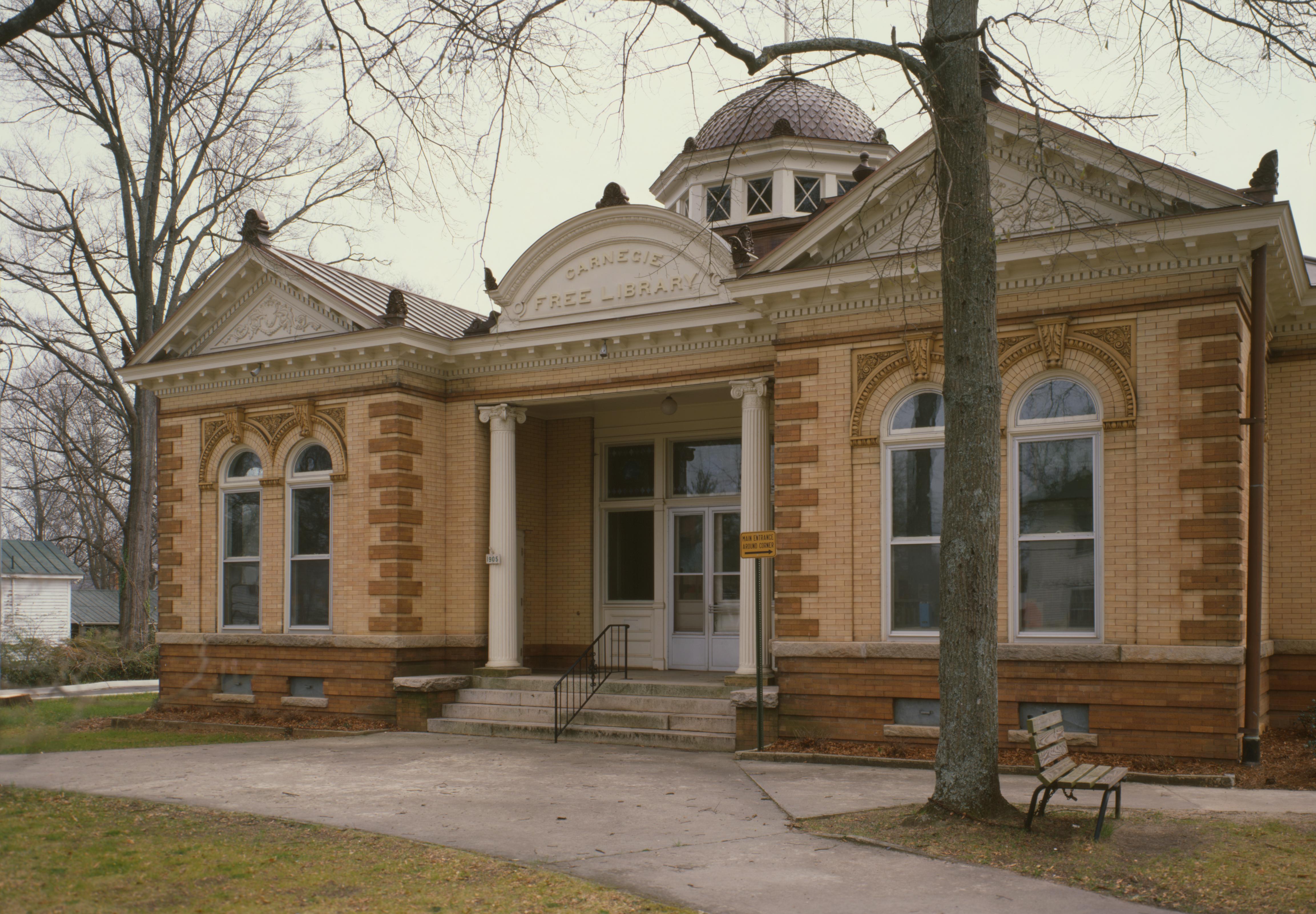
34°43′07″N 81°37′15″W / 34.718611°N 81.620833°WUnion 9 East Main Street-Douglass Heights Historic District July 17, 1989 Roughly bounded by Perrin Ave., S. Church St., and E. Main St., and 100-121 Douglass Heights Union 10 Episcopal Church of the Nativity August 30, 1974 Church and Pinckney Sts. Union 11 Fair Forest Hotel November 1, 1984 221 E. Main St.
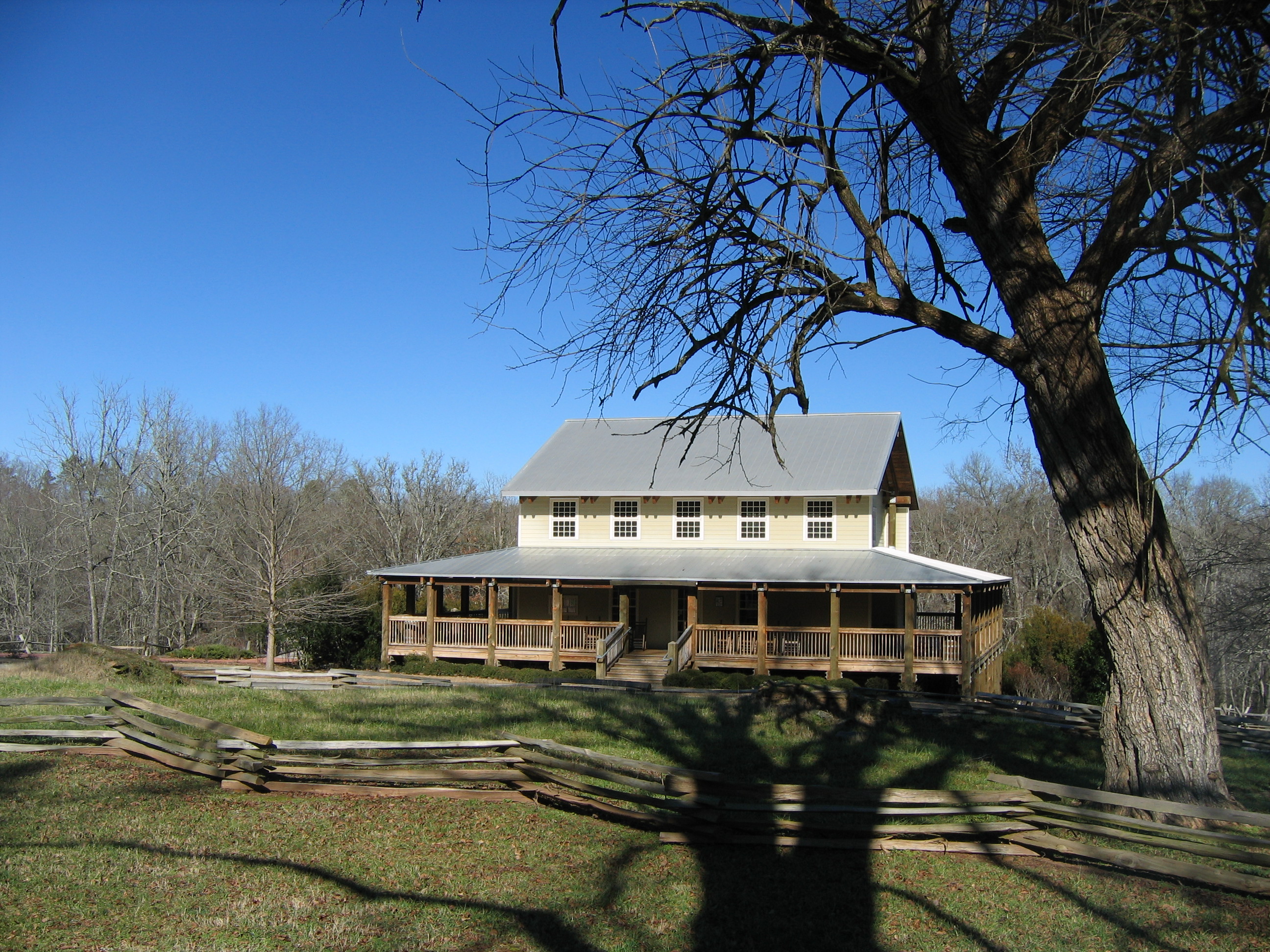
34°42′56″N 81°37′20″W / 34.715556°N 81.622222°WUnion 12 Nathaniel Gist House February 11, 2011 162 Fant Acres Rd.
Union vicinity 13 Herndon Terrace August 25, 1970 N. Pinckney St. and Catherine St.
34°43′28″N 81°37′45″W / 34.724444°N 81.629167°WUnion 14 Hillside February 17, 1978 Northwest of Carlisle on South Carolina Highway 215 Carlisle 15 Gov. Thomas B. Jeter House December 2, 1974 203 Thompson Boulevard
34°43′18″N 81°37′38″W / 34.721667°N 81.627222°WUnion 16 McWhirter House April 18, 2003 415 Pacolet St.
34°49′59″N 81°40′54″W / 34.833056°N 81.681667°WJonesville 17 Means House April 13, 1973 2 miles southwest of Jonesville on South Carolina Highway 12
34°48′34″N 81°42′55″W / 34.809444°N 81.715278°WJonesville 18 Meng House July 12, 1976 117 Academy St.
34°43′08″N 81°37′24″W / 34.718889°N 81.623333°WUnion 19 Merridun June 20, 1974 100 Merridun Pl.
34°43′10″N 81°37′48″W / 34.719444°N 81.63°WUnion 20 Musgrove's Mill Historic Battle Site 
March 4, 1975 2.5 miles south of Cross Anchor on South Carolina Highway 56 Cross Anchor 21 Padgett's Creek Baptist Church May 6, 1971 East of Cross Keys on South Carolina Highway 18 Cross Keys 22 Pinckneyville December 3, 1969 13 miles northeast of Union on South Carolina Highway 13
34°30′44″N 81°28′10″W / 34.512222°N 81.469444°WUnion 23 Rose Hill June 5, 1970 9 miles south-southwest of Union on County Road 16 Union 24 South Street-South Church Street Historic District 
May 19, 1983 Roughly South St. between Church and Boyce Sts.; also roughly S. Church St. from South St. to Henrietta St. Union Second set of boundaries represents a boundary increase of July 17, 1989 25 Union Community Hospital August 1, 1996 213 W. Main St.
34°42′52″N 81°37′32″W / 34.714444°N 81.625556°WUnion 26 Union County Jail August 30, 1974 Main St.
34°42′55″N 81°37′38″W / 34.715278°N 81.627222°WUnion 27 Union Downtown Historic District July 17, 1989 Roughly bounded by E. Academy, N. Church, Main, and N. Herndon Sts., Sharpe Ave., and N. Gadberry St.; also 125-129 W. Main St. Union 125-129 W. Main represents a boundary increase of April 11, 2003 28 Union High School-Main Street Grammar School July 20, 1989 E. Main and N. Church Sts.
34°42′58″N 81°37′12″W / 34.716111°N 81.62°WUnion 29 Woodland Plantation May 30, 2001 3435 Santuc-Carlisle Highway-South Carolina Highway 215 Carlisle See also
- List of National Historic Landmarks in South Carolina
- National Register of Historic Places listings in South Carolina
References
- ^ The latitude and longitude information provided in this table was derived originally from the National Register Information System, which has been found to be fairly accurate for about 99% of listings. For about 1% of NRIS original coordinates, experience has shown that one or both coordinates are typos or otherwise extremely far off; some corrections may have been made. A more subtle problem causes many locations to be off by up to 150 yards, depending on location in the country: most NRIS coordinates were derived from tracing out latitude and longitudes off of USGS topographical quadrant maps created under North American Datum of 1927, which differs from the current, highly accurate GPS system used by Google maps. Chicago is about right, but NRIS longitudes in Washington are higher by about 4.5 seconds, and are lower by about 2.0 seconds in Maine. Latitudes differ by about 1.0 second in Florida. Some locations in this table may have been corrected to current GPS standards.
- ^ "National Register of Historic Places: Weekly List Actions". National Park Service, United States Department of the Interior. Retrieved on November 10, 2011.
- ^ Numbers represent an ordering by significant words. Various colorings, defined here, differentiate National Historic Landmark sites and National Register of Historic Places Districts from other NRHP buildings, structures, sites or objects.
- ^ "National Register Information System". National Register of Historic Places. National Park Service. . http://nrhp.focus.nps.gov/natreg/docs/All_Data.html.
U.S. National Register of Historic Places in South Carolina Lists by county Abbeville • Aiken • Allendale • Anderson • Bamberg • Barnwell • Beaufort • Berkeley • Calhoun • Charleston • Cherokee • Chester • Chesterfield • Clarendon • Colleton • Darlington • Dillon • Dorchester • Edgefield • Fairfield • Florence • Georgetown • Greenville • Greenwood • Hampton • Horry • Jasper • Kershaw • Lancaster • Laurens • Lee • Lexington • Marion • Marlboro • McCormick • Newberry • Oconee • Orangeburg • Pickens • Richland • Saluda • Spartanburg • Sumter • Union • Williamsburg • York

Lists by city Other lists Keeper of the Register • History of the National Register of Historic Places • Property types • Historic district • Contributing property Municipalities and communities of Union County, South Carolina County seat: Union City 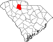
Towns CDPs Categories:- Union County, South Carolina
- National Register of Historic Places in South Carolina by county
-


Wikimedia Foundation. 2010.