- National Register of Historic Places listings in Somerset County, Maryland
-
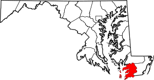 Location of Somerset County in Maryland
This is a list of the National Register of Historic Places listings in Somerset County, Maryland.
This is intended to be a complete list of the properties and districts on the National Register of Historic Places in Somerset County, Maryland, United States. Latitude and longitude coordinates are provided for many National Register properties and districts; these locations may be seen together in a Google map.[1]
There are 73 properties and districts listed on the National Register in the county.
Contents: Counties in Maryland Allegany - Anne Arundel - Baltimore (city) - Baltimore County - Calvert - Caroline - Carroll - Cecil - Charles - Dorchester - Frederick - Garrett - Harford - Howard - Kent - Montgomery - Prince George's - Queen Anne's - Somerset - St. Mary's - Talbot - Washington - Wicomico - Worcester -
- This National Park Service list is complete through NPS recent listings posted November 10, 2011.[2]
Current listings
[3] Landmark name[4] Image Date listed Location City or Town Summary 1 Academy Grove Historic District May 3, 1984 Maryland Route 361
38°5′58″N 75°48′32″W / 38.09944°N 75.80889°WUpper Fairmount 2 Adams Farm November 10, 1988 Princess Anne-Westover Rd.
38°11′35″N 76°1′48″W / 38.19306°N 76.03°WPrincess Anne 3 All Saints Church at Monie August 3, 1990 Venton Rd. northwest of its junction with Deal Island Rd.
38°11′37″N 75°45′55″W / 38.19361°N 75.76528°WVenton 4 Arlington May 21, 1992 Maryland Route 361
38°7′42″N 75°44′4″W / 38.12833°N 75.73444°WWestover 5 Beauchamp House August 9, 1984 Old Westover-Marion Rd.
38°5′26″N 75°42′23″W / 38.09056°N 75.70639°WWestover 6 Beckford August 13, 1974 Beckford Ave.
38°12′2″N 75°41′56″W / 38.20056°N 75.69889°WPrincess Anne 7 Beverly March 30, 1973 South of Princess Anne on U.S. Route 13
38°9′27″N 75°41′22″W / 38.1575°N 75.68944°WPrincess Anne 8 Brentwood Farm September 4, 1986 Allen Rd.
38°15′58″N 75°41′22″W / 38.26611°N 75.68944°WWestover 9 Caldicott December 22, 1983 Southwest of U.S. Route 13
38°3′13″N 75°39′2″W / 38.05361°N 75.65056°WRehobeth 10 Burton Cannon House April 3, 1975 1 mile north of Cokesbury on Dublin Rd.
38°9′4″N 75°35′40″W / 38.15111°N 75.59444°WCokesbury 11 Catalpa Farm November 10, 1988 Old Princess Anne-Westover Rd.
38°11′9″N 75°40′46″W / 38.18583°N 75.67944°WPrincess Anne 12 Cedar Hill March 14, 1991 Eastern side of Sign Post Rd. at Back Creek
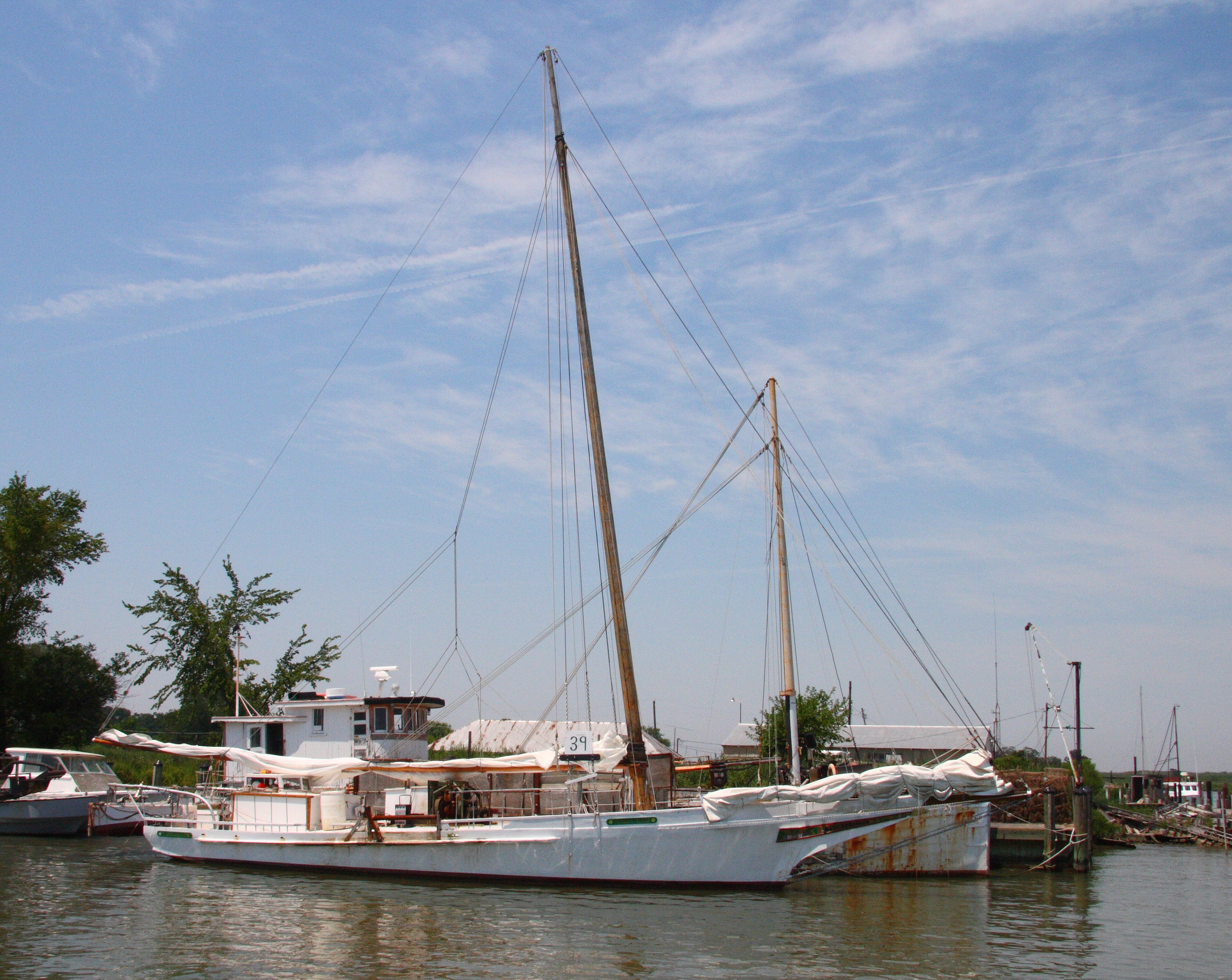
38°7′55″N 75°42′42″W / 38.13194°N 75.71167°WWestover 13 CLARENCE CROCKETT May 16, 1985 Lower Thorofare
38°7′41″N 75°56′54″W / 38.12806°N 75.94833°WWenona 14 Coventry Parish Ruins August 9, 1984 Off Maryland Route 667
38°2′18″N 75°39′59″W / 38.03833°N 75.66639°WRehobeth 15 Crisfield Armory September 25, 1985 Main St. Extended
38°0′29″N 75°50′34″W / 38.00806°N 75.84278°WCrisfield 16 Crisfield Historic District July 9, 1990 Roughly bounded by Chesapeake Ave., Maryland Ave., 4th and Cove Sts., including area between Asbury Ave. and E. Main St.
37°58′53″N 75°50′57″W / 37.98139°N 75.84917°WCrisfield 17 Cullen Homestead Historic District November 18, 2009 4533, 27049, and 27067 Lawson Barnes Rd.
38°0′27.41″N 75°49′6.89″W / 38.0076139°N 75.8185806°WCrisfield 18 Deal Island Historic District September 6, 2006 Deal Island Rd. from Upper Thorofare to Ballard Rd. and intersecting Sts.
38°9′38″N 75°56′49″W / 38.16056°N 75.94694°WDeal Island 19 F.C. LEWIS, JR May 16, 1985 Lower Thorofare
38°7′41″N 75°56′54″W / 38.12806°N 75.94833°WWenona 20 FANNIE L. DAUGHERTY May 16, 1985 Lower Thorofare
38°7′41″N 75°56′54″W / 38.12806°N 75.94833°WWenona 21 Glebe House November 18, 2009 10950 Market Lane
38°10′51.28″N 75°41′25.33″W / 38.1809111°N 75.6903694°WPrincess Anne 22 Grace Episcopal Church November 1, 1990 Mt. Vernon Rd. north of its junction with Ridge Rd.
38°14′36″N 75°46′9″W / 38.24333°N 75.76917°WMt. Vernon 23 Harrington September 11, 1975 Northwest of Princess Anne off Maryland Route 362
38°15′41″N 75°45′33″W / 38.26139°N 75.75917°WPrincess Anne 24 Jeptha Hayman House December 27, 1990 Westover-Marion Rd. south of its junction with Charles Barnes Rd.
38°4′8″N 75°42′26″W / 38.06889°N 75.70722°WKingston 25 Hayward's Lott May 13, 1976 1.75 miles northwest of Pocomoke City on Hayward Rd.
38°5′35″N 75°35′21″W / 38.09306°N 75.58917°WPocomoke City 26 HOWARD (Skipjack) May 16, 1985 Lower Thorofare
38°7′41″N 75°56′54″W / 38.12806°N 75.94833°WWenona 27 IDA MAY May 16, 1985 Upper Thorofare
38°10′10″N 75°56′49″W / 38.16944°N 75.94694°WChance 28 ISLAND BELLE March 16, 1979 Ewell
37°59′47″N 76°1′44″W / 37.99639°N 76.02889°WSmith Island 29 Kingston Hall December 31, 1974 Western side of Maryland Route 667, 0.5 miles from Kingston
38°5′11″N 75°43′8″W / 38.08639°N 75.71889°WKingston 30 Lankford House August 9, 1984 Maryland Route 667
38°3′4″N 75°42′21″W / 38.05111°N 75.70583°WMarion 31 Liberty Hall December 27, 1976 South of Westover off Maryland Route 361
38°5′35″N 75°43′48″W / 38.09306°N 75.73°WWestover 32 George Maddox Farm September 17, 1985 River Rd.
38°5′59″N 75°45′5″W / 38.09972°N 75.75139°WManokin 33 Maddux House December 27, 2002 9084 Maddox Island Rd.
38°7′59″N 75°47′44″W / 38.13306°N 75.79556°WUpper Fairmount 34 Make Peace November 20, 1975 1.5 miles southeast of Crisfield on Johnson's Creek Rd.
37°58′25″N 75°49′13″W / 37.97361°N 75.82028°WCrisfield 35 Manokin Historic District June 29, 1976 Southwest of Princess Anne at the Manokin River
38°9′16″N 75°47′22″W / 38.15444°N 75.78944°WPrincess Anne 36 Manokin Presbyterian Church November 21, 1976 N. Somerset Ave.
38°12′27″N 75°41′43″W / 38.2075°N 75.69528°WPrincess Anne 37 Mt. Zion Memorial Church November 1, 2007 29071 Polks Rd.
38°15′37″N 75°44′38″W / 38.26028°N 75.74389°WPrincess Anne 38 Nelson Homestead September 12, 1985 Cash Corner and Hopewell-Bedsworth Rds.
37°59′29″N 75°49′38″W / 37.99139°N 75.82722°WCrisfield 39 Panther's Den March 22, 1984 Drawbridge Rd.
38°12′12″N 75°47′25″W / 38.20333°N 75.79028°WVenton 40 Pomfret Plantation September 7, 1984 Maryland Route 667
38°2′31″N 75°48′6″W / 38.04194°N 75.80167°WMarion Station 41 Princess Anne Historic District 
October 14, 1980 Off Maryland Route 413
38°12′14″N 75°41′38″W / 38.20389°N 75.69389°WPrincess Anne 42 Dr. William B. Pritchard House August 8, 1996 29994 Polks Rd.
38°15′49″N 75°42′36″W / 38.26361°N 75.71°WPrincess Anne 43 Puncheon Mill House July 27, 1994 Puncheon Landing Rd.
38°4′35″N 75°36′26″W / 38.07639°N 75.60722°WPocomoke City 44 Quindocqua United Methodist Church March 28, 1996 Junction of Quindocqua, Whittington, and L.Q. Powell Rds.
38°1′2″N 75°44′58″W / 38.01722°N 75.74944°WMarion Station 45 Rehobeth Presbyterian Church November 5, 1974 South of Rehobeth off Maryland Route 667
38°2′21″N 75°39′53″W / 38.03917°N 75.66472°WRehobeth 46 Reward August 13, 1974 Southeast of Shelltown on Williams Point Rd.
37°57′24″N 75°39′26″W / 37.95667°N 75.65722°WShelltown 47 Rock Creek Methodist Episcopal Church November 2, 1990 Deal Island Rd. northeast of Scotts Cove
38°10′35″N 75°56′12″W / 38.17639°N 75.93667°WChance 48 Salisbury Plantation June 20, 1975 Southwest of Westover off Maryland Route 361
38°5′18″N 75°44′13″W / 38.08833°N 75.73694°WWestover 49 Schoolridge Farm September 7, 1984 Maryland Route 361
38°5′53″N 75°48′19″W / 38.09806°N 75.80528°WUpper Fairmount 50 SEA GULL May 16, 1985 Lower thorofare
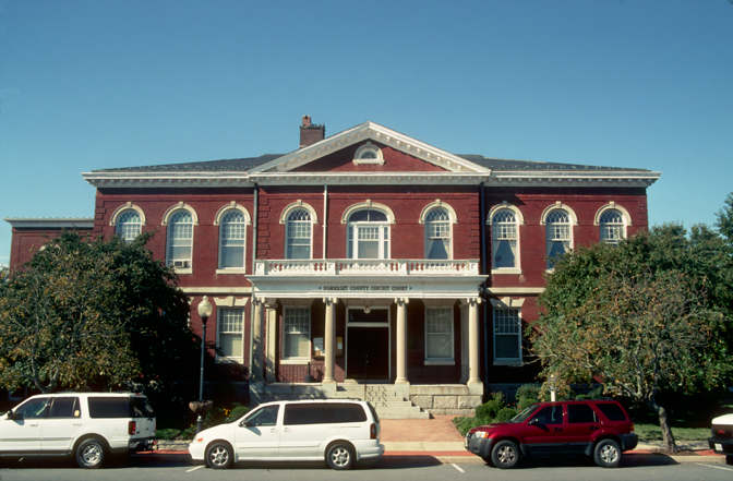
38°7′41″N 75°56′54″W / 38.12806°N 75.94833°WDeal Island 51 William S. Smith House July 9, 1991 Southern side of Oriole Rd., east of its junction with Crab Island Rd.
38°10′22″N 75°48′56″W / 38.17278°N 75.81556°WOriole 52 Somerset Academy Archaeological Site 
September 11, 1986 Address Restricted Princess Anne 53 St. John's Methodist Episcopal Church and Joshua Thomas Chapel November 1, 1990 Deal Island Rd. north of its junction with Tangier Rd.
38°9′19″N 75°56′50″W / 38.15528°N 75.94722°WDeal Island 54 St. Mark's Episcopal Church October 25, 1990 Junction of Westover-Marion and Charles Barnes Rds.
38°4′21″N 75°42′35″W / 38.0725°N 75.70972°WKingston 55 St. Paul's Methodist Episcopal Church April 12, 1996 Junction of Maryland Route 413 and Sign Rd.
38°7′23″N 75°42′26″W / 38.12306°N 75.70722°WWestover 56 St. Paul's Protestant Episcopal Church August 3, 1990 Near the junction of Farm Market Rd. and St. Pauls Church Rd.
38°0′56″N 75°46′14″W / 38.01556°N 75.77056°WTulls Corner 57 St. Peter's Methodist Episcopal Church November 2, 1990 Junction of Old Crisfield-Marion Rd. and Heart's Ease Rd.
38°1′1″N 75°49′13″W / 38.01694°N 75.82028°WHopewell 58 Sudler's Conclusion August 28, 1973 Northwest of Manokin off Maryland Route 361
38°7′16″N 75°46′37″W / 38.12111°N 75.77694°WManokin 59 SUSAN MAY May 16, 1985 Lower Thorofare
38°7′41″N 75°56′54″W / 38.12806°N 75.94833°WWenona 60 Capt. Leonard Tawes House April 5, 1990 Somerset Ave.
37°58′32″N 75°50′43″W / 37.97556°N 75.84528°WCrisfield 61 Teackle Mansion 
October 26, 1971 Mansion St.
38°12′12″N 75°42′8″W / 38.20333°N 75.70222°WPrincess Anne 62 THOMAS W. CLYDE 
May 16, 1985 Lower Thorofare
38°7′41″N 75°56′54″W / 38.12806°N 75.94833°WWenona 63 Tudor Hall December 19, 1974 Southeast of Upper Fairmount off Maryland Route 361
38°5′52″N 75°46′31″W / 38.09778°N 75.77528°WUpper Fairmount 64 William T. Tull House March 26, 1996 Along the western side of Maryland Route 413
38°7′32″N 75°42′22″W / 38.12556°N 75.70611°WWestover 65 University of Maryland Eastern Shore September 16, 2005 1 Backbone Rd.
38°12′36″N 75°41′8″W / 38.21°N 75.68556°WPrincess Anne 66 Upper Fairmount Historic District September 13, 1993 Both sides of Maryland Route 361
38°6′25″N 75°48′1″W / 38.10694°N 75.80028°WUpper Fairmount 67 Waddy House November 3, 1988 Perryhawkin Rd.
38°11′37″N 75°38′54″W / 38.19361°N 75.64833°WPrincess Anne 68 Ward Brothers' House and Shop November 21, 1997 3199 Sackertown Rd.
37°58′13″N 75°50′42″W / 37.97028°N 75.845°WCrisfield 69 Waterloo February 13, 1986 Mt. Vernon Rd.
38°13′35″N 75°45′9″W / 38.22639°N 75.7525°WPrincess Anne 70 Waters' River August 9, 1984 Hood Rd.
38°5′54″N 75°45′50″W / 38.09833°N 75.76389°WManokin 71 Watkins Point Farm December 27, 2002 27737 Phoenix Church Rd.
37°58′51″N 75°47′28″W / 37.98083°N 75.79111°WMarion Station 72 White Hall June 7, 1984 Cooley Rd.
38°15′59″N 75°43′23″W / 38.26639°N 75.72306°WPrincess Anne 73 Williams' Conquest May 3, 1984 Charles Cannon Rd.
38°4′23″N 75°45′43″W / 38.07306°N 75.76194°WMarion Station See also
- List of National Historic Landmarks in Maryland
- National Register of Historic Places listings in Maryland
References
- ^ The latitude and longitude information provided in this table was derived originally from the National Register Information System, which has been found to be fairly accurate for about 99% of listings. For about 1% of NRIS original coordinates, experience has shown that one or both coordinates are typos or otherwise extremely far off; some corrections may have been made. A more subtle problem causes many locations to be off by up to 150 yards, depending on location in the country: most NRIS coordinates were derived from tracing out latitude and longitudes off of USGS topographical quadrant maps created under the North American Datum of 1927, which differs from the current, highly accurate WGS84 GPS system used by Google maps. Chicago is about right, but NRIS longitudes in Washington are higher by about 4.5 seconds, and are lower by about 2.0 seconds in Maine. Latitudes differ by about 1.0 second in Florida. Some locations in this table may have been corrected to current GPS standards.
- ^ "National Register of Historic Places: Weekly List Actions". National Park Service, United States Department of the Interior. Retrieved on November 10, 2011.
- ^ Numbers represent an ordering by significant words. Various colorings, defined here, differentiate National Historic Landmark sites and National Register of Historic Places Districts from other NRHP buildings, structures, sites or objects.
- ^ "National Register Information System". National Register of Historic Places. National Park Service. 2008-04-24. http://nrhp.focus.nps.gov/natreg/docs/All_Data.html.
U.S. National Register of Historic Places in Maryland Lists by county Allegany • Anne Arundel • Baltimore County • Calvert • Caroline • Carroll • Cecil • Charles • Dorchester • Frederick • Garrett • Harford • Howard • Kent • Montgomery • Prince George's • Queen Anne's • Somerset • St. Mary's • Talbot • Washington • Wicomico • Worcester

Lists by city Other lists Municipalities and communities of Somerset County, Maryland City 
Town CDPs Other
communitiesCokesbury | Ewell | Hopewell | Hudson's Corner | Kingston | Manokin | Marion Station | Oriole | Rehobeth | Rhodes Point | Shelltown | Tulls Corner | Tylerton | Upper Fairmount | Upper Falls | Venton | Wenona | Westover
Categories:- National Register of Historic Places in Maryland by county
- Somerset County, Maryland
-


Wikimedia Foundation. 2010.