- National Register of Historic Places listings in Polk County, Iowa
-
 Location of Polk County in Iowa
This is a list of the National Register of Historic Places listings in Polk County, Iowa.
This is intended to be a complete list of the properties and districts on the National Register of Historic Places in Polk County, Iowa, United States. Latitude and longitude coordinates are provided for many National Register properties and districts; these locations may be seen together in a Google map.[1]
There are 165 properties and districts listed on the National Register in the county, including 2 National Historic Landmarks.
-
- This National Park Service list is complete through NPS recent listings posted November 10, 2011.[2]
Current listings
[3] Landmark name [4] Image Date listed Location City or town Summary 1 Abraham Lincoln High School 
October 24, 2002 2600 SW. 9th St.
41°33′43″N 93°37′34″W / 41.561944°N 93.626111°WDes Moines 2 William W. and Elizabeth J. Ainsworth House October 22, 1998 1310 7th St.
41°36′08″N 93°37′38″W / 41.602222°N 93.627222°WDes Moines 3 Josiah Andrews House November 1, 1988 1128 27th St.
41°35′58″N 93°39′13″W / 41.599444°N 93.653611°WDes Moines 4 Ashby Manor Historic District September 4, 1992 Roughly bounded by Beaver Ave. and Ashby Park
41°37′30″N 93°40′23″W / 41.625°N 93.673056°WDes Moines 5 Ayrshire Apartments 
October 25, 1996 1815 6th Ave.
41°36′38″N 93°37′30″W / 41.610556°N 93.625°WDes Moines 1920 6 William H. and Alice Bailey House October 25, 1996 1810 6th Ave.
41°36′44″N 93°37′30″W / 41.612222°N 93.625°WDes Moines 7 C.H. Baker Double House 
October 25, 1996 1700-1702 6th Ave.
41°36′32″N 93°37′31″W / 41.608889°N 93.625278°WDes Moines 8 Baker-Devotie-Hollingsworth Block November 14, 1978 524 E. Grand Ave.; also 516-526 E. Grand Ave.
41°35′27″N 93°36′37″W / 41.590833°N 93.610278°WDes Moines 516-526 E. Grand represents a boundary increase of January 10, 2008 9 Walter M. Bartlett Double House October 22, 1998 1416-1418 6th Ave.
41°36′15″N 93°37′32″W / 41.604167°N 93.625556°WDes Moines 10 Bates Park Historic District October 25, 1996 4th St. between Orchard and Clark Sts.
41°36′18″N 93°37′24″W / 41.605°N 93.623333°WDes Moines 11 William A. and Etta Baum Cottage October 25, 1996 1604 8th St.
41°36′29″N 93°37′40″W / 41.608056°N 93.627778°WDes Moines 12 Boyt Company Building 
March 10, 2009 210 Court Ave.
41°35′07″N 93°37′11″W / 41.58516°N 93.61965°WDes Moines 13 Byron A. Beeson House October 25, 1996 1503 5th Ave.
41°36′21″N 93°37′28″W / 41.605833°N 93.624444°WDes Moines 14 Hill McClelland Bell House January 11, 1988 1091 26th St.
41°35′53″N 93°39′06″W / 41.598056°N 93.651667°WDes Moines 15 F.A. Benham House November 5, 1998 716 19th. St.
41°35′24″N 93°38′33″W / 41.59°N 93.6425°WDes Moines 16 Big Creek Schoolhouse August 11, 2004 112 3rd St.
41°46′14″N 93°42′51″W / 41.770556°N 93.714167°WPolk City 17 Byron and Ivan Boyd House April 6, 2004 304 42nd St.
41°35′08″N 93°40′50″W / 41.585556°N 93.680556°WDes Moines 18 Burns United Methodist Church June 15, 1977 811 Crocker St.
41°35′37″N 93°37′41″W / 41.593611°N 93.628056°WDes Moines 19 Burnstein-Malin Grocery 
October 22, 1998 1241 6th Ave.
41°36′07″N 93°37′31″W / 41.601944°N 93.625278°WDes Moines 20 Camp Dodge Pool District February 17, 1995 Buildings A22-A24 at Camp Dodge
41°42′12″N 93°42′34″W / 41.703333°N 93.709444°WJohnston 21 James Sansom Carpenter House April 23, 1998 3320 Kinsey Ave.
41°36′26″N 93°33′01″W / 41.607222°N 93.550278°WDes Moines 22 Larnerd Case House June 21, 1982 3111 Easton 400 Walnut St.41°36′41″N 93°33′19″W / 41.61139°N 93.55528°W Des Moines 23 Chaffee-Hunter House October 22, 1998 1821 8th St.
41°36′40″N 93°37′40″W / 41.611111°N 93.627778°WDes Moines 24 D.S. Chamberlain Building 
June 28, 2007 1312 Locust St.
41°35′04″N 93°38′03″W / 41.58458°N 93.63422°WDes Moines Built in 1917-1918. 25 Chautauqua Park Historic District March 22, 1990 Roughly bounded by 16th St., Hickman Rd., and the Chautauqua Parkway
41°36′46″N 93°38′06″W / 41.612778°N 93.635°WDes Moines 26 Civic Center Historic District December 7, 1988 Both banks of the Des Moines River from the Center St. Dam to the Scott Ave. Dam
41°34′59″N 93°36′57″W / 41.583056°N 93.615833°WDes Moines 27 Clemens Automobile Company Building 
May 9, 2009 200 10th St.
41°35′03″N 93°37′46″W / 41.584089°N 93.629522°WDes Moines Built in 1916. 28 College Corner Commercial Historic Business District April 23, 1998 Euclid Ave. between 2nd and 3rd Aves.
41°37′39″N 93°37′13″W / 41.6275°N 93.620278°WDes Moines 29 Court Avenue Bridge 
May 15, 1998 Court Ave. over the Des Moines River
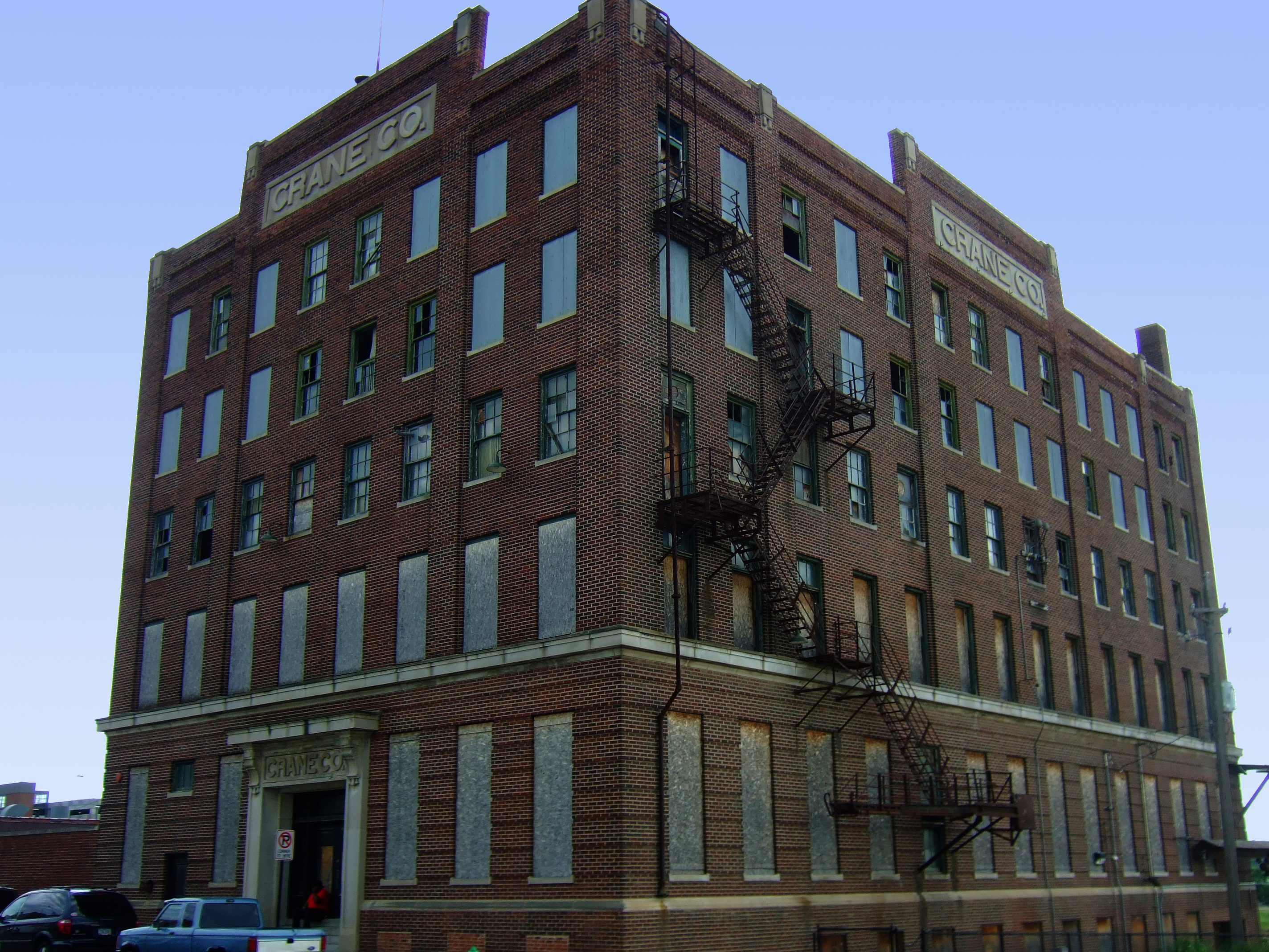
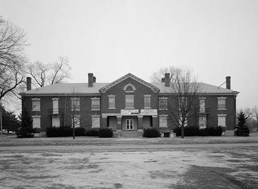
41°35′09″N 93°37′03″W / 41.585833°N 93.6175°WDes Moines 30 Crane Building 
August 30, 2001 1440 Walnut
41°35′03″N 93°38′09″W / 41.584167°N 93.635833°WDes Moines Built in 1916. 31 Crawford House January 27, 1983 2203 Grand Ave.
41°35′05″N 93°38′50″W / 41.584722°N 93.647222°WDes Moines 32 Albert Baird Cummins House June 30, 1982 2404 Forest Dr.
41°35′02″N 93°39′00″W / 41.583889°N 93.65°WDes Moines 33 Jay Norwood and Genevieve Pendleton Darling House September 30, 1992 2320 Terrace Rd.
41°34′57″N 93°39′14″W / 41.5825°N 93.653889°WDes Moines 34 Professor Charles O. Denny House September 8, 1988 1084 25th St.
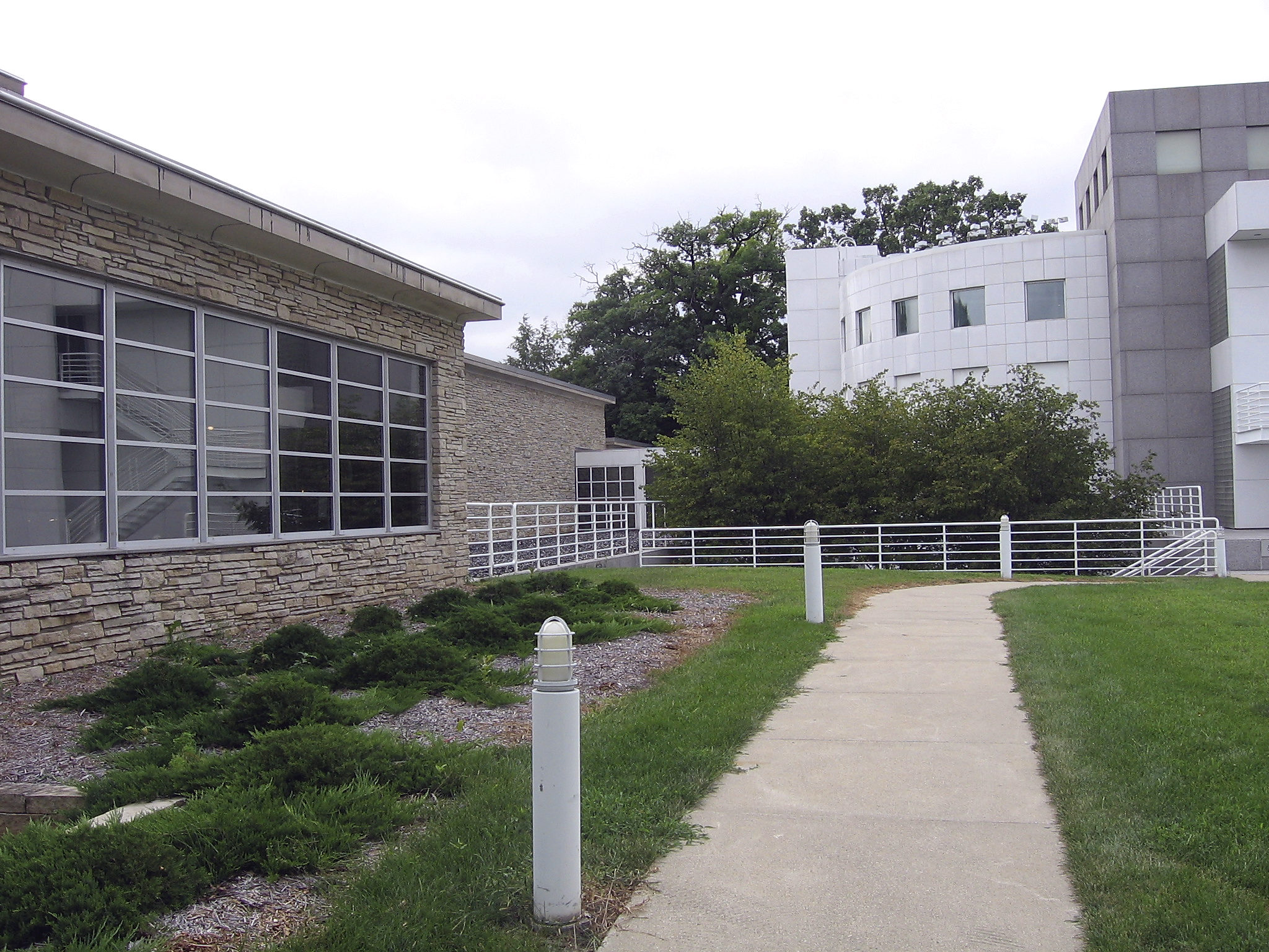
41°35′52″N 93°39′03″W / 41.597778°N 93.650833°WDes Moines 35 Des Moines Art Center 
October 19, 2004 4700 Grand Ave.
41°35′00″N 93°40′52″W / 41.583333°N 93.681111°WDes Moines 36 Des Moines Saddlery Company Building 
June 27, 1985 307-311 Court Ave.
41°35′07″N 93°37′15″W / 41.585278°N 93.620833°WDes Moines Built in 1881. 37 Des Moines Western Railway Freight House July 10, 2008 625 E. Court Ave.
41°35′15″N 93°36′29″W / 41.58737°N 93.60795°WDes Moines 38 Drake University Campus Historic District September 8, 1988 Roughly two blocks along University Ave. near 25th St.
41°36′03″N 93°39′07″W / 41.600833°N 93.651944°WDes Moines 39 Earle & LeBosquet Block 
June 11, 2009 407-409 Court Ave.
41°35′06″N 93°37′18″W / 41.585036°N 93.621747°WDes Moines Built in 1896. 40 Edward B. and Nettie E. Evans House April 1, 2002 1410 19th St.
41°36′16″N 93°38′34″W / 41.604444°N 93.642778°WDes Moines 41 Fire Station No. 4 June 27, 1979 1041 8th St.
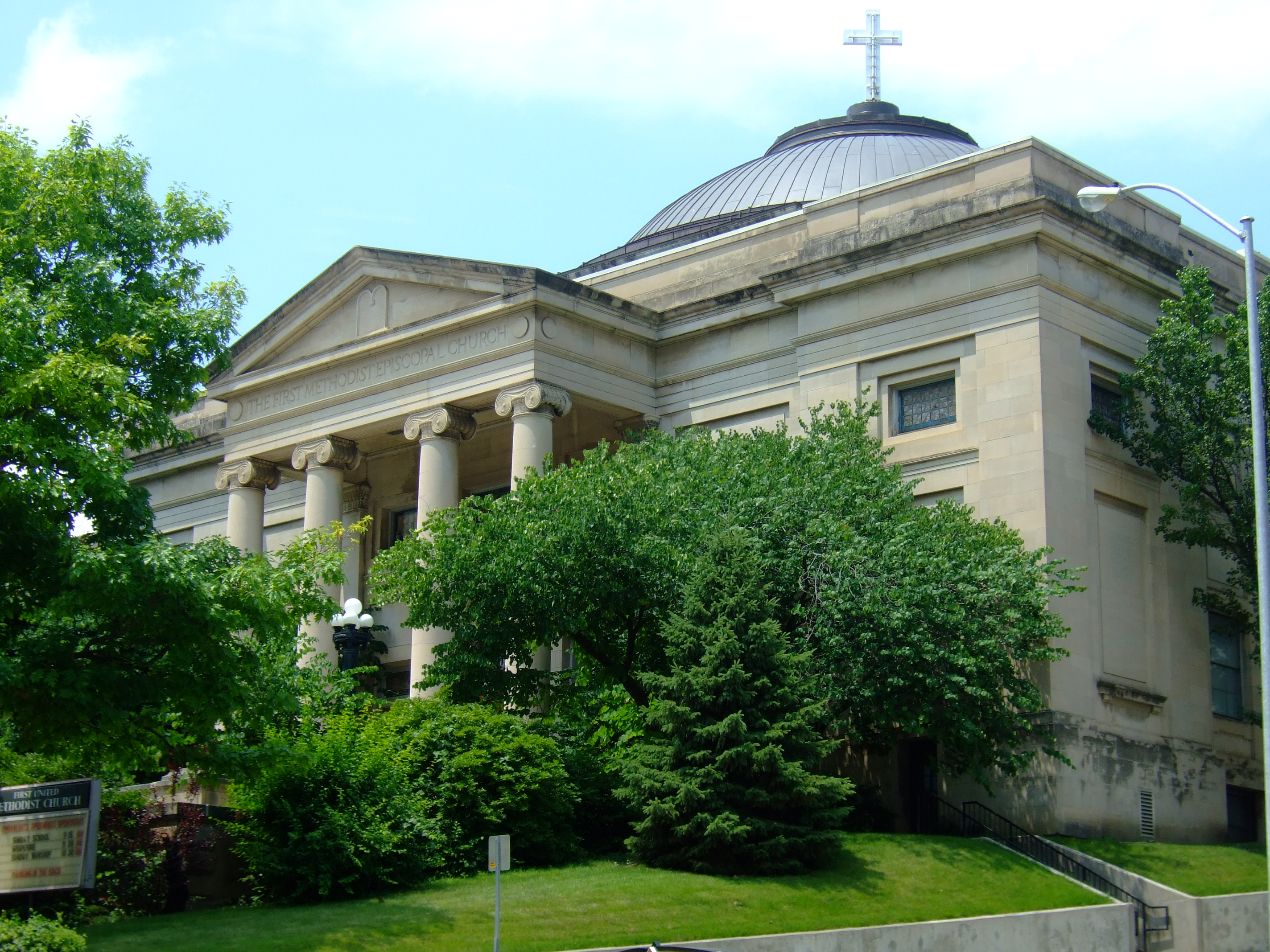
41°35′51″N 93°37′39″W / 41.5975°N 93.6275°WDes Moines 42 First Methodist Episcopal Church 
April 12, 1984 10th and Pleasant Sts.
41°35′21″N 93°37′51″W / 41.589167°N 93.630833°WDes Moines 1905-08 43 Fish and Game Pavilion and Aquarium December 23, 1991 Iowa State Fairgrounds
41°35′46″N 93°33′21″W / 41.596111°N 93.555833°WDes Moines 44 Fleming Building 
May 22, 2002 218 6th Ave.
41°35′08″N 93°37′29″W / 41.585556°N 93.624722°WDes Moines Built in 1907. 45 Flynn Farm, Mansion, and Barn November 30, 1973 2600 111th St.
41°37′18″N 93°46′33″W / 41.621667°N 93.775833°WDes Moines 46 Fort Des Moines Provisional Army Officer Training School 
May 30, 1974 Fort Des Moines Military Reservation
41°31′25″N 93°37′11″W / 41.523611°N 93.619722°WDes Moines 47 Franklin Apartments 
October 25, 1996 1811 6th Ave.
41°36′40″N 93°37′30″W / 41.611111°N 93.625°WDes Moines 48 Rees Gabriel House December 21, 1978 1701 Pennsylvania Ave.
41°36′33″N 93°36′34″W / 41.609167°N 93.609444°WDes Moines 49 Goddard Bungalow Court Historic District November 21, 2000 1410-21 Goddard Court and 1232 14th St.
41°36′05″N 93°38′09″W / 41.601389°N 93.635833°WDes Moines 50 Lowry W. and Hattie N. Goode First North Des Moines House 
October 22, 1998 1813 7th St.
41°36′40″N 93°37′35″W / 41.611111°N 93.626389°WDes Moines 51 Grand View College (Old Main) May 23, 1978 1200 Grandview Ave.
41°37′15″N 93°36′15″W / 41.620833°N 93.604167°WDes Moines 52 Greek Orthodox Church of Saint George 
February 28, 1997 1118 35th St.
41°35′55″N 93°39′49″W / 41.598611°N 93.663611°WDes Moines 53 Grocers Wholesale Company Building 
April 25, 2008 22 W. 9th St.
41°34′59″N 93°37′41″W / 41.58298°N 93.62792°WDes Moines Built in 1906. 54 F.E. Haley Double House October 22, 1998 1233-1235 7th St.
41°36′06″N 93°37′35″W / 41.601667°N 93.626389°WDes Moines 55 Hallett Flat-Rawson & Co. Apartment Building 
December 1, 2000 1301-1307 Locust St.
41°35′06″N 93°38′01″W / 41.585°N 93.633611°WDes Moines Built in 1906. 56 Dr. John B. and Anna M. Hatton House April 23, 1998 1730 7th St.
41°36′37″N 93°37′38″W / 41.610278°N 93.627222°WDes Moines 57 Hawkeye Insurance Company Building 
April 28, 1986 209 4th St.
41°35′08″N 93°37′17″W / 41.585556°N 93.621389°WDes Moines Built in 1868. 58 Hawkeye Transfer Company Warehouse March 22, 2010 702 Elm St.
41°34′50″N 93°37′28″W / 41.580644°N 93.624369°WDes Moines 59 William B. Hayes House October 25, 1996 1547 Arlington Ave.
41°36′27″N 93°37′18″W / 41.6075°N 93.621667°WDes Moines 60 Allen Hazen Water Tower August 11, 2004 4800 Hickman Rd.
41°36′59″N 93°41′01″W / 41.616389°N 93.683611°WDes Moines 61 Henshie-Briggs Row House August 8, 2001 1106 High St.
41°35′12″N 93°37′58″W / 41.586667°N 93.632778°WDes Moines 62 Herndon Hall July 27, 1977 2000 Grand Ave.
41°35′03″N 93°38′39″W / 41.584167°N 93.644167°WDes Moines 63 Herring Motor Car Company Building 
December 6, 2004 110 W. 10th St.
41°35′03″N 93°37′45″W / 41.584167°N 93.629167°WDes Moines Built in 1912. 64 Herrold Bridge May 15, 1998 NW. 88th Ave. over Beaver Creek
41°43′19″N 93°44′59″W / 41.721944°N 93.749722°WHerrold 65 Highland Park Historic Business District at Euclid and Sixth Avenues July 15, 1998 Roughly the junction of Euclid and 6th Aves.
41°37′42″N 93°37′27″W / 41.628333°N 93.624167°WDes Moines 66 Hohberger Building September 12, 2002 502-506 E. Locust St.
41°35′24″N 93°36′39″W / 41.59°N 93.610833°WDes Moines Built in 1898. 67 Home of Marshall's Horseradish October 22, 1998 1546 2nd Place
41°36′27″N 93°37′14″W / 41.6075°N 93.620556°WDes Moines 68 Homestead Building 
March 5, 1982 303 Locust St.
41°35′16″N 93°37′17″W / 41.587778°N 93.621389°WDes Moines Built in 1893. 69 Hotel Fort Des Moines 
September 16, 1982 10th and Walnut Sts.
41°35′03″N 93°37′46″W / 41.584167°N 93.629444°WDes Moines Built in 1919. 70 Hotel Kirkwood 
December 10, 2003 400 Walnut St.
41°35′15″N 93°36′33″W / 41.5875°N 93.609167°WDes Moines Built in 1930. 71 Hotel Randolph June 11, 2009 200-204 4th St.
41°35′06″N 93°37′18″W / 41.58505°N 93.621678°WDes Moines Built in 1911. 72 Hubbell Building 
August 11, 2004 904 Walnut St.
41°35′08″N 93°37′43″W / 41.585556°N 93.628611°WDes Moines Built in 1913. 73 Hubbell Warehouse November 12, 2010 340 SW 5th St.
41°34′50″N 93°37′17″W / 41.580556°N 93.621389°WDes Moines Architectural Legacy of Proudfoot & Bird in Iowa MPS 74 Ingersoll Place Plat Historic District November 21, 2000 28th, Linden, and High Sts.
41°35′14″N 93°39′11″W / 41.587222°N 93.653056°WDes Moines 75 Iowa Commission for the Blind Building July 1, 2010 524 4th St.
41°35′20″N 93°37′22″W / 41.588889°N 93.622778°WDes Moines 76 Iowa State Capitol 
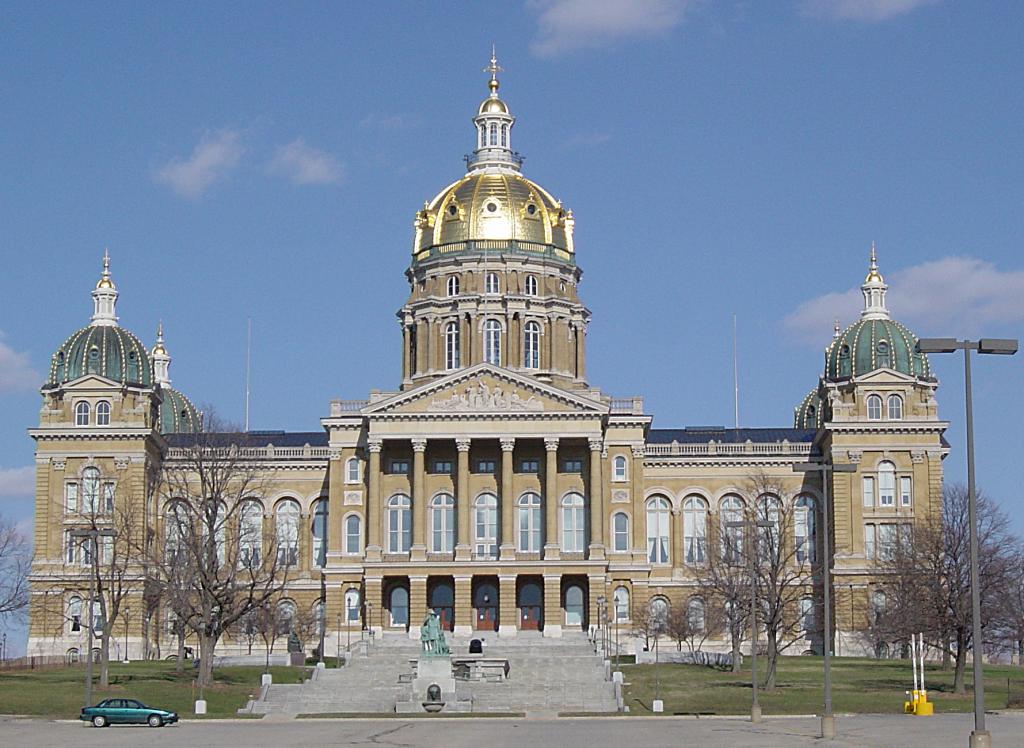
October 21, 1976 Grand Ave. and E. 12th St.
41°35′27″N 93°36′15″W / 41.590833°N 93.604167°WDes Moines Built in 1884-1886. 77 Iowa State Fair and Exposition Grounds Historic District September 14, 1987 E. 30th St. and Grand Ave.
41°35′43″N 93°32′58″W / 41.595278°N 93.549444°WDes Moines 78 Iowa State Historical Building November 14, 1978 E. 12th and Grand Ave.
41°35′34″N 93°36′09″W / 41.592778°N 93.6025°WDes Moines 79 Iowa-Des Moines National Bank Building 
July 10, 1979 520 Walnut St.
41°35′08″N 93°37′27″W / 41.585556°N 93.624167°WDes Moines 80 Capt. Nicholas W. and Emma Johnson House December 6, 1990 Junctino of 21st St. and University Ave.
41°36′00″N 93°38′42″W / 41.6°N 93.645°WDes Moines 81 Dr. Anna E. and Andrew A. Johnstone House October 25, 1996 1830 8th St.
41°36′40″N 93°37′41″W / 41.611111°N 93.628056°WDes Moines 82 Jordan House December 10, 1973 2251 Fuller Rd.
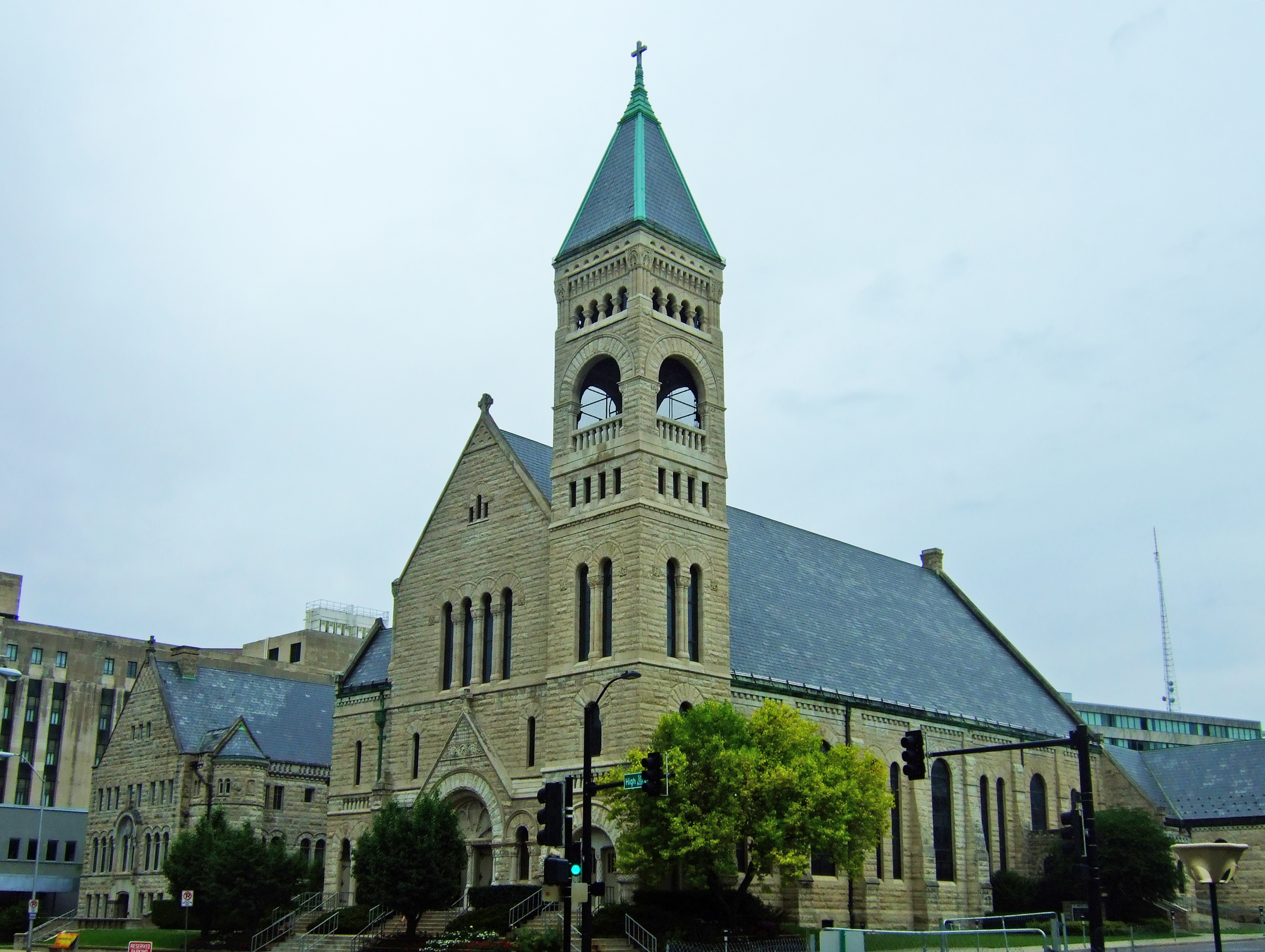
41°33′36″N 93°44′05″W / 41.56°N 93.734722°WWest Des Moines 83 Rev. R.W. and Fannie E. Keeler House November 4, 1993 1430 10th St.
41°36′21″N 93°37′50″W / 41.605833°N 93.630556°WDes Moines 84 Kingman Place Historic District November 21, 2000 27th to 31st Sts., Kingman Boulevard, Rutland St. and Cottage Ave.
41°36′04″N 93°39′04″W / 41.601111°N 93.651111°WDes Moines 85 Francis M. Kirkham House September 8, 1988 1026 24th St.
41°35′45″N 93°38′58″W / 41.595833°N 93.649444°WDes Moines 86 Nellie and Thomas Knotts House September 8, 1988 1021 26th St.
41°35′44″N 93°39′05″W / 41.595556°N 93.651389°WDes Moines 87 Kromer Flats 
October 25, 1996 1433-1439 6th Ave.
41°36′17″N 93°37′31″W / 41.604722°N 93.625278°WDes Moines 88 The Lexington December 12, 1976 1721 Pleasant St.
41°35′24″N 93°38′26″W / 41.59°N 93.640556°WDes Moines 89 Liberty Building 
July 22, 2010 418 Sixth Ave.
41°35′15″N 93°37′32″W / 41.5875°N 93.625556°WDes Moines Architectural Legacy of Proudfoot & Bird in Iowa MPS 90 Linden Heights Historic District December 10, 2003 Foster Dr., Glenview Dr., Woodlawn, and Park Hill Dr. west of SW. 42nd St.
41°34′25″N 93°40′35″W / 41.573611°N 93.676389°WDes Moines 91 Richard T.C. Lord and William V. Wilcox House September 8, 1988 2416 Kingman Boulevard
41°35′46″N 93°39′01″W / 41.596111°N 93.650278°WDes Moines 92 Mahnke House October 13, 1983 2707 High St.
41°35′14″N 93°39′12″W / 41.587222°N 93.653333°WDes Moines 93 The Maine 
October 25, 1996 1635 6th Ave.
41°36′34″N 93°37′30″W / 41.609444°N 93.625°WDes Moines 94 Maish House April 11, 1977 1623 Center St.
41°35′31″N 93°38′23″W / 41.591944°N 93.639722°WDes Moines 95 Masonic Temple of Des Moines 
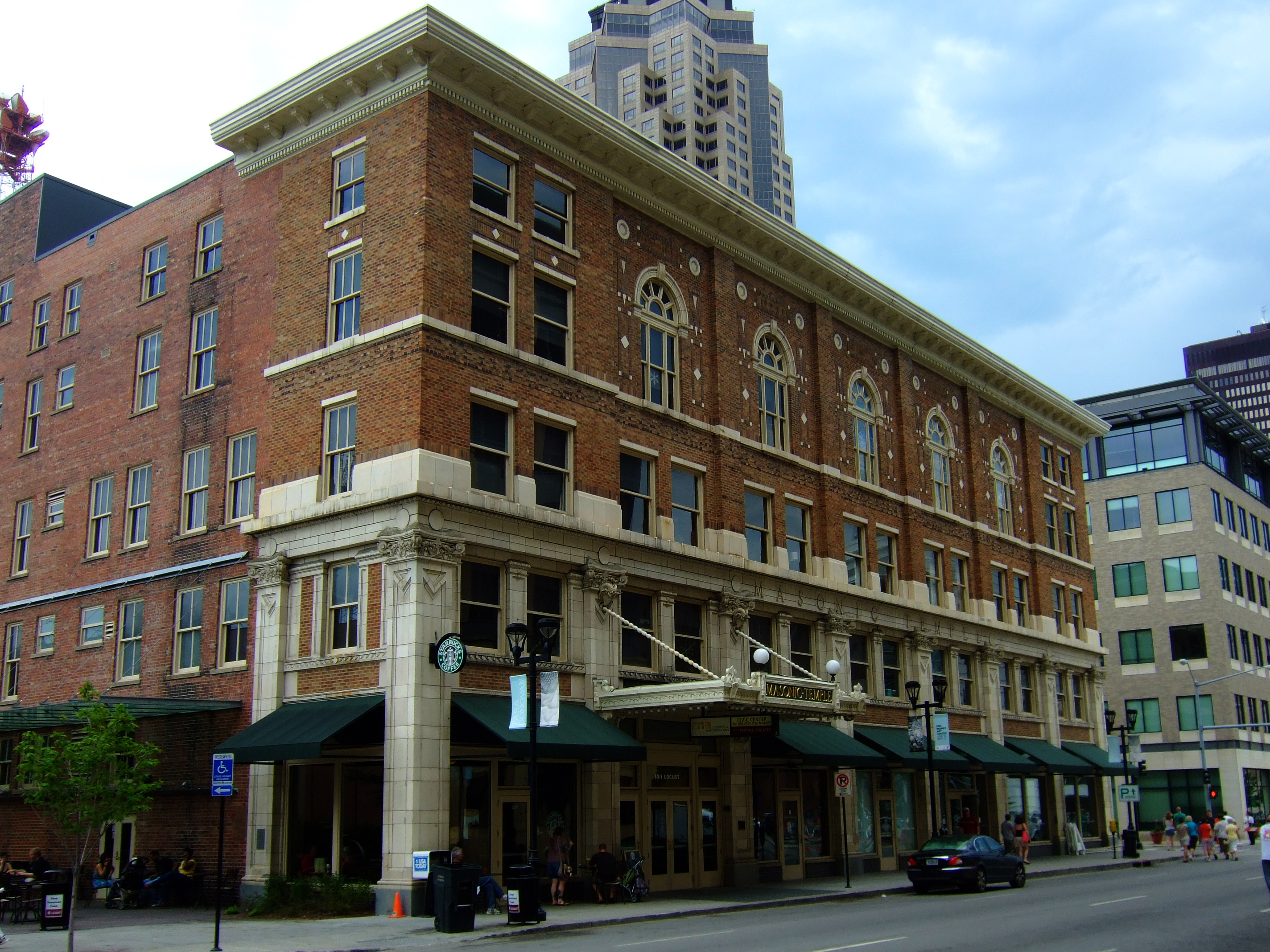
August 29, 1997 1011 Locust St.
41°35′09″N 93°37′47″W / 41.585833°N 93.629722°WDes Moines Built in 1913. 96 Minnie Y. and Frank P. Mattes House December 16, 2009 1305 34th St.
41°36′09″N 93°39′46″W / 41.602411°N 93.662811°WDes Moines 97 Methodist Deaconess Institute—Esther Hall 
March 4, 2009 921 Pleasant Street
41°35′21″N 93°37′50″W / 41.589142°N 93.63055°WDes Moines 1921 98 Middlesex Plat Historic District 
November 21, 2000 Center St. to Woodland Ave., 31st to 35th Sts.
41°35′44″N 93°39′39″W / 41.595556°N 93.660833°WDes Moines 99 Municipal Building 
November 10, 1977 E. 1st and Locust Sts.
41°35′21″N 93°36′58″W / 41.589167°N 93.616111°WDes Moines Built in 1909-1910. 100 Murillo Flats June 9, 2009 605 16th St.
41°35′14″N 93°38′20″W / 41.587283°N 93.638881°WDes Moines Built in 1903. 101 National Biscuit Company Building 
May 6, 2009 1001 Cherry St.
41°34′59″N 93°37′45″W / 41.58295°N 93.629264°WDes Moines Built in 1906. 102 Naylor House July 10, 1974 944 W. 9th St.
41°35′41″N 93°37′45″W / 41.594722°N 93.629167°WDes Moines 103 The New Lawn 
October 25, 1996 1245 6th Ave.
41°36′06″N 93°37′30″W / 41.601667°N 93.625°WDes Moines 104 Newens Sanitary Dairy Historic District December 17, 2003 2225 and 2300-2312 University Ave.
41°36′01″N 93°38′52″W / 41.600278°N 93.647778°WDes Moines 105 Norman Apartment Building September 8, 1988 3103 University Ave.
41°36′02″N 93°39′34″W / 41.600556°N 93.659444°WDes Moines 106 Northwestern Hotel 
January 12, 1984 321 E. Walnut
41°35′17″N 93°36′43″W / 41.588056°N 93.611944°WDes Moines 107 The Oaklands Historic District October 25, 1996 Oakland and Arlington Aves. between Franklin and College Aves.
41°36′34″N 93°37′22″W / 41.609444°N 93.622778°WDes Moines 108 F. F. Odenweller-James P. and Nettie Morey House November 1, 1988 1115 27th St.
41°36′08″N 93°39′26″W / 41.602222°N 93.657222°WDes Moines 109 Owl's Head Historic District October 11, 1978 Ridge Rd., Forest Dr., and 28th and 29th Sts.
41°34′57″N 93°39′18″W / 41.5825°N 93.655°WDes Moines 110 George B. Peak House November 14, 1978 1080 22nd St.
41°35′52″N 93°38′48″W / 41.597778°N 93.646667°WDes Moines 111 Perry and Brainard Block 
October 25, 1996 1601 6th Ave.
41°36′29″N 93°37′31″W / 41.608056°N 93.625278°WDes Moines Built in 1888. 112 Polk County Courthouse 
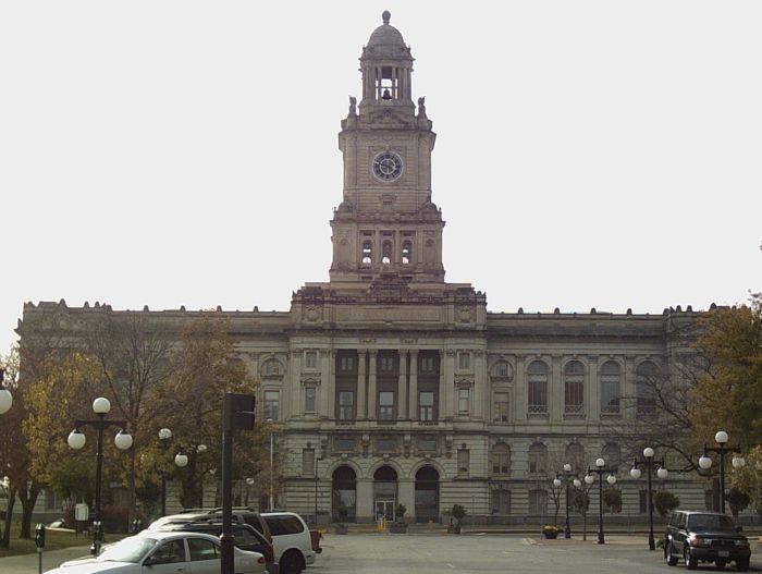
April 30, 1979 6th and Mulberry Sts.
41°35′05″N 93°37′23″W / 41.584722°N 93.623056°WDes Moines Built in 1900. 113 Prospect Park Second Plat Historic District April 23, 1998 Roughly along the Des Moines River south to Franklin Ave., between 6th Ave. and 9th St.
41°36′45″N 93°37′39″W / 41.6125°N 93.6275°WDes Moines 114 Public Library of Des Moines 
July 25, 1977 Locust St.
41°35′15″N 93°37′07″W / 41.5875°N 93.618611°WDes Moines Built in 1903. 115 Anson O. Reynolds House September 8, 1988 1022 26th St.
41°35′44″N 93°39′07″W / 41.595556°N 93.651944°WDes Moines 116 Riverview Park Plat Historic District October 25, 1996 Arlington Ave. between Franklin and 6th Aves.
41°36′43″N 93°37′24″W / 41.611944°N 93.623333°WDes Moines 117 Ralph Rollins House 
November 14, 1978 2801 Fleur Dr.
41°33′36″N 93°38′38″W / 41.56°N 93.643889°WDes Moines 118 Rumely-Des Moines Drug Company Building November 16, 1989 110 SW. 4th St.
41°34′58″N 93°37′16″W / 41.582778°N 93.621111°WDes Moines Built in 1903. 119 St. Ambrose Cathedral and Rectory 
March 30, 1979 607 High St.
41°35′19″N 93°37′32″W / 41.588611°N 93.625556°WDes Moines Built in 1891. 120 Saint John's Roman Catholic Church 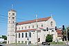
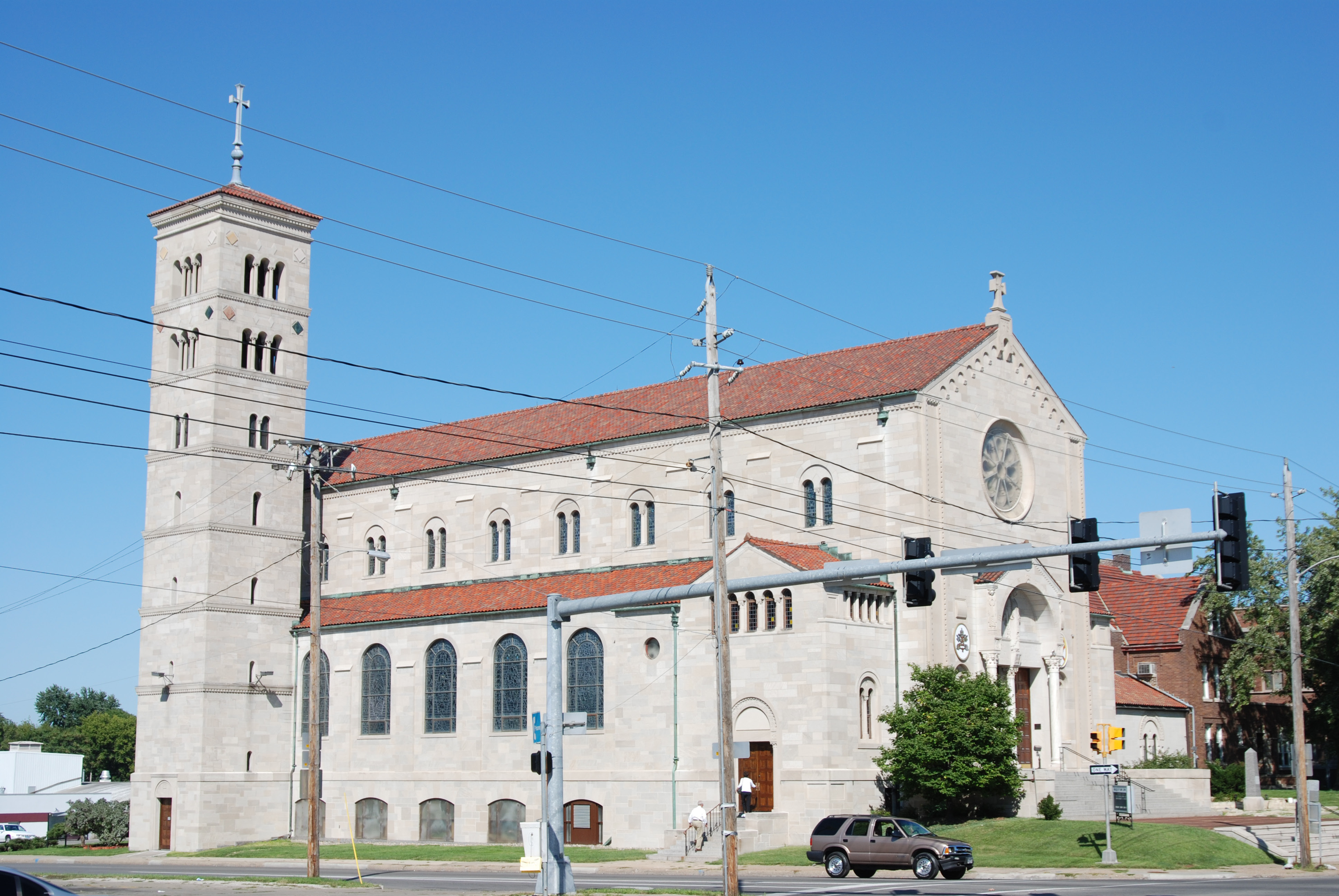
September 8, 1987 1915 University Ave.
41°35′30″N 93°38′35″W / 41.591667°N 93.643056°WDes Moines 121 St. Paul's Episcopal Church March 31, 2010 815 High St.
41°35′17″N 93°37′44″W / 41.588042°N 93.629°WDes Moines 122 Salisbury House July 20, 1977 4025 Tonawanda Dr.
41°34′46″N 93°40′17″W / 41.579444°N 93.671389°WDes Moines Built in 1927-1928. 123 Sargent's Garage October 22, 1998 510 College Ave.
41°36′27″N 93°37′31″W / 41.6075°N 93.625278°WDes Moines 124 Savery Hotel 
November 5, 1998 401 Locust St.
41°35′15″N 93°37′22″W / 41.5875°N 93.622778°WDes Moines Built in 1919. 125 Julius Scheibe Cottage October 22, 1998 815 College Ave.
41°36′28″N 93°37′42″W / 41.607778°N 93.628333°WDes Moines 126 Schmitt and Henry Manufacturing Company March 17, 2010 309 SW 8th St.
41°34′50″N 93°37′31″W / 41.580683°N 93.625303°WDes Moines 127 Mary A. and Caleb D. Scott House September 8, 1988 1014 26th St.
41°35′44″N 93°39′07″W / 41.595556°N 93.651944°WDes Moines 128 Scottish Rite Consistory Building 
February 9, 1983 6th Ave. and Park St.
41°35′29″N 93°37′30″W / 41.591389°N 93.625°WDes Moines 1926-27 129 Seth Richards Commercial Block March 11, 2005 300-310 Court Ave.
41°35′07″N 93°36′30″W / 41.585278°N 93.608333°WDes Moines Built in 1889. 130 Sherman Hill Historic District January 25, 1979 Roughly bounded by Woodland Ave., 19th, School, and 15th Sts.
41°35′28″N 93°38′25″W / 41.591111°N 93.640278°WDes Moines 131 Hoyt Sherman Place September 19, 1977 1501 Woodland Ave.
41°35′19″N 93°38′16″W / 41.588611°N 93.637778°WDes Moines 132 Lampson P. Sherman House September 8, 1988 1052 26th St.
41°35′49″N 93°39′07″W / 41.596944°N 93.651944°WDes Moines 133 John P. Simmons House November 1, 1988 1113 27th St.
41°36′08″N 93°39′24″W / 41.602222°N 93.656667°WDes Moines 134 Sixth and Forest Historic District October 25, 1996 Northeastern and northwestern corners of the junction of 6th and Forest Aves.
41°36′17″N 93°37′32″W / 41.604722°N 93.625556°WDes Moines 135 David W. Smouse Opportunity School October 24, 2002 2820 Center St.
41°35′29″N 93°39′17″W / 41.591389°N 93.654722°WDes Moines 136 Southeast Water Trough October 8, 1976 SE. 11th and Scott St.
41°34′58″N 93°35′58″W / 41.582778°N 93.599444°WDes Moines 137 Southwest Fifth St. Bridge 
May 15, 1998 SW. 5th St. over the Raccoon River
41°34′37″N 93°37′10″W / 41.576944°N 93.619444°WDes Moines 138 Standard Glass and Paint Company Building December 6, 2004 112 10th St.
41°35′02″N 93°37′42″W / 41.583889°N 93.628333°WDes Moines 139 Samuel A. and Margaret Stevenson House January 3, 1985 2940 Cottage Grove Ave.
41°35′54″N 93°39′31″W / 41.598333°N 93.658611°WDes Moines 140 Thomas I. Stoner House February 12, 1992 1030 56th St.
41°35′47″N 93°41′37″W / 41.596389°N 93.693611°WDes Moines 141 Dr. Richard and Paulina Stuart House September 8, 1988 1060 25th St.
41°35′50″N 93°39′03″W / 41.597222°N 93.650833°WDes Moines 142 Sylvan Theater Historic District August 15, 1995 In Greenwood Park on the western side of 45th St., 1 block south of its junction with Grand Ave.
41°34′50″N 93°40′48″W / 41.580556°N 93.68°WDes Moines 143 Syndicate Block October 1, 2001 501 E. Locust
41°35′22″N 93°36′38″W / 41.589444°N 93.610556°WDes Moines Built in 1883. 144 Taft-West Warehouse December 20, 2006 216-222 Court Ave.
41°35′06″N 93°37′17″W / 41.585°N 93.621389°WDes Moines Built in 1922. 145 Teachout Building April 29, 1999 500-502 E. Locust St.
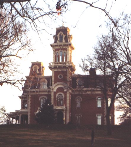
41°35′24″N 93°36′39″W / 41.59°N 93.610833°WDes Moines Built in 1912. 146 Terrace Hill 
July 31, 2003 2300 Grand Ave.
41°35′00″N 93°38′56″W / 41.583333°N 93.648889°WDes Moines 147 Theodore Roosevelt High School October 24, 2002 4419 Center St.
41°35′34″N 93°40′45″W / 41.592778°N 93.679167°WDes Moines 148 Trent-Beaver House 
October 25, 1996 1802 6th Ave.
41°36′42″N 93°37′30″W / 41.611667°N 93.625°WDes Moines 149 Paul J. and Ida Trier House November 9, 1988 6880 N.W. Beaver Dr.
41°41′10″N 93°41′21″W / 41.686111°N 93.689167°WJohnston 150 Trinity Methodist Episcopal Church April 23, 1998 1548 8th St.
41°36′28″N 93°37′42″W / 41.607778°N 93.628333°WDes Moines 151 Susie P. Turner Double House October 22, 1998 1420-1422 8th St.
41°36′17″N 93°37′41″W / 41.604722°N 93.628056°WDes Moines 152 U.S. Post Office November 19, 1974 2nd and Walnut Sts.
41°35′13″N 93°37′10″W / 41.58684°N 93.61948°WDes Moines 153 Universalist Church 
September 6, 2005 420 4th St.
41°40′16″N 93°21′41″W / 41.671111°N 93.361389°WMitchellville 154 Mrs. Marian D. Vail-Prof. Charles Noyes Kinney House November 1, 1988 1318 27th St.
41°36′10″N 93°39′13″W / 41.602778°N 93.653611°WDes Moines 155 Valley Junction-West Des Moines City Hall and Engine House February 17, 1983 137 5th St.
41°34′15″N 93°42′29″W / 41.570833°N 93.708056°WWest Des Moines Built in 1905. 156 Veneman's Bungalow Court Historic District November 21, 2000 1101-115 Droukas Court and 1228 and 1232 E. 12th St.
41°36′03″N 93°36′25″W / 41.600833°N 93.606944°WDes Moines 157 Henry Wallace House May 14, 1993 756 16th St.
41°35′29″N 93°38′23″W / 41.591389°N 93.639722°WDes Moines 158 Warfield, Pratt, and Howell Company Warehouse 
May 15, 1985 100 West Court Ave.
41°35′08″N 93°37′04″W / 41.585556°N 93.617778°WDes Moines 159 Charles H. and Lena May Weitz House October 22, 1998 1424 5th Ave.
41°36′16″N 93°37′27″W / 41.604444°N 93.624167°WDes Moines 160 West Chester January 19, 1984 3520 Grand Ave.
41°35′02″N 93°39′52″W / 41.583889°N 93.664444°WDes Moines 161 West Ninth Streetcar Line Historic District April 23, 1998 W. 9th St. from University Ave. to Hickman Rd.
41°36′23″N 93°37′47″W / 41.606389°N 93.629722°WDes Moines 162 Wherry Block 
October 22, 1998 1600-1602 6th Ave.
41°36′28″N 93°37′33″W / 41.607778°N 93.625833°WDes Moines Built in 1887. 163 Woodland Place Historic District November 21, 2000 25th to 27th St. to Woodland Ave.
41°35′24″N 93°39′06″W / 41.59°N 93.651667°WDes Moines 164 Youngerman Block June 10, 2009 206-208 4th St.
41°35′07″N 93°37′18″W / 41.585392°N 93.6218°WDes Moines Built in 1876. 165 Younker Brothers Department Store March 17, 2010 713 Walnut St.
41°35′09″N 93°37′36″W / 41.585783°N 93.626558°WDes Moines See also
References
- ^ The latitude and longitude information provided in this table was derived originally from the National Register Information System, which has been found to be fairly accurate for about 99% of listings. For about 1% of NRIS original coordinates, experience has shown that one or both coordinates are typos or otherwise extremely far off; some corrections may have been made. A more subtle problem causes many locations to be off by up to 150 yards, depending on location in the country: most NRIS coordinates were derived from tracing out latitude and longitudes off of USGS topographical quadrant maps created under North American Datum of 1927, which differs from the current, highly accurate GPS system used by Google maps. Chicago is about right, but NRIS longitudes in Washington are higher by about 4.5 seconds, and are lower by about 2.0 seconds in Maine. Latitudes differ by about 1.0 second in Florida. Some locations in this table may have been corrected to current GPS standards.
- ^ "National Register of Historic Places: Weekly List Actions". National Park Service, United States Department of the Interior. Retrieved on November 10, 2011.
- ^ Numbers represent an ordering by significant words. Various colorings, defined here, differentiate National Historic Landmark sites and National Register of Historic Places Districts from other NRHP buildings, structures, sites or objects.
- ^ "National Register Information System". National Register of Historic Places. National Park Service. . http://nrhp.focus.nps.gov/natreg/docs/All_Data.html.
U.S. National Register of Historic Places Topics Lists by states Alabama • Alaska • Arizona • Arkansas • California • Colorado • Connecticut • Delaware • Florida • Georgia • Hawaii • Idaho • Illinois • Indiana • Iowa • Kansas • Kentucky • Louisiana • Maine • Maryland • Massachusetts • Michigan • Minnesota • Mississippi • Missouri • Montana • Nebraska • Nevada • New Hampshire • New Jersey • New Mexico • New York • North Carolina • North Dakota • Ohio • Oklahoma • Oregon • Pennsylvania • Rhode Island • South Carolina • South Dakota • Tennessee • Texas • Utah • Vermont • Virginia • Washington • West Virginia • Wisconsin • WyomingLists by territories Lists by associated states Other  Category:National Register of Historic Places •
  Portal:National Register of Historic Places
Municipalities and communities of Polk County, Iowa County seat: Des Moines Cities Alleman | Altoona | Ankeny | Bondurant | Carlisle‡ | Clive‡ | Des Moines‡ | Elkhart | Granger‡ | Grimes‡ | Johnston | Mitchellville‡ | Norwalk‡ | Pleasant Hill | Polk City | Runnells | Sheldahl‡ | Urbandale‡ | West Des Moines‡ | Windsor Heights

CDP Other
communitiesFootnotes ‡This populated place also has portions in an adjacent county or counties
Categories:- National Register of Historic Places in Iowa by county
- Polk County, Iowa
- Buildings and structures in Polk County, Iowa
-


Wikimedia Foundation. 2010.