- National Register of Historic Places listings in Penobscot County, Maine
-
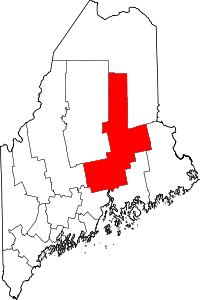 Location of Penobscot County in Maine
This is a list of the National Register of Historic Places listings in Penobscot County, Maine.
This is intended to be a complete list of the properties and districts on the National Register of Historic Places in Penobscot County, Maine, United States. Latitude and longitude coordinates are provided for many National Register properties and districts; these locations may be seen together in a Google map.[1]
There are 102 properties and districts listed on the National Register in the county.
-
- This National Park Service list is complete through NPS recent listings posted November 10, 2011.[2]
Contents: Counties in Maine Androscoggin - Aroostook - Cumberland - Franklin - Hancock - Kennebec - Knox - Lincoln - Oxford - Penobscot - Piscataquis - Sagadahoc - Somerset - Waldo - Washington - York Current listings
[3] Landmark name [4] Image Date listed Location City or town Summary 1 Abbott Memorial Library November 20, 1978 State Route 7
45°01′28″N 69°17′21″W / 45.024444°N 69.289167°WDexter 2 Adams-Pickering Block May 2, 1974 Corner of Main and Middle Sts.
44°48′00″N 68°46′23″W / 44.8°N 68.773056°WBangor 3 All Souls Congregational Church June 18, 1992 10 Broadway
44°48′09″N 68°46′05″W / 44.8025°N 68.768056°WBangor 4 Harold Allan Schoolhouse July 16, 2008 15 Rebel Hill Rd.
44°48′21″N 68°32′23″W / 44.80573°N 68.53966°WClifton 5 Archeological Site No. 122-6 October 31, 1995 Address Restricted Millinocket 6 Archeological Site No. 122-8 October 31, 1995 Address Restricted Millinocket 7 Archeological Site No. 122-14 October 31, 1995 Address Restricted Millinocket 8 Archeological Site No. 122-16 October 31, 1995 Address Restricted Millinocket 9 Archeological Site No. 122-22 October 31, 1995 Address Restricted Millinocket 10 Archeological Site No. 134-8 October 31, 1995 Address Restricted Millinocket 11 Archeological Site No. 134-9 October 31, 1995 Address Restricted Millinocket 12 Bangor Children's Home September 9, 1975 218 Ohio St.
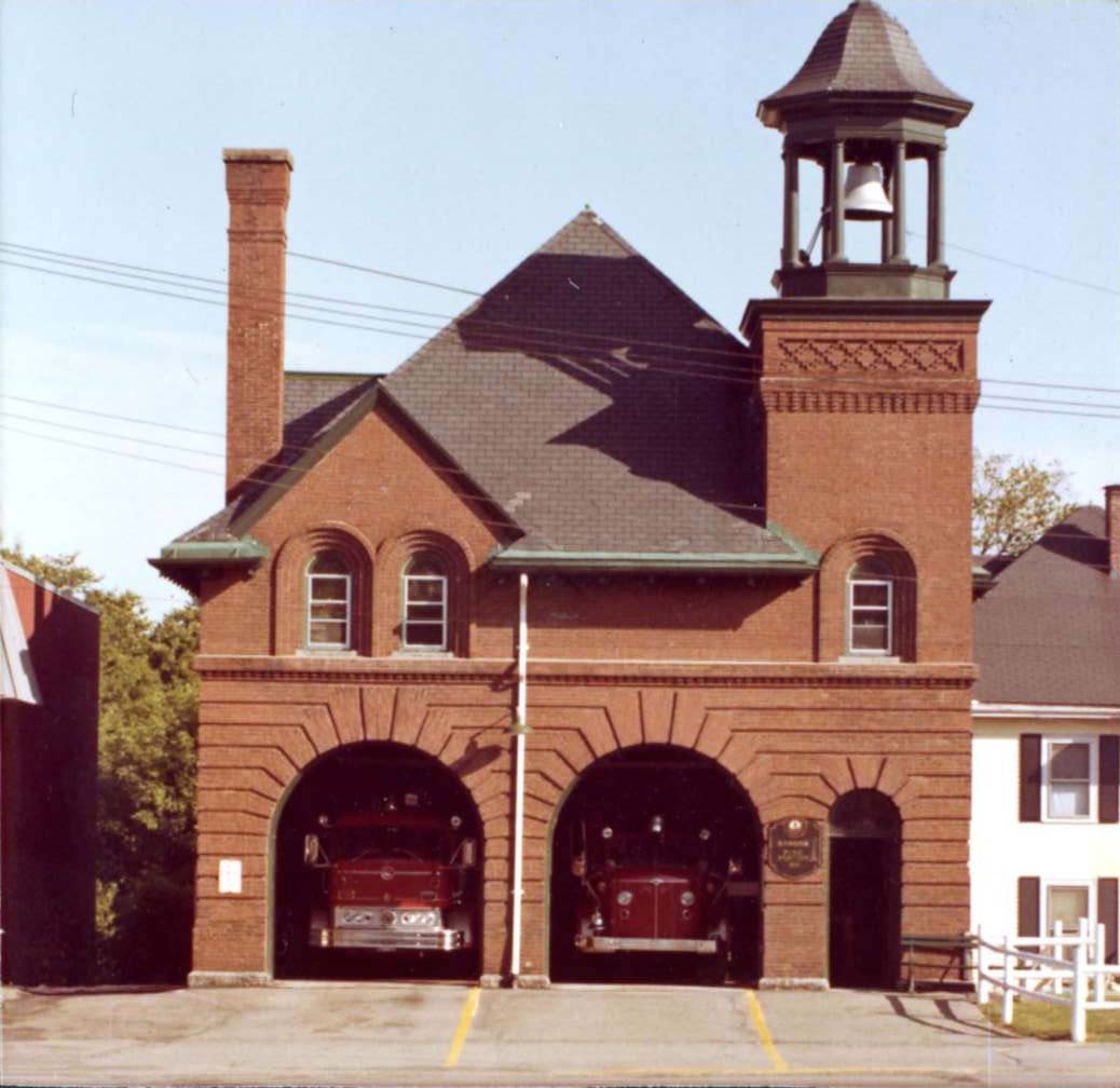
44°48′28″N 68°46′55″W / 44.807778°N 68.781944°WBangor 13 Bangor Fire Engine House No. 6 April 7, 1988 284 Center St.
44°48′48″N 68°46′26″W / 44.813333°N 68.773889°WBangor 14 Bangor Hose House No. 5 
September 11, 1997 247 State St.
44°48′20″N 68°45′37″W / 44.805556°N 68.760278°WBangor 15 Bangor House February 23, 1972 174 Main St.
44°47′54″N 68°46′23″W / 44.798333°N 68.773056°WBangor 16 Bangor Mental Health Institute July 16, 1987 656 State St.
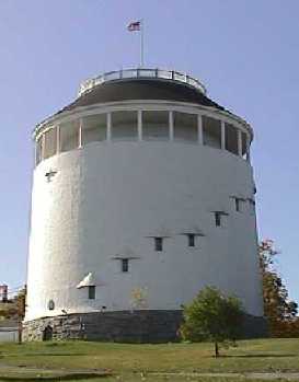
44°49′02″N 68°44′31″W / 44.817222°N 68.741944°WBangor 17 Bangor Standpipe 
August 30, 1974 Jackson St.
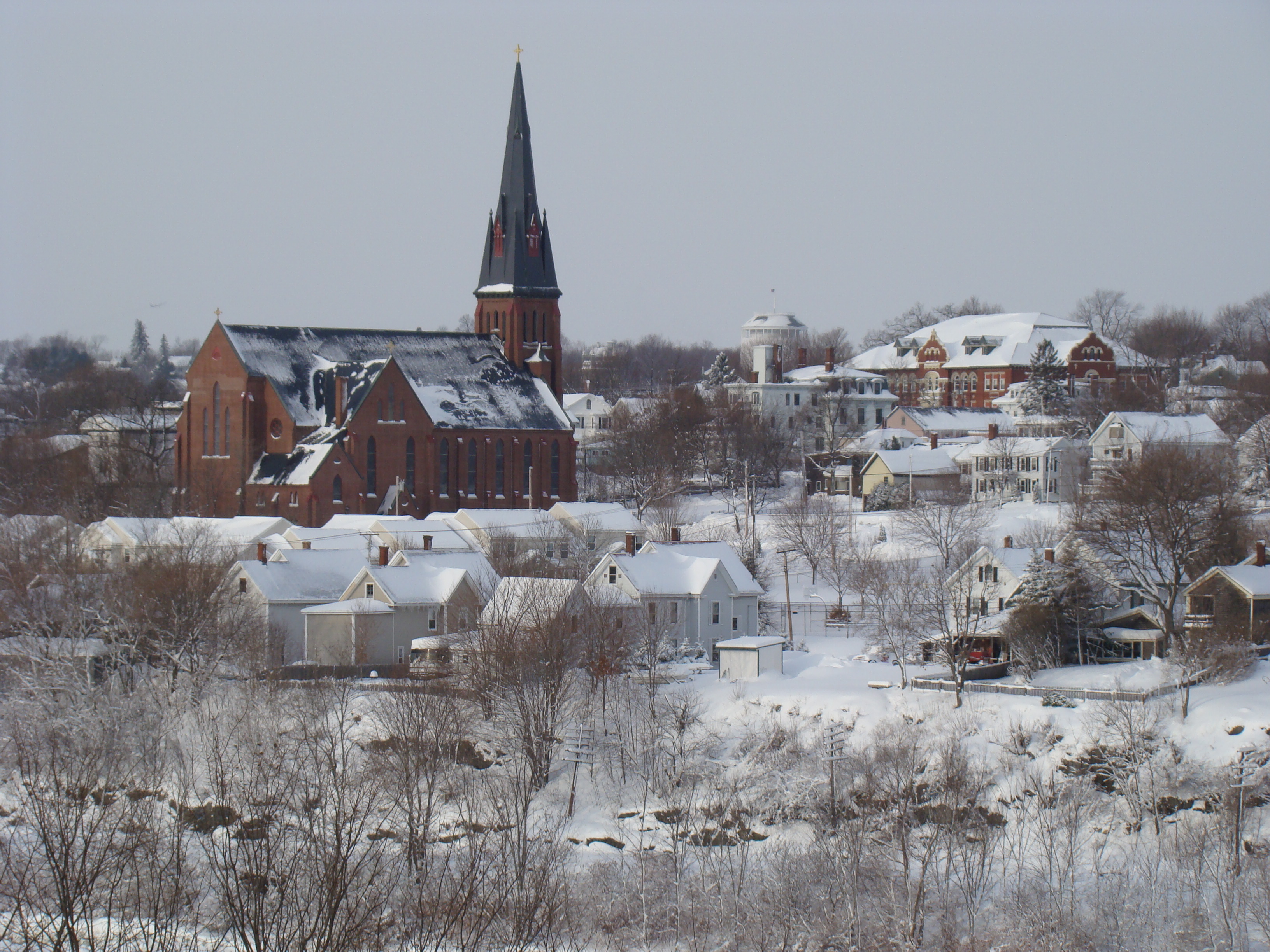
44°48′25″N 68°47′00″W / 44.806944°N 68.783333°WBangor 18 Bangor Theological Seminary Historic District 
August 2, 1977 Union St.
44°48′06″N 68°46′50″W / 44.801667°N 68.780556°WBangor 19 Bank Block March 25, 1999 15 Main St.
45°01′28″N 69°17′29″W / 45.024444°N 69.291389°WDexter 20 Battleship Maine Monument October 8, 1999 Junction of Main and Cedar Sts.
44°47′50″N 68°46′27″W / 44.797222°N 68.774167°WBangor 21 Blake House October 31, 1972 107 Court St.
44°48′13″N 68°46′37″W / 44.803611°N 68.776944°WBangor 22 Bodwell Water Power Company Plant September 29, 1988 Eastern side of the Penobscot River at Bridge St.
44°56′28″N 68°38′53″W / 44.941111°N 68.648056°WMilford 23 Bradford Farm Historic District April 22, 2003 100 Main St.
45°59′56″N 68°27′02″W / 45.998889°N 68.450556°WPatten 24 Broadway Historic District May 7, 1973 Bounded by Garland, Essex, State, Park, and Center Sts.
44°48′20″N 68°45′22″W / 44.805556°N 68.756111°WBangor 25 Charles G. Bryant Double House June 20, 1986 16-18 Division St.
44°48′31″N 68°46′33″W / 44.808611°N 68.775833°WBangor 26 Building at 84-96 Hammond Street August 5, 2005 84-96 Hammond St.
44°48′04″N 68°46′23″W / 44.801111°N 68.773056°WBangor 27 Louis I. Bussey School November 7, 1976 U.S. Route 202
44°40′50″N 69°09′45″W / 44.680556°N 69.1625°WDixmont 28 Cliffwood Hall July 16, 2008 15 Rebel Hill Rd.
44°48′21″N 68°32′23″W / 44.80573°N 68.53966°WClifton 29 William Colburn House June 19, 1973 91 Bennoch Rd.
44°53′19″N 68°40′42″W / 44.888611°N 68.678333°WOrono 30 Congregational Church of Medway November 21, 1977 Off State Route 11
45°36′20″N 68°31′39″W / 45.605556°N 68.5275°WMedway 31 Connors House October 6, 1983 277 State St.
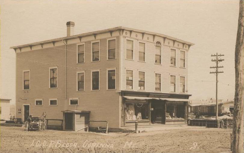
44°48′21″N 68°45′33″W / 44.805833°N 68.759167°WBangor 32 Corinth Town Hall and Corinthian Lodge No. 59, I.O.O.F. 
January 24, 2008 328 Main St.
45°00′08″N 69°01′22″W / 45.002222°N 69.022778°WCorinth 33 Corinth Village June 4, 1973 3.5 miles west of East Corinth
44°57′20″N 69°01′23″W / 44.955556°N 69.023056°WEast Corinth 34 John B. Curtis Free Public Library April 14, 1997 Northeastern corner of the junction of State Routes 11 and 221
45°04′03″N 68°56′13″W / 45.0675°N 68.936944°WBradford 35 Abial Cushman Store December 18, 1990 Main St. east of State Route 168
45°21′36″N 68°17′10″W / 45.36°N 68.286111°WLee 36 Dexter Grist Mill October 10, 1975 State Route 7
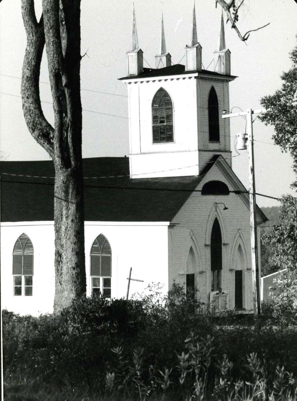
45°01′23″N 69°17′29″W / 45.023056°N 69.291389°WDexter 37 Dexter Universalist Church June 20, 1985 Church St.
45°01′29″N 69°17′22″W / 45.024722°N 69.289444°WDexter 38 District No. 2 School April 15, 1997 Southeastern corner of the junction of Pleasant St. and Caribou Rd.
45°11′07″N 68°36′51″W / 45.185278°N 68.614167°WPassadumkeag 39 District No. 5 School House September 11, 1997 Billings Rd., 0.15 miles northeast of the junction of U.S. Route 2 and Billings Rd.
44°48′42″N 68°54′36″W / 44.811667°N 68.91°WHermon 40 Dixmont Corner Church 
July 21, 1983 U.S. Route 202
44°40′50″N 69°09′42″W / 44.680556°N 69.161667°WDixmont 41 East Eddington Public Hall 
January 28, 2004 Airline Rd., 0.4 miles west of its junction with State Route 46, S.
44°47′32″N 68°35′11″W / 44.792222°N 68.586389°WEddington 42 Eddington Bend (Site 74-8) September 28, 1988 Address Restricted Eddington 43 Enterprise Grange, No. 173 January 24, 2008 446 Dow Rd.
44°43′14″N 68°47′20″W / 44.720556°N 68.788889°WOrrington 44 Samuel Farrar House May 23, 1974 123 Court St.
44°48′15″N 68°46′40″W / 44.804167°N 68.777778°WBangor 45 Garland Grange Hall May 12, 1975 Off State Route 94
45°02′27″N 69°09′38″W / 45.040833°N 69.160556°WGarland 46 Godfrey-Kellogg House June 18, 1973 212 Kenduskeag Ave.
44°48′54″N 68°47′01″W / 44.815°N 68.783611°WBangor 47 Grand Army Memorial Home October 31, 1972 159 Union St.
44°47′59″N 68°46′30″W / 44.799722°N 68.775°WBangor 48 Great Fire of 1911 Historic District 
June 14, 1984 Harlow, Center, Park, State, York, and Central Sts.
44°48′13″N 68°46′16″W / 44.803611°N 68.771111°WBangor 49 Gut Island Site March 17, 1994 Address Restricted Old Town 50 Hannibal Hamlin House October 9, 1979 15 5th St.
44°48′02″N 68°46′50″W / 44.800556°N 68.780556°WBangor 51 Hammond Street Congregation Church July 8, 1982 Hammond and High Sts.
44°48′04″N 68°46′28″W / 44.801111°N 68.774444°WBangor 52 Hampden Academy September 11, 1975 Alternate U.S. Route 1
44°44′24″N 68°50′17″W / 44.74°N 68.838056°WHampden 53 Hampden Congregational Church June 25, 1987 Main Rd., N.
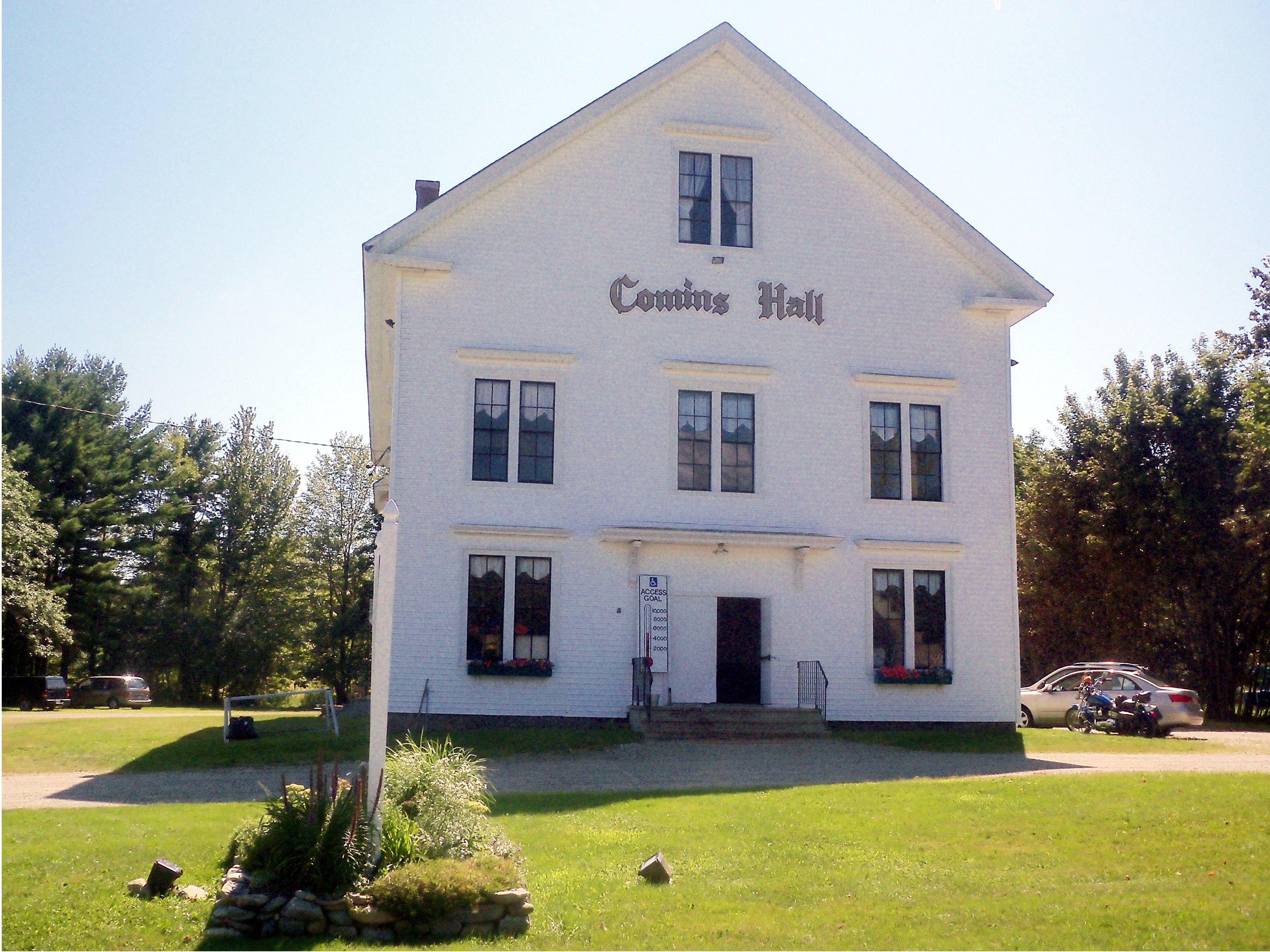
44°44′47″N 68°50′12″W / 44.746389°N 68.836667°WHampden 54 Harmony Hall June 27, 2007 24 Kennebec Rd.
44°43′57″N 68°50′40″W / 44.7325°N 68.844444°WHampden 55 Hexagon Barn January 24, 1980 Spring and Railroad Sts.
44°50′05″N 69°16′36″W / 44.834722°N 69.276667°WNewport 56 Hirundo Site September 11, 1975 Address Restricted Old Town 57 Charles W. Jenkins House September 18, 1990 67 Pine St.
44°48′10″N 68°45′59″W / 44.802778°N 68.766389°WBangor 58 Jonas Cutting-Edward Kent House April 2, 1973 48-50 Penobscot St.
44°48′16″N 68°46′04″W / 44.804444°N 68.767778°WBangor 59 Romanzo Kingman House February 19, 1982 Main St.
45°32′57″N 68°11′58″W / 45.549167°N 68.199444°WKingman 60 Martin Kinsley House April 14, 1983 Main Rd.
44°44′14″N 68°50′44″W / 44.737222°N 68.845556°WHampden Highlands 61 Jabez Knowlton Store January 18, 1978 West of Newburgh on State Route 9
44°42′38″N 69°02′30″W / 44.710556°N 69.041667°WNewburgh 62 Joseph W. Low House December 4, 1973 51 Highland St.
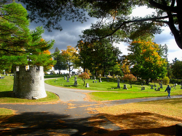
44°48′23″N 68°47′00″W / 44.806389°N 68.783333°WBangor 63 Maine Archeological Survey Site January 26, 1984 Address Restricted Indian Island 64 Maine Experiment Station Barn September 18, 1990 University of Maine campus
44°53′51″N 68°40′00″W / 44.8975°N 68.666667°WOrono 65 Mallett Hall October 29, 1993 Northern side of State Route 6, 0.1 miles east of its junction with State Route 168
45°21′35″N 68°17′03″W / 45.359722°N 68.284167°WLee 66 Milford Congregational Church July 13, 1989 Main and Perry Sts.
44°56′48″N 68°38′45″W / 44.946667°N 68.645833°WMilford 67 Morse & Co. Office Building April 2, 1973 Harlow St.
44°48′26″N 68°46′39″W / 44.807222°N 68.7775°WBangor 68 Morse Bridge February 16, 1970 Valley Ave. over Kenduskeag Stream
44°48′28″N 68°46′43″W / 44.807778°N 68.778611°WBangor 69 Mount Hope Cemetery District 
December 4, 1974 U.S. Route 2
44°49′29″N 68°43′28″W / 44.824722°N 68.724444°WBangor 70 North Newport Christian Church June 20, 1995 Northeastern corner of the junction of State Route 222 and Pratt Rd.
44°53′29″N 69°12′25″W / 44.891389°N 69.206944°WNorth Newport 71 Old Fire Engine House September 12, 1985 N. Main St.
44°53′07″N 68°39′53″W / 44.885278°N 68.664722°WOrono 72 Old Tavern April 4, 1986 State Route 188 and Old Dam Rd.
45°12′32″N 68°25′30″W / 45.208889°N 68.425°WBurlington 73 Orono Main Street Historic District December 7, 1977 Main St. from Maplewood Ave. to Pine St.
44°52′40″N 68°40′38″W / 44.877778°N 68.677222°WOrono 74 Edith Marion Patch House November 29, 2001 500 College Ave.
44°54′37″N 68°40′36″W / 44.910278°N 68.676667°WOld Town 75 Penobscot Expedition Site April 23, 1973 Address Restricted Bangor and Brewer 76 Penobscot Salmon Club and Pool September 15, 1976 N. Main St.
44°48′30″N 68°44′04″W / 44.808333°N 68.734444°WNorth Brewer 77 Robyville Bridge February 16, 1970 Over Kenduskeag Stream
44°56′35″N 68°58′08″W / 44.943056°N 68.968889°WRobyville 78 St. Anne's Church and Mission Site November 26, 1973 On Indian Island off State Route 43
44°56′33″N 68°39′10″W / 44.9425°N 68.652778°WOld Town 79 St. James Episcopal Church November 19, 1974 Centre St.
44°56′02″N 68°38′47″W / 44.933889°N 68.646389°WOld Town 80 St. John's Catholic Church 
April 2, 1973 York St.
44°48′13″N 68°45′40″W / 44.803611°N 68.761111°WBangor 81 Daniel Sargent House October 29, 1982 613 S. Main St.
44°46′03″N 68°47′05″W / 44.7675°N 68.784722°WBrewer 82 Sargent-Roberts House December 13, 1996 178 State St.
44°48′17″N 68°45′51″W / 44.804722°N 68.764167°WBangor 83 Sebasticook Lake Fishweir Complex November 10, 1994 Address Restricted Newport 84 George W. Smith Homestead January 15, 1980 Main St.
45°30′54″N 68°21′15″W / 45.515°N 68.354167°WMattawamkeag 85 Zebulon Smith House January 21, 1974 55 Summer St.
44°47′47″N 68°46′24″W / 44.796389°N 68.773333°WBangor 86 Springfield Congregational Church December 22, 1978 State Route 6
45°23′45″N 68°08′16″W / 45.395833°N 68.137778°WSpringfield 87 Stetson Union Church July 15, 1981 State Route 222
44°53′35″N 69°08′17″W / 44.893056°N 69.138056°WStetson 88 Stewart Free Library July 30, 1974 State Routes 11/43
44°55′16″N 69°15′46″W / 44.921111°N 69.262778°WCorinna 89 Symphony House October 26, 1972 166 Union St.
44°47′58″N 68°46′32″W / 44.799444°N 68.775556°WBangor 90 Nathaniel Treat House September 20, 1973 114 Main St.
44°52′48″N 68°39′48″W / 44.88°N 68.663333°WOrono 91 University of Maine at Orono Historic District July 12, 1978 Munson, Sebec, and Schoodic Rds.
44°53′56″N 68°40′17″W / 44.898889°N 68.671389°WOrono Boundary increase (listed April 27, 2010): Roughly bounded by the Mall, College Ave, lower Munson and Long Rds. 92 US Post Office-Old Town Main September 25, 1986 Center St.
44°55′51″N 68°39′26″W / 44.930833°N 68.657222°WOld Town 93 US Post Office-Orono Main May 2, 1986 Forest and Bennoch Sts.
44°52′36″N 68°40′57″W / 44.876667°N 68.6825°WOrono 94 Jones P. Veazie House June 23, 1988 88 Fountain St.
44°48′45″N 68°46′38″W / 44.8125°N 68.777222°WBangor 95 Wardwell-Trickey Double House June 18, 1992 97-99 Ohio St.
44°48′12″N 68°46′47″W / 44.803333°N 68.779722°WBangor 96 Gov. Israel Washburn House January 12, 1973 120 Main St.
44°52′37″N 68°40′40″W / 44.876944°N 68.677778°WOrono 97 West Market Square Historic District December 27, 1979 W. Market Sq.
44°48′05″N 68°46′17″W / 44.801389°N 68.771389°WBangor 98 Wheelwright Block July 18, 1974 34 Hammond St.
44°48′05″N 68°46′16″W / 44.801389°N 68.771111°WBangor 99 Whitney Park Historic District October 13, 1988 Roughly bounded by 8th, Union, Pond and Hayford Sts.
44°48′05″N 68°46′58″W / 44.801389°N 68.782778°WBangor 100 Gen. John Williams House December 22, 1978 62 High St.
44°47′58″N 68°46′28″W / 44.799444°N 68.774444°WBangor 101 Young Site March 26, 1976 Address Unknown Hudson 102 Zions Hill October 16, 1989 37 Zions Hill
45°01′23″N 69°17′42″W / 45.023056°N 69.295°WDexter See also
References
- ^ The latitude and longitude information provided in this table was derived originally from the National Register Information System, which has been found to be fairly accurate for about 99% of listings. For about 1% of NRIS original coordinates, experience has shown that one or both coordinates are typos or otherwise extremely far off; some corrections may have been made. A more subtle problem causes many locations to be off by up to 150 yards, depending on location in the country: most NRIS coordinates were derived from tracing out latitude and longitudes off of USGS topographical quadrant maps created under the North American Datum of 1927, which differs from the current, highly accurate WGS84 GPS system used by Google maps. Chicago is about right, but NRIS longitudes in Washington are higher by about 4.5 seconds, and are lower by about 2.0 seconds in Maine. Latitudes differ by about 1.0 second in Florida. Some locations in this table may have been corrected to current GPS standards.
- ^ "National Register of Historic Places: Weekly List Actions". National Park Service, United States Department of the Interior. Retrieved on November 10, 2011.
- ^ Numbers represent an ordering by significant words. Various colorings, defined here, differentiate National Historic Landmark sites and National Register of Historic Places Districts from other NRHP buildings, structures, sites or objects.
- ^ "National Register Information System". National Register of Historic Places. National Park Service. . http://nrhp.focus.nps.gov/natreg/docs/All_Data.html.
U.S. National Register of Historic Places Topics Lists by states Alabama • Alaska • Arizona • Arkansas • California • Colorado • Connecticut • Delaware • Florida • Georgia • Hawaii • Idaho • Illinois • Indiana • Iowa • Kansas • Kentucky • Louisiana • Maine • Maryland • Massachusetts • Michigan • Minnesota • Mississippi • Missouri • Montana • Nebraska • Nevada • New Hampshire • New Jersey • New Mexico • New York • North Carolina • North Dakota • Ohio • Oklahoma • Oregon • Pennsylvania • Rhode Island • South Carolina • South Dakota • Tennessee • Texas • Utah • Vermont • Virginia • Washington • West Virginia • Wisconsin • WyomingLists by territories Lists by associated states Other Municipalities and communities of Penobscot County, Maine Cities 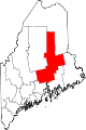
Towns Alton | Bradford | Bradley | Burlington | Carmel | Charleston | Chester | Clifton | Corinna | Corinth | Dexter | Dixmont | East Millinocket | Eddington | Edinburg | Enfield | Etna | Exeter | Garland | Glenburn | Greenbush | Hampden | Hermon | Holden | Howland | Hudson | Kenduskeag | Lagrange | Lakeville | Lee | Levant | Lincoln | Lowell | Mattawamkeag | Maxfield | Medway | Milford | Millinocket | Mount Chase | Newburgh | Newport | Orono | Orrington | Passadumkeag | Patten | Plymouth | Springfield | Stacyville | Stetson | Veazie | Winn | Woodville
Plantations Unorganized
territoriesArgyle | East Central Penobscot | Kingman | North Penobscot | Prentiss | Twombly | Whitney
CDPs Dexter | East Millinocket | Hampden | Howland | Lincoln | Milford | Millinocket | Newport | Orono
Indian
reservationCategories:- National Register of Historic Places in Maine by county
- Penobscot County, Maine
-


Wikimedia Foundation. 2010.