- Namungoona
-
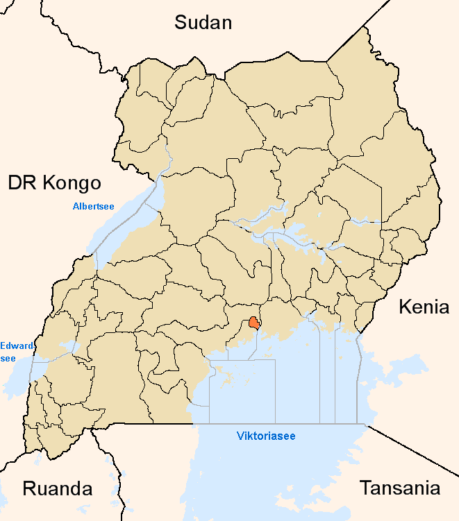
Namungoona Map of Kampala showing the location of Namungoona.
 Namungoona
Coordinates: 00°19′57″N 32°31′59″E / 0.3325°N 32.53306°E Region Central Uganda District Kampala Capital City Authority Division Lubaga Division Elevation 1,200 m (3,937 ft) Time zone EAT (UTC+3) Namungoona is a neighborhood within Kampala, Uganda's capital and largest city.
Contents
Location
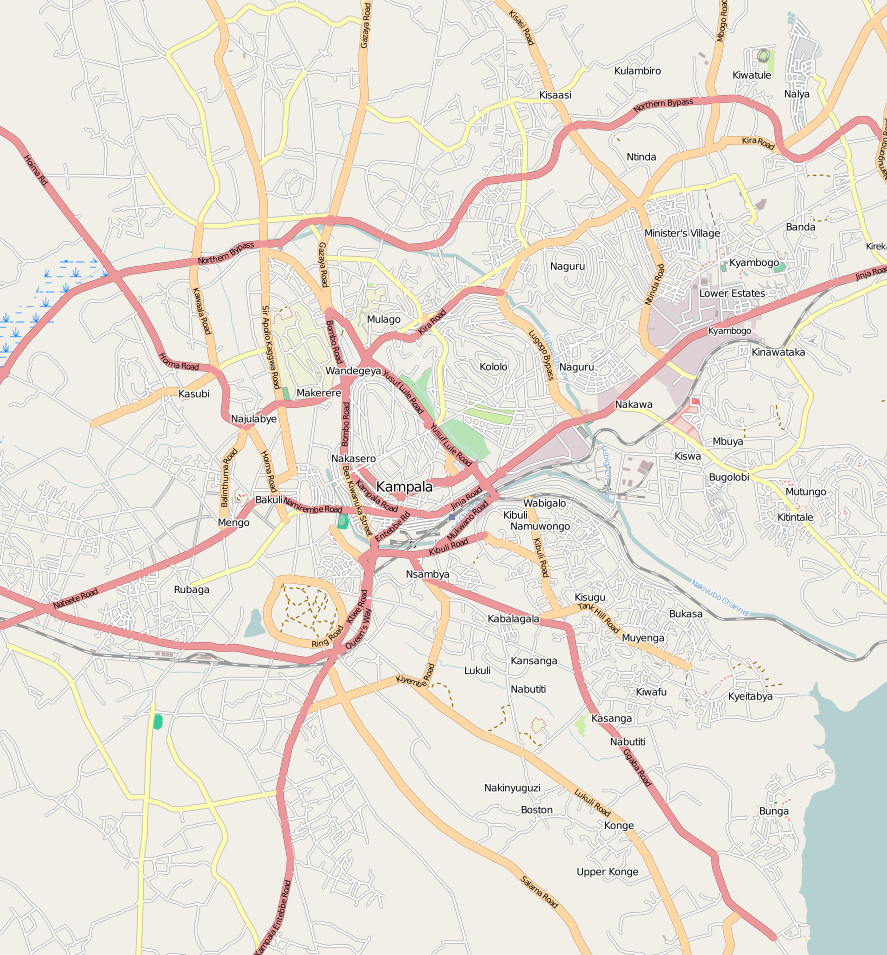
Namungoona is bordered by unincorporated Wakiso District to the west, northwest and to the north, the Kampala-Hoima Road and Kawaala to the east, Kasubi to the southeast, Lubya and Lusaze to the south and Busega to the southwest. This location is approximately 6.5 kilometres (4.0 mi), by road, northwest of the downtown area of Kampala. The coordinates of Namungoona are:00 19 57N, 32 31 59E (Latitude:0.3325; Longitude:32.5331).
Overview
Namungoona is primarily a middle-income residential neighborhood, including high-rise apartment complexes,[1] with upscale single-family residences interspersed between the apartment towers. The Kampala Northern Bypass Highway passes through Namungoona. Also located in this area is the headquarters of the Seventh Day Adventist Church in Uganda, together with a hospital and a school.
Landmarks
The landmarks in or near Namungoona include:
- The headquarters of the Seventh Day Adventist Church in Uganda
- The Adventist Day Church School - An elementary and secondary school administered by the Seventh Day Adventist Church in Uganda
- St. Nicholas Parish Hospital - A private hospital administered by the Seventh Day Adventist Church
- The Kampala Northern Bypass Highway - The highway passes through the northern reaches of Namungoona in a west to east direction
- Namungoona Condominium and Apartment Complex - A development by National Housing and Construction Company with an estimated 2,368 housing units, when complete][2]
- St. Kizito Primary School - A kindergarten and elementary school administered by BULAinc, an NGO based in Bayport, New York, USA.
Photos
See also
- Kampala District
- Kampala Northern Bypass Highway
- Kampala
- Lubaga Division
- Central Region, Uganda
References
External links
Kampala District Capital: KampalaDivisions Neighborhoods Bugoloobi · Bukoto · Busega · Butabika · Bwaise · Ggaba · Kabalagala · Kamwookya · Kansanga · Kaleerwe · Kanyanya · Kasubi · Katwe · Kawaala · Kawempe · Kibuli · Kibuye · Kigoowa · Kikaaya · Kisaasi · Kiwaatule · Kulambiro · Kololo · Kyambogo · Kyebando · Lubaga · Lungujja · Luzira · Makerere · Makindye · Mbuya · Mengo · Mpererwe · Mulago · Munyonyo · Mutundwe · Muyenga · Naakulabye · Naguru · Najjanankumbi · Nakasero · Nakawa · Namirembe · Namungoona · Namuwongo · Nateete · Ndeeba · Nsambya · Ntinda · Old Kampala · Port Bell · Wandegeya 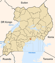
Economy Air Uganda · Aya Group · Quality Chemical Industries Limited · Mukwano Group · Ruparelia Group · Bank of Uganda · ABC Capital Bank · Bank of Africa · Bank of Baroda · Barclays Bank · DFCU Group · Cairo International Bank · Centenary Bank · Citibank · Crane Bank · DFCU Bank · Diamond Trust Bank · Ecobank · Equity Bank · Fina Bank · Global Trust Bank · Housing Finance Bank · Imperial Bank Uganda · Kenya Commercial Bank · National Bank of Commerce · Orient Bank · PostBank Uganda · Stanbic Bank · Standard Chartered Bank · Tropical Bank · United Bank for Africa · East African Development Bank · Uganda Development Bank · National Housing and Construction Company · Uganda Air Cargo · International Medical Group · National Social Security Fund · Umeme · Uganda Securities Exchange · Uganda Investment Authority · Capital Markets Authority · The Monitor · New Vision · New Vision Group · Uganda Telecom · Mercantile Credit Bank · Pride Microfinance Limited · Uganda Finance Trust Limited · Opportunity Uganda Limited · Kyagalanyi Coffee Limited · FINCA Uganda Limited · UGAFODE Microfinance LimitedNotable
landmarksBulange · Uganda Parliament Buildings · Butabika National Referral Hospital · Mulago Hospital Complex · Nsambya Hospital · Rubaga Hospital · Mengo Hospital · International Hospital Kampala · Kibuli Hospital · Kampala Capital City Authority Complex · Kampala Serena Hotel · Hotel Africana · Kampala Sheraton Hotel · Imperial Hotels Group · Imperial Royale Hotel · Grand Imperial Hotel · Hotel Equatoria · Kampala Hilton Hotel · Kampala Intercontinental Hotel · Kampala Speke Hotel · East African Development Bank Building · Bank of Uganda Building Complex · Mengo Palace · St. Paul's Cathedral Namirembe · St. Mary's Cathedral Lubaga · Makerere University Main Campus · Kibuli Mosque · Old Kampala Mosque · Kampala Airport · Uganda Museum · Uganda National Cultural Centre · Kampala Northern Bypass Highway · Kampala-Jinja Highway · Kasubi Tombs · Roman Catholic Archdiocese of KampalaEducation Makerere University · Makerere University Business School · Kampala International University · Kampala University · Kyambogo University · Law Development Centre · International Health Sciences University · International University of East Africa · Makerere College School · Rubaga Community School · Saint Lawrence University · Uganda Management Institute · Cavendish University Uganda · Victoria University Uganda · Uganda Martyrs University School of MedicineNotable people Apolo Nsibambi · Nasser Ntege Sebaggala · David Serwadda · Fred Ruhindi · John Ssebaana Kizito · Bulaimu Muwanga Kibirige · Erias Lukwago · Dr. Ian Clarke · Jennifer Musisi · Maria Kiwanuka · Laurence Sematimba · Joseph Kizito · Justinian Tamusuza · Robert Ssejjemba · Eugene Sseppuya · Phillip Ssozi · Wasswa Serwanga · Yusef Sozi · Derrick SebagalaCategories:- Neighborhood of Kampala
- Cities in the Great Rift Valley
- Kampala District
- Kampala
- Lubaga Division
- Central Region, Uganda
Wikimedia Foundation. 2010.