- Nahant Beach Boulevard
-
Nahant Beach Boulevard-Metropolitan Park System of Greater Boston

Location: Lynn and Nahant, Massachusetts Coordinates: 42°26′12″N 70°56′17″W / 42.43667°N 70.93806°WCoordinates: 42°26′12″N 70°56′17″W / 42.43667°N 70.93806°W Built: 1936 Architect: Eliot, Charles; et al. Governing body: State MPS: Metropolitan Park System of Greater Boston MPS NRHP Reference#: 03000747
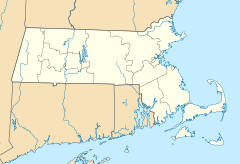
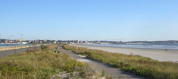
[1]Added to NRHP: August 11, 2003 Nahant Beach Boulevard is a historic road on the isthmus connecting Nahant, Massachusetts to the mainland at Lynn, Massachusetts.
Nomenclature and location
- The Department of Conservation and Recreation map of its reservations in Massachusetts calls out Nahant Beach Boulevard.
- The USGS topo calls out Nahant Causeway.
- Bing Maps, Google Maps, and Mapquest, as well as the Universal map book call out Nahant Road.
The beach on the seaward side is "Long Beach". The USGS topo shows that the road is in Nahant, as the town line is at the mainland end of the isthmus.
References
- ^ "National Register Information System". National Register of Historic Places. National Park Service. 2008-04-15. http://nrhp.focus.nps.gov/natreg/docs/All_Data.html.
U.S. National Register of Historic Places Topics Lists by states Alabama • Alaska • Arizona • Arkansas • California • Colorado • Connecticut • Delaware • Florida • Georgia • Hawaii • Idaho • Illinois • Indiana • Iowa • Kansas • Kentucky • Louisiana • Maine • Maryland • Massachusetts • Michigan • Minnesota • Mississippi • Missouri • Montana • Nebraska • Nevada • New Hampshire • New Jersey • New Mexico • New York • North Carolina • North Dakota • Ohio • Oklahoma • Oregon • Pennsylvania • Rhode Island • South Carolina • South Dakota • Tennessee • Texas • Utah • Vermont • Virginia • Washington • West Virginia • Wisconsin • WyomingLists by territories Lists by associated states Other Metropolitan Park System of Greater Boston Coastal reservations Belle Isle Marsh • Boston Harbor Islands • Castle Island • Dorchester Shores • Fort Revere Park • Lynn Shore • Nahant Beach • Nantasket Beach • Quincy Shore • Revere Beach • Rumney Marsh • Webb Memorial State Park • Weymouth Back RiverRiver reservations Alewife Brook • Charles River • Chestnut Hill • Cutler Park • Elm Bank • Hemlock Gorge • Mystic River • Neponset River • Pope John Paul II Park • Squantum Point Park • Upper Charles RiverWoodland reservations Beaver Brook • Blue Hills • Breakheart • Hammond Pond • Middlesex Fells • Quincy Quarries • Southwest Corridor Park • Stony Brook • Wilson MountainHeritage state parks Lynn Heritage State Park • Roxbury Heritage State ParkParkways and roads Alewife Brook Parkway · Arborway · Blue Hills Parkway · Blue Hills Reservation Parkways · Charles River Reservation Parkways · Day Boulevard · Fells Connector Parkways · Fenway · Fresh Pond Parkway · Furnace Brook Parkway · Hammond Pond Parkway · Hull Shore Drive · Jamaicaway · Lynn Fells Parkway · Memorial Drive · Morrissey Boulevard · Mystic Valley Parkway · Nahant Beach Boulevard · Nantasket Avenue · Park Drive · Quincy Shore Drive · Revere Beach Parkway · Riverway · Soldiers Field Road · Stony Brook Reservation Parkways · Storrow Drive · Truman Parkway · VFW Parkway · West Roxbury Parkway • Winthrop Parkway • Winthrop Shore DriveThis article about a National Register of Historic Places listing in Essex County Massachusetts is a stub. You can help Wikipedia by expanding it.

