- Na Tan District
-
Na Tan
นาตาล— Amphoe — Amphoe location in Ubon Ratchathani Province
Coordinates: 15°54′18″N 105°16′36″E / 15.905°N 105.27667°ECoordinates: 15°54′18″N 105°16′36″E / 15.905°N 105.27667°E Country  Thailand
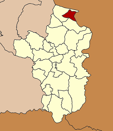
Province Ubon Ratchathani Seat Na Tan Tambon Muban Amphoe established Area - Total 191.9 km2 (74.1 sq mi) Population (2005) - Total 34,735 - Density 181.0/km2 (468.8/sq mi) Time zone THA (UTC+7) Postal code 34170 Geocode 3430 Na Tan (Thai: นาตาล) is a district (Amphoe) in the northeastern part of Ubon Ratchathani Province, northeastern Thailand.
Contents
History
Na Tan area was separated from Khemarat district to create a minor district (King Amphoe) on April 30, 1994.[1]
Following a decision by the Thai government on May 15 2007, all of the 81 minor districts were to be upgraded to full districts.[2] With the publishing in the Royal Gazette on August 24 the upgrade became official.[3]
Geography
Neighboring districts are (from the south clockwise) Pho Sai and Khemarat. To the east across the Mekong river is the Laotian province of Salavan.
The important water resource is the Mekong river.
Administration
The district is subdivided into 4 subdistricts (tambon), which are further subdivided into 64 villages (muban). There are no municipal (thesaban) areas, and four Tambon administrative organizations (TAO).
No. Name Thai name Villages Inh. 1. Na Tan นาตาล 19 10,725 2. Phalan พะลาน 14 6,046 3. Kong Phon กองโพน 13 7,165 4. Phang Khen พังเคน 18 10,799 References
- ^ "ประกาศกระทรวงมหาดไทย เรื่อง แบ่งเขตท้องที่อำเภอเขมราฐ จังหวัดอุบลราชธานี ตั้งเป็นกิ่งอำเภอนาตาล" (in Thai). Royal Gazette 111 (42 ง): 18. May 26 1994. http://www.ratchakitcha.soc.go.th/DATA/PDF/2537/D/042/18.PDF.
- ^ "แถลงผลการประชุม ครม. ประจำวันที่ 15 พ.ค. 2550" (in Thai). Manager Online. http://www.manager.co.th/Politics/ViewNews.aspx?NewsID=9500000055625.
- ^ "พระราชกฤษฎีกาตั้งอำเภอฆ้องชัย...และอำเภอเหล่าเสือโก้ก พ.ศ. ๒๕๕๐" (in Thai). Royal Gazette 124 (46 ก): 14–21. August 24 2007. http://www.ratchakitcha.soc.go.th/DATA/PDF/2550/A/046/14.PDF.
External links
Mueang Ubon Ratchathani · Si Mueang Mai · Khong Chiam · Khueang Nai · Khemarat · Det Udom · Na Chaluai · Nam Yuen · Buntharik · Trakan Phuet Phon · Kut Khaopun · Muang Sam Sip · Warin Chamrap · Phibun Mangsahan · Tan Sum · Pho Sai · Samrong · Don Mot Daeng · Sirindhorn · Thung Si Udom · Na Yia · Na Tan · Lao Suea Kok · Sawang Wirawong · Nam Khun
Categories:- Amphoe of Ubon Ratchathani
- Populated places on the Mekong River
- Isan geography stubs
Wikimedia Foundation. 2010.