- Mueang Amnat Charoen District
-
Mueang Amnat Charoen
เมืองอำนาจเจริญ— Amphoe — Amphoe location in Amnat Charoen Province
Coordinates: 15°51′30″N 104°37′46″E / 15.85833°N 104.62944°ECoordinates: 15°51′30″N 104°37′46″E / 15.85833°N 104.62944°E Country  Thailand
Province Amnat Charoen Seat Bung Tambon Muban Amphoe established Area – Total 598.8 km2 (231.2 sq mi) Population (2008) – Total 128,992 – Density 216.2/km2 (560/sq mi) Time zone THA (UTC+7) Postal code 37000 Geocode 3701 Mueang Amnat Charoen (Thai: เมืองอำนาจเจริญ) is the capital district (amphoe mueang) of Amnat Charoen Province, northeastern Thailand.
Contents
History
Originally Amnat Charoen was a Mueang under Mueang Khemarat. In the thesaphiban administrative reforms around 1900 it was reassigned to Ubon Ratchathani and converted into a district. It was later named Bung after the central tambon. In 1939 it was renamed to Amnat Charoen.[1] In 1993 the new province Amnat Charoen was created, and the district was then renamed to Mueang Amnat Charoen.[2]
Geography
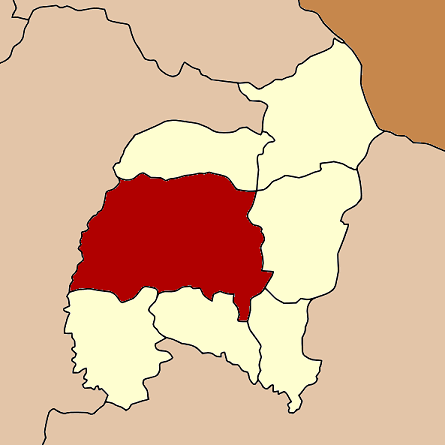
Neighboring districts are (from the north clockwise) Senangkhanikhom, Pathum Ratchawongsa, Phana, Lue Amnat and Hua Taphan of Amnat Charoen Province, and Pa Tio and Thai Charoen of Yasothon Province.
Administration
The district is subdivided into 19 subdistricts (tambon), which are further subdivided into 213 villages (muban). The town (thesaban mueang) Amnat Charoen covers parts of the tambon Bung. Nam Plik is a subdistrict municipality (thesaban tambon) which covers parts of the same-named tambon. Na Wong, Na Mo Ma and Na Yom are subdistrict municipalities which cover the full same-named subdistrict. There are further 16 Tambon administrative organizations (TAO).
No. Name Thai Villages Inh. 1. Bung บุ่ง 23 28,931 2. Kai Kham ไก่คำ 13 8,111 3. Na Chik นาจิก 8 4,187 4. Pla Khao ปลาค้าว 12 5,656 5. Lao Phruan เหล่าพรวน 8 3,915 6. Sang Nok Tha สร้างนกทา 16 6,385 7. Khuem Yai คึมใหญ่ 10 5,408 8. Na Phue นาผือ 12 6,728 9. Nam Plik น้ำปลีก 10 7,676 10. Na Wang นาวัง 11 4,632 11. Na Mo Ma นาหมอม้า 8 4,016 12. Non Pho โนนโพธิ์ 11 6,537 13. Non Nam Thaeng โนนหนามแท่ง 14 7,928 14. Huai Rai ห้วยไร่ 10 5,413 15. Nong Masaeo หนองมะแซว 13 4,236 16. Kut Pla Duk กุดปลาดุก 12 5,870 17. Don Moei ดอนเมย 5 2,822 18. Na Yom นายม 8 5,072 19. Na Tae นาแต้ 9 5,469 References
- ^ "พระราชกฤษฎีกาเปลี่ยนนามอำเภอ กิ่งอำเภอ และตำบลบางแห่ง พุทธศักราช ๒๔๘๒" (in Thai). Royal Gazette 56 (0 ก): 354–364. April 17 1939. http://www.ratchakitcha.soc.go.th/DATA/PDF/2482/A/354.PDF.
- ^ "พระราชบัญญัติตั้งจังหวัดอำนาจเจริญ พ.ศ. ๒๕๓๖" (in Thai). Royal Gazette 110 (125 ก ฉบับพิเศษ): 4–6. 1993-09-02. http://www.ratchakitcha.soc.go.th/DATA/PDF/2536/A/125/4.PDF.
External links
Amphoe Landmarks Categories:- Amphoe of Amnat Charoen
- Isan geography stubs
Wikimedia Foundation. 2010.