- Historic Adobe Building
-
Mountain View Adobe
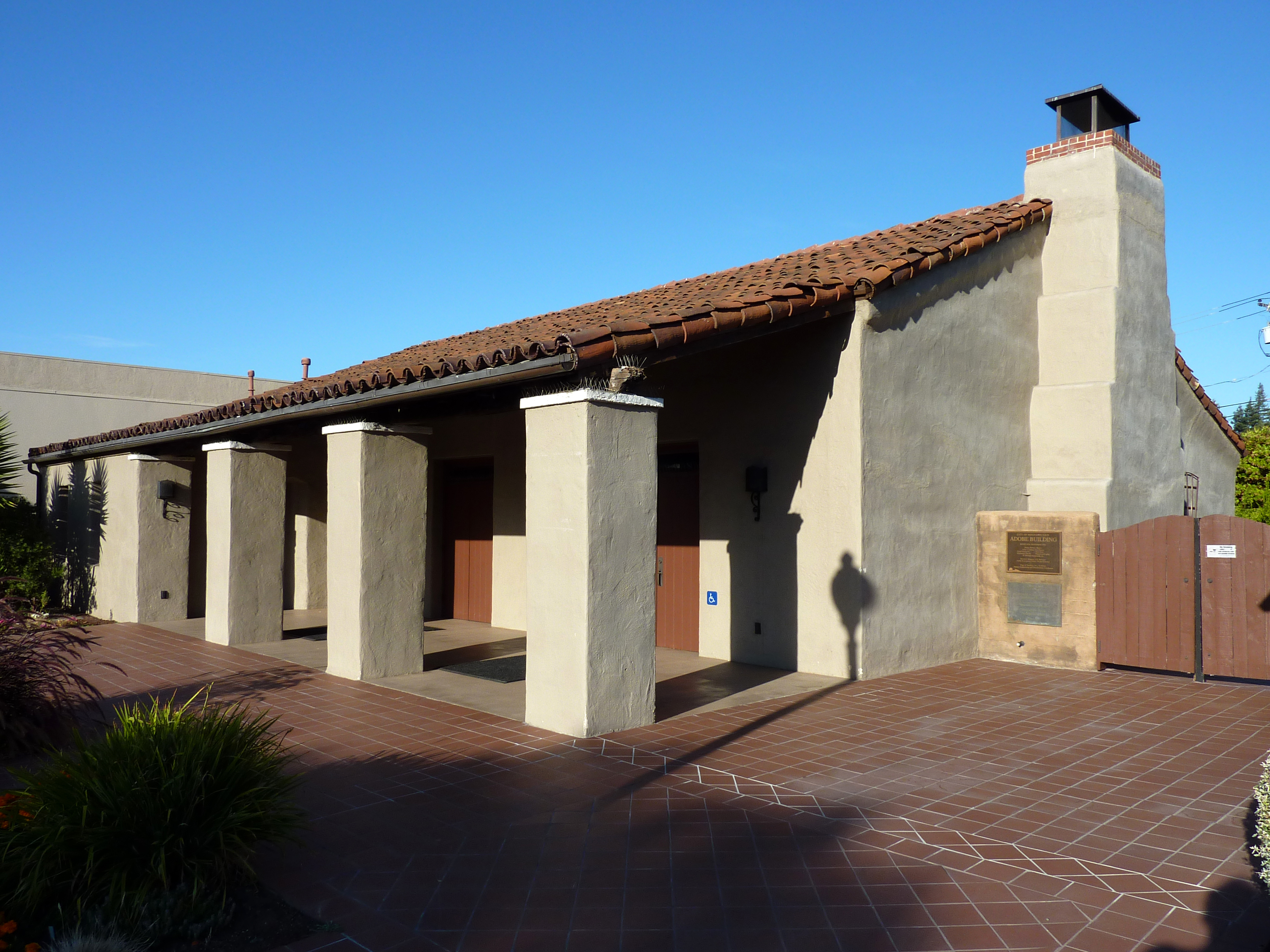
 Street-side exterior.

Location: 157 Moffett Blvd., Mountain View, California Coordinates: 37°23′45″N 122°4′37″W / 37.39583°N 122.07694°WCoordinates: 37°23′45″N 122°4′37″W / 37.39583°N 122.07694°W Built: 1934 Architectural style: Mission/Spanish Revival Governing body: Local NRHP Reference#: 02001256[1] Added to NRHP: October 28, 2002 The Historic Adobe Building, also known as the Mountain View Adobe, is a multi-purpose structure in Mountain View, California. The building was placed on the National Register of Historic Places on October 28, 2002.
The land under the structure was purchased by Mountain View in 1929 for $10 from Wallace and Alice Angelo; it was used for a pump station and reservoir and served as the town's primary water source. Several years later, the city wanted to create a meeting place between downtown Mountain View and the Navy's Moffett Field; the land's location at the corner of Moffett Boulevard and Central Expressway proved ideal.[2]
The structure was built in 1934 as a New Deal, Civil Works Administration project during the Great Depression, and was constructed by local laborers using adobe bricks.[3] The project also involved the time and money of members of the Junior Chamber of Commerce, one of the building's first tenants. Once World War II broke out, the building was also used as a serviceman's club and hospitality house for veterans.[2]
After the war, the structure took on many more civilian events, and was renamed the Eagle Shack teen center as it hosted high school dances numerous weddings in the late 1940s. In 1949, the first National Guard leased it for four years as its armory. It then served city programs, including housing the Mountain View Recreation Division and the preparation of a senior lunch program. Over the years, the building had been altered and worn down to the point that it was commonly referred to as the "Adobe Shack".[2]
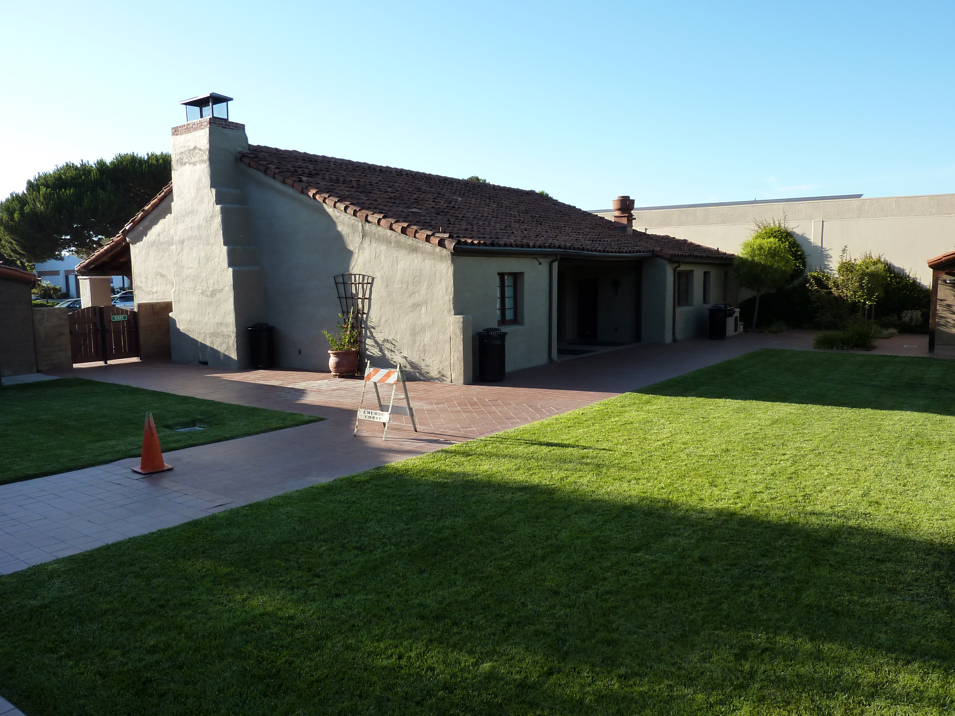
 Courtyard view of Historic Adobe Building.
In 1987, new seismic building regulations forced the city to close it. As the structure sat abandoned over several years, a community-driven, "Save the Adobe" campaign began in 1995. As a result, the building was restored to 1935 appearance and reopened for public use on September 29, 2001, at a cost of $1.2 million.[3] The building is now rented by the city as an event center, and includes a modern catering kitchen, office and great room with space for 100 in indoor dining.
The building was designated a California Historical Landmark on August 2, 2002. It was nominated to the NRHP based on its use as a community hall and its method of construction.[4] It was placed on the NRHP primarily in recognition of its historic value was a Works Project Administration project; it was also noted for its aesthetic value in Spanish Revival architecture.[2]
References
- ^ "National Register Information System". National Register of Historic Places. National Park Service. 2009-03-13. http://nrhp.focus.nps.gov/natreg/docs/All_Data.html.
- ^ a b c d Candice Shih, Adobe Building makes historic list, Mountain View Voice, February 7, 2003, Accessed July 30, 2009.
- ^ a b Brandon Hong, Now earthquake-safe, Adobe Building reopens its doors, Mountain View Voice, September 28, 2001, Accessed July 30, 2009.
- ^ Bill D'Agostino, Feds will likely say Adobe building a historic place, Mountain View Voice, August 16, 2002, Accessed July 30, 2009.
External links
- The Historic Adobe Building rental information, City of Mountain View
U.S. National Register of Historic Places Topics Lists by states Alabama • Alaska • Arizona • Arkansas • California • Colorado • Connecticut • Delaware • Florida • Georgia • Hawaii • Idaho • Illinois • Indiana • Iowa • Kansas • Kentucky • Louisiana • Maine • Maryland • Massachusetts • Michigan • Minnesota • Mississippi • Missouri • Montana • Nebraska • Nevada • New Hampshire • New Jersey • New Mexico • New York • North Carolina • North Dakota • Ohio • Oklahoma • Oregon • Pennsylvania • Rhode Island • South Carolina • South Dakota • Tennessee • Texas • Utah • Vermont • Virginia • Washington • West Virginia • Wisconsin • WyomingLists by territories Lists by associated states Other Categories:- California adobes
- History of Santa Clara County, California
- Government buildings on the National Register of Historic Places in California
- National Register of Historic Places in the San Francisco Bay Area
- Buildings and structures in Santa Clara County, California
- 1934 architecture
- Civilian Conservation Corps in California
- Works Progress Administration in California
- Mountain View, California

Wikimedia Foundation. 2010.