- Mount Sinabung
-
Mount Sinabung Gunung Sinabung 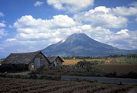
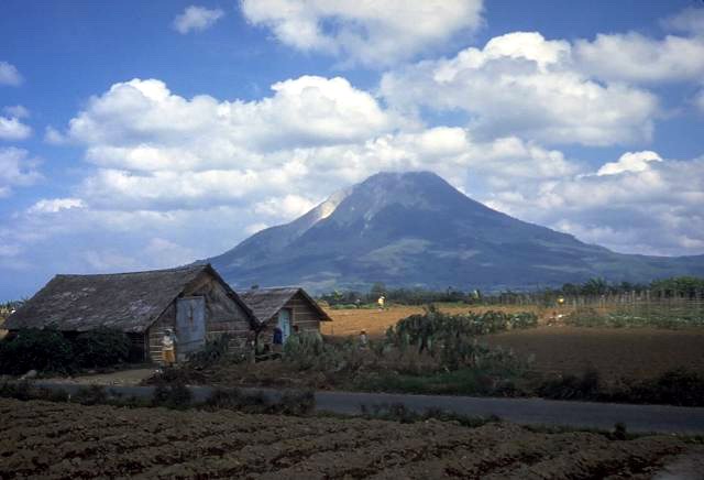
Sinabung in 1987Elevation 2,460 m (8,071 ft) [1] Listing Ribu Location Sumatra, Indonesia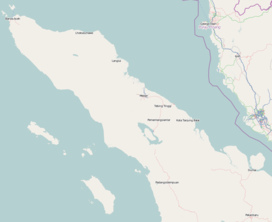
 Mount Sinabung
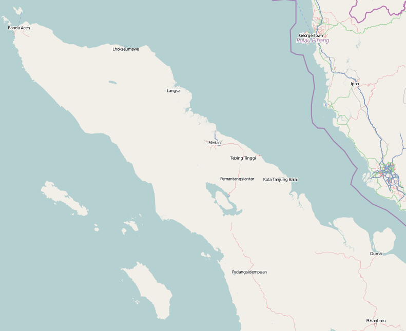
Coordinates 3°10′N 98°24′E / 3.17°N 98.392°ECoordinates: 3°10′N 98°24′E / 3.17°N 98.392°E Geology Type Stratovolcano Age of rock Pleistocene Volcanic arc/belt Sunda Arc Last eruption 7 September 2010 Mount Sinabung (Indonesian: Gunung Sinabung) is a Pleistocene-to-Holocene stratovolcano of andesite and dacite in the Karo plateau of Karo Regency, North Sumatra, Indonesia, 25 miles from Lake Toba supervolcano. Many old lava flows are on its flanks and the last known eruption, before recent times, occurred in the year 1600. Solfataric activities (cracks where steam, gas, and lava are emitted) were last observed at the summit in 1912, but no other documented events had taken place until an eruption in the early hours of 29 August 2010.[1][2] With the 2010 eruption, Sinabung joins other, long inactive volcanoes such as Fourpeaked Mountain in Alaska which have erupted in recent years.[3]
Contents
Geology
For more details on this topic, see List of volcanoes in Indonesia.Most of Indonesian volcanism stems from the Sunda Arc, created by the subduction of the Indo-Australian Plate under the Eurasian Plate. This arc is bounded on the north-northwest by the Andaman Islands, a chain of basaltic volcanoes, and on the East by the Banda Arc, also created by subduction.[4]
Sinabung is an andesitic-dacitic stratovolcano with a total of four volcanic craters, only one being active.[5]
August 2010 eruption
On 29 August 2010 (local time), the volcano experienced a minor eruption after several days of rumbling.[6] Ash spewed into the atmosphere up to 1.5 kilometres (0.93 mi) and lava was seen overflowing the crater.[6] The volcano had been inactive for four centuries with the most recent eruption occurring in 1600.[6] On 31 August, 6,000 of the 30,000 villagers who have been evacuated returned to their homes.[7][8] In Indonesia the volcano was assigned category “B”, because it was not active for more than 400 years, which means it is not necessary for it to be monitored intensively. (Other volcanoes, in category “A”, must be monitored frequently).[9] Surono, head of the Indonesian national volcanology and geology agency,[10] says he plans to lift the evacuation order in a week or two if the situation does not change.[8] The Indonesian Red Cross Society and the Health Ministry of Indonesia sent doctors and medicines to the region.[8] The National Disaster Management Agency is providing thousands of face masks and food to assist the evacuees.[8]
September 2010 eruption
On Friday 3 September, two more eruptions were noted. The first happened at 04:45 am in the early morning, forcing more villagers to leave their houses - some of them had just returned the day before. This eruption was the most intense so far, with ash spewed up into the atmosphere about 3.0 kilometres (1.9 mi) high. Some hours before the eruption a warning had been issued through the volcanology agency, and most villagers were prepared to leave quickly.[11] A second eruption occurred the same evening, around 18:00 pm. The eruption came with earth quakes which could be noticed in a 25.0 kilometres (15.5 mi) distance around the volcano[12]
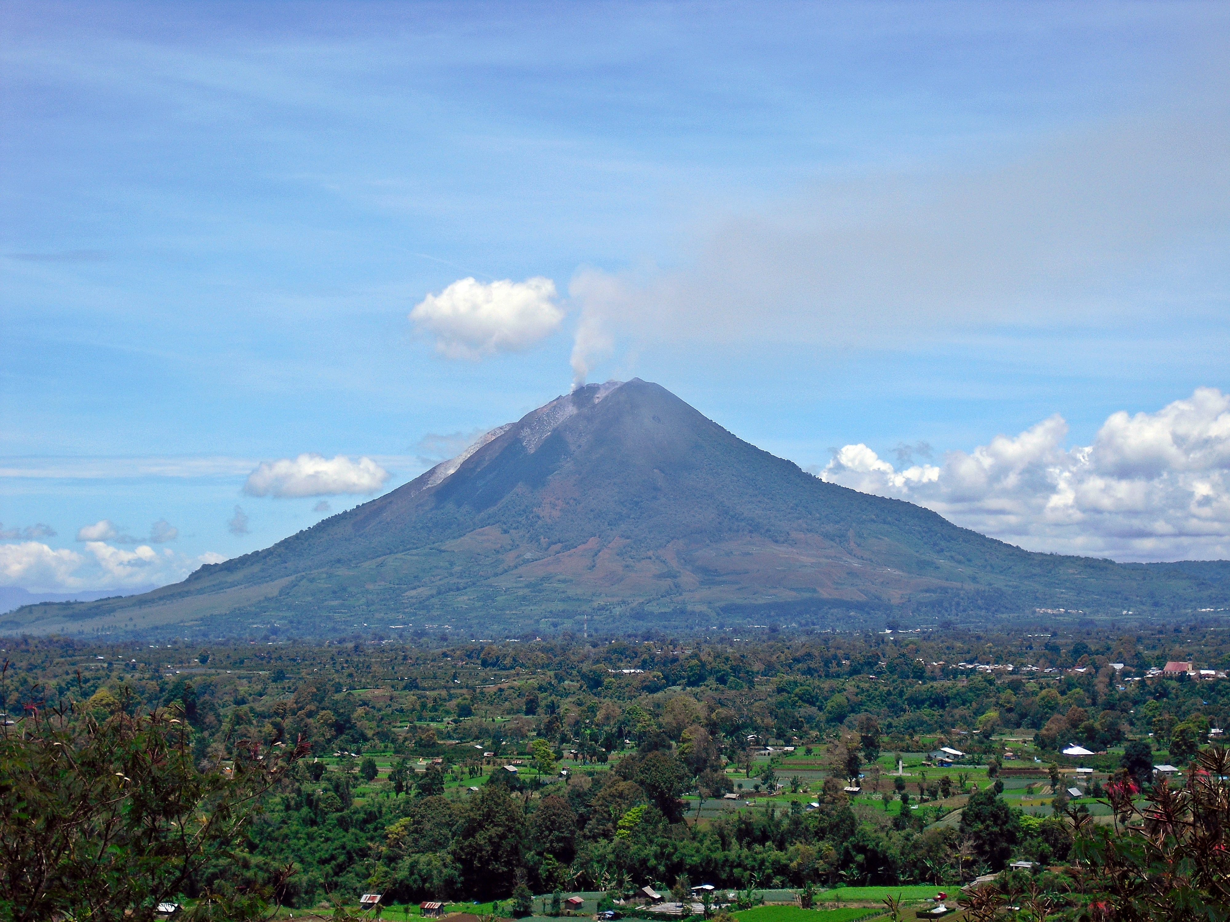
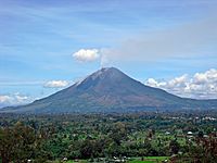 Mount Sinabung, 13 September 2010
On Tuesday 7 September, Mount Sinabung erupted yet again, its biggest eruption since it became active on August 29, 2010 and experts warned of more blasts to come. Indonesia's chief vulcanologist, Surono, said "It was the biggest eruption yet and the sound was heard from 8 kilometres away. The smoke was 5,000 metres in the air". "I think this will not be the last eruption. It will happen again," he said. Heavy rain mixed with the ash to form muddy precipitation that is lying a centimetre thick on buildings and trees. Electricity in one village has been cut off, but there have so far been no casualties.[13]
Government response
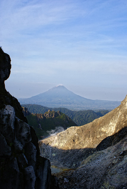
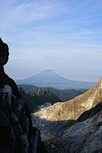 Mount Sinabung, March 20th, 2010.
The Indonesian government was reported to have evacuated around 17,500 people from the region on and around the volcano.[14] The government issued the highest-level warning for the area, which was expected to remain in force for around a week, since scientists were unfamiliar with the characteristics of the volcano, due to it having been dormant for so long.[14] The government also set up kitchens for refugees to have access to food and handed out 7,000 masks.[15] Over 10,000 people have been internally evacuated after the eruption, Secretary of the provincial administration, Edy Sofyan told Xinhua by phone. Spokesman of National Disaster Management Agency Priyadi Kardono said the eruption had not been predicted earlier like other volcanoes and that authorities must conduct a quick preparation for emergency work because Mount Sinabung’s seismic activity has been monitored intensively only since Friday after it showed an increase in activity.[16]
Effects
The towns nearest to the volcano are Kabanjahe and Berastagi. There were no disruptions reported to air services at the regional airport, Medan's Polonia.[17] One person was reported dead due to the eruption; he had respiratory problems while fleeing his home.[18]
See also
- Mount Sibayak – an active volcano near Sinabung
References
- ^ a b "Sinabung". Global Volcanism Program, Smithsonian Institution. http://www.volcano.si.edu/world/volcano.cfm?vnum=0601-08=. Retrieved 2006-12-18.
- ^ "Mount Sinabung in Sumatra erupts". The Jakarta Post. http://www.thejakartapost.com/news/2010/08/29/mount-sinabung-sumatra-erupts.html. Retrieved 2010-08-29.
- ^ "Fourpeaked reported activity". Alaska Volcano Observatory. http://www.avo.alaska.edu/volcanoes/volcact.php?volcname=Fourpeaked&eruptionid=555&page=basic. Retrieved August 30, 2010.
- ^ "Volcanoes of Indonesia: Highlights". Global Volcanism Program. Smithsonian Institution. http://www.volcano.si.edu/world/region.cfm?rnum=06&rpage=highlights. Retrieved August 29, 2010.
- ^ "Sinabung". Global Volcanism Program. Smithsonian Institution. http://www.volcano.si.edu/world/volcano.cfm?vnum=0601-08=. Retrieved August 29, 2010.
- ^ a b c "Volcano quiet for 400 years erupts in Indonesia". Associated Press. 2010. http://www.msnbc.msn.com/id/38900122/ns/world_news/. Retrieved 2010-08-28.[dead link]
- ^ "Villagers return to slopes of Indonesian volcano". The Associated Press. 2010-08-31. http://www.google.com/hostednews/ap/article/ALeqM5ip0DHCVSi8VFY3fjkPYrhckXNIPwD9HUIN4O0. Retrieved 2010-09-01.
- ^ a b c d "Indonesia Volcano Calmer After Sudden Eruptions". Voice of America. 2010-08-31. http://www.voanews.com/english/news/Indonesia-Volcano-Calmer-After-Sudden-Eruptions--101867448.html. Retrieved 2010-09-01.
- ^ Xinhua News
- ^ CNN Wire Staff (29 August 2010). "Long-dormant volcano erupts in Indonesia". CNN. http://articles.cnn.com/2010-08-29/world/indonesia.volcano_1_volcanology-destructive-eruption-volcanic-ash?_s=PM:WORLD. Retrieved 1 September 2010.
- ^ The Jakarta Post 04 September 2010
- ^ [1]
- ^ Sinabung September Eruption
- ^ a b Arlina Arshad (29 August 2010). "Thousands flee as Indonesian volcano erupts". Yahoo! News. AFP. http://news.yahoo.com/s/afp/20100829/wl_asia_afp/indonesiavolcano. Retrieved 29 August 2010.[dead link]
- ^ "Mount Sinabung Volcano Erupts in North Sumatra, Indonesia". The News of Today. 2010. http://thenewsoftoday.com/mount-sinabung-volcano-erupts-in-north-sumatra-indonesia/1796/. Retrieved 2010-08-29.
- ^ Indonesia’s Sinabung volcano August 29, 2010. Retrieved August 30, 2010.
- ^ "Volcano erupts on Indonesia's Sumatra after 400 years". Reuters. 2010-08-29. http://www.reuters.com/article/idUSTRE67S06O20100829. Retrieved 2010-08-29.
- ^ "One dies in Mount Sinabung eruption". The Jakarta Post. 2010. http://www.thejakartapost.com/news/2010/08/29/one-dies-mount-sinabung-eruption.html. Retrieved 2010-08-29.
External links
 Media related to Mount Sinabung at Wikimedia Commons
- Thousands flee Indonesia volcano. Al Jazeera. August 29, 2010. http://www.youtube.com/watch?v=7jx_ZQ9848g.
Categories:- Landforms of Karo Regency
- Volcanoes of Sumatra
- Stratovolcanoes
- Mountains of Indonesia
- Active volcanoes of Indonesia
Wikimedia Foundation. 2010.