- Mont Mégantic
-
Mont Mégantic 
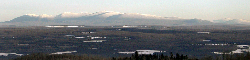
Mont Mégantic from Stoke Mountains, 40 km to the west.Elevation 1,102 m (3,615 ft) [1] Prominence 576 m (1,890 ft) [1] Location Location Québec, Canada Coordinates 45°27.341′N 71°9.126′W / 45.455683°N 71.1521°WCoordinates: 45°27.341′N 71°9.126′W / 45.455683°N 71.1521°W Geology Type Intrusive Age of rock Cretaceous Mont Mégantic is a monadnock located in Québec, Canada, about 15 km north of the border between Québec and the U.S. states of Maine and New Hampshire. Mégantic is on the border of the regional county municipalities of Le Granit and Le Haut-Saint-François. Its summit is the highest point of the latter. Many geologists believe that Mont Mégantic is a member of the Monteregian Hills formed by the New England hotspot, as it has the same mechanism and depth of intrusion.[2]
 Hang gliding off Mégantic's Mont St.-Joseph subpeak.
Mont Mégantic stands within the watershed of the Saint Lawrence River, which drains into the Gulf of Saint Lawrence. The east side of Mégantic drains into Rivière Victoria, thence into Lac Mégantic, the Chaudière River, and the St. Lawrence. The rest of Mégantic drains into Rivière Au Saumon (Salmon River), thence into the Saint-François River, and the St. Lawrence.
 Dome of OMM's 1.6 m telescope.
Observatoire du Mont Mégantic (OMM) is located on the mountain's summit, which is the highest point in Québec accessible by road. The mountain is in the middle of the 55 km² Parc national du Mont-Mégantic.[3] The annual Tour de Beauce bicycle race is routed over Mont Mégantic.
Notes
- ^ a b "Mont Mégantic, Québec". Peakbagger.com. http://www.peakbagger.com/peak.aspx?pid=6789. Retrieved 2009-03-30.
- ^ Tomas Feininger and Alan K. Goodacre, "The distribution of igneous rocks beneath Mont Mégantic (the easternmost Monteregian) as revealed by gravity", Can. J. Earth Sci./Rev., 40(5): 765–773 (2003) http://pubs.nrc-cnrc.gc.ca/cgi-bin/rp/rp2_abst_e?cjes_e03-022_40_ns_nf_cjes (abstract)
- ^ Parc national du Mont-Mégantic (French)
Categories:- Mountains of Quebec
- Intrusions
- Estrie geography stubs


Wikimedia Foundation. 2010.