Missouri Buttes

Missouri Buttes
Missouri Buttes

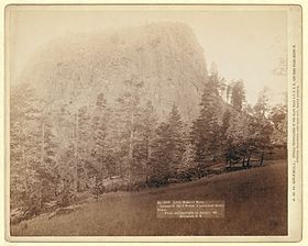
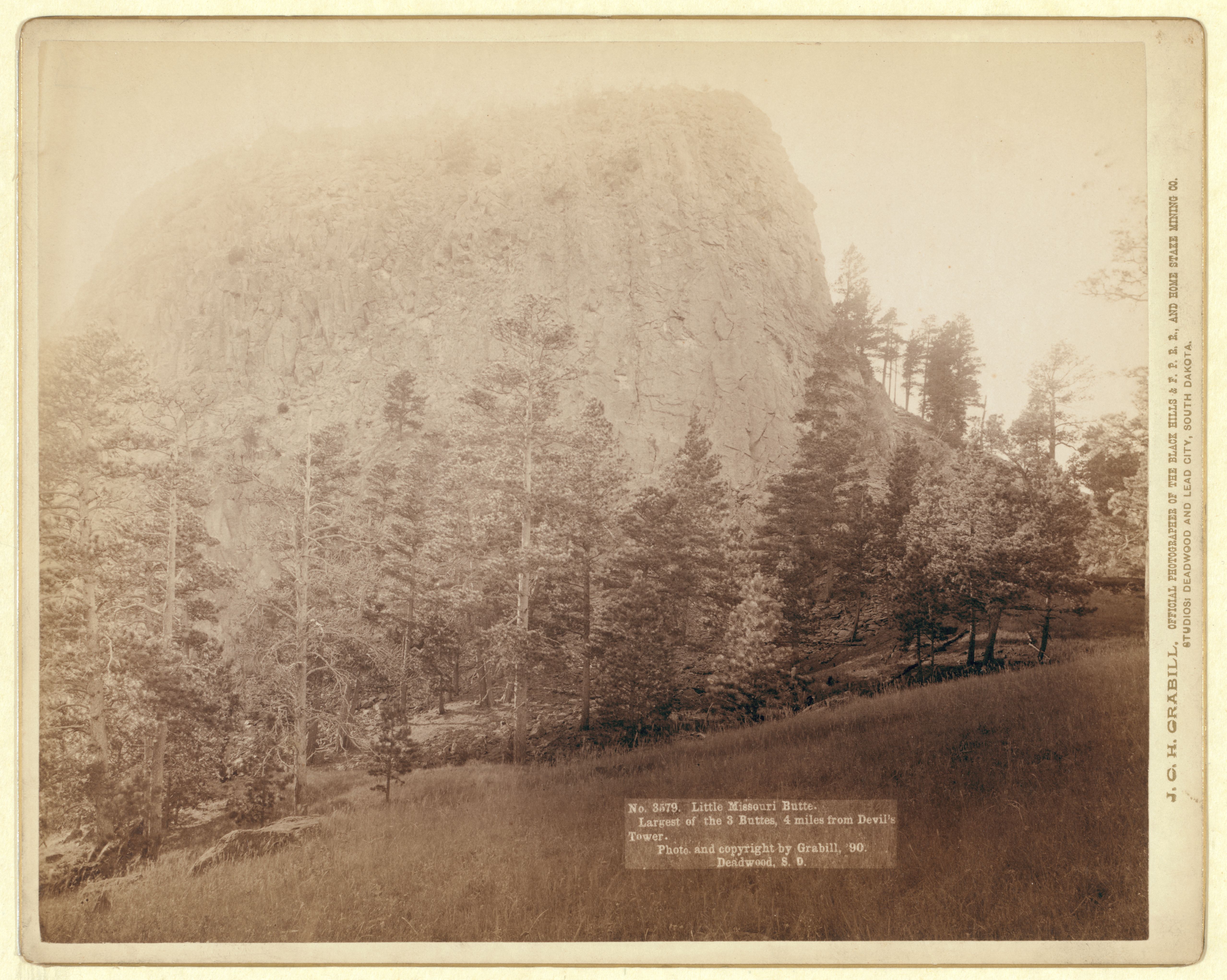
Little Missouri Butte, The tallest of the buttes, as seen in 1890
Elevation 5,374 ft (1,638 m) [1]
Prominence 1,204 ft (367 m) [1]
Location
Location Crook County, Wyoming, USA
Range Black Hills
Coordinates 44°36′57″N 104°46′29″W / 44.61583°N 104.77472°W / 44.61583; -104.77472Coordinates: 44°36′57″N 104°46′29″W / 44.61583°N 104.77472°W / 44.61583; -104.77472[2]
Topo map USGS Missouri Buttes, WY

Missouri Buttes (5,374 feet (1,638 m)) are located in the U.S. state of Wyoming.[3] The buttes are 4 miles (6.4 km) northwest of Devils Tower and consist of 4 separate summits. Like Devils Tower, the buttes are believed to be part of a laccolith that became exposed at the surface after overlying rocks eroded away.

Cited references


Wikimedia Foundation. 2010.

Игры ⚽ Поможем написать курсовую

Look at other dictionaries:

  • Battle of Slim Buttes — Infobox Military Conflict conflict=Battle of Slim Buttes caption= partof=the Black Hills War date=September 9 ndash;10, 1876 place= Dakota Territory result=U.S. victory combatant2= combatant1= commander2=George Crook commander1=American Horse… …   Wikipedia

  • Cheyenne-Black Hills Stage Route and Rawhide Buttes and Running Water Stage Stations — U.S. National Register of Historic Places U.S. Historic district …   Wikipedia

  • Devils Tower — National Monument Devils Tower …   Deutsch Wikipedia

  • Devils Tower National Monument — Devils Tower …   Deutsch Wikipedia

  • Bear Butte — Infobox nrhp name = Bear Butte nrhp type = nhl caption = location = NE of Sturgis nearest city = Sturgis, South Dakota lat degrees = 44 lat minutes = 24 lat seconds = 0 lat direction = N long degrees = 103 long minutes = 31 long seconds = 0 long… …   Wikipedia

  • Geography of South Dakota — Terrain and primary geographic features of South Dakota South Dakota is a state located in the north central United States. It is usually considered to be in the Midwestern region of the country. The state can generally be divided into three… …   Wikipedia

  • Montana — This article is about the U.S. state of Montana. For other uses, see Montana (disambiguation). State of Montana …   Wikipedia

  • List of U.S. county name etymologies, A-D — This is a list of U.S. county name etymologies, covering the letters A to D. A *Aitkin County, Minnesota: Aitkin is named for William Alexander Aitken, a fur trader in the region. *Alachua County, Florida: Alachua is named for a Native American… …   Wikipedia

  • Dakota du Sud — 44° 30′ N 100° 00′ W / 44.5, 100 …   Wikipédia en Français

  • South Dakota — This article is about the U.S. state of South Dakota. For other uses, see South Dakota (disambiguation). State of South Dakota …   Wikipedia

Share the article and excerpts

Direct link
Do a right-click on the link above
and select “Copy Link”