- Mezhdurechensky District, Vologda Oblast
-
Mezhdurechensky District (English)
Междуреченский район (Russian)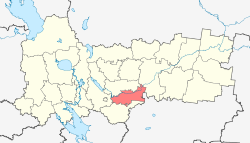
Location of Mezhdurechensky District on the map of Vologda OblastCoordinates: 59°22′N 41°02′E / 59.367°N 41.033°ECoordinates: 59°22′N 41°02′E / 59.367°N 41.033°E 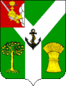
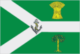
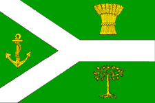
The Coat of Arms of Mezhdurechensky District The flag of Mezhdurechensky District Administrative status Country Russia Federal subject Vologda Oblast[1] Administrative center selo of Shuyskoye[2] # of cities/towns 0[2] # of urban-type settlements 0[2] # of selsoviets 8[2] Municipal status (as of May 2010) Municipally incorporated as Mezhdurechensky Municipal District[3] - # of urban settlements 0[3] - # of rural settlements 5[3] Statistics Area 3,600 km2 (1,400 sq mi)[4] Population (2010 Census,
preliminary)6,109 inhabitants[5] Population (2002 Census) 7,641 inhabitants[6] - Urban population 0% - Rural population 100% Density 2 /km2 (5.2 /sq mi)[7] Time zone MSD (UTC+04:00)[8] Established July 15, 1929[9] Official website Mezhdurechensky District (Russian: Междуреченский район) is an administrative district (raion), one of the twenty-six in Vologda Oblast, Russia.[1] Municipally, it is incorporated as Mezhdurechensky Municipal District.[3] It is located in the center of the oblast and borders with Sokolsky District in the north, Totemsky District in the northeast, Soligalichsky District of Kostroma Oblast in the southeast, Gryazovetsky District in the south, and Vologodsky District in the west. The area of the district is 3,600 square kilometers (1,400 sq mi).[4] Its administrative center is the selo of Shuyskoye.[2] District's population: 6,109 (2010 Census preliminary results);[5] 7,641 (2002 Census);[6] 9,361 (1989 Census).[10] Population of Shuyskoye accounts for 31.9% of the district's population.[6] As of 2010, Mezhdurechensky District had the lowest population among all the districts of Vologda Oblast.
Contents
History
The area was originally populated by the Finno-Ugric peoples and then colonized by the Novgorod Republic. The principal direction of the colonization was along the Sukhona, which at the time was the main waterway connecting central Russia with the White Sea. In the 15th century, the area gradually went under the control of the Grand Duchy of Moscow, after being split into insignificant principalities such as the Principality of Avnega. The selo of Shuyskoye was first mentioned in 1555 as Shuysky Nizovets and achieved prominence in the 17th century as a settlement of shipbuilders, delivering ships mainly to Vologda. In 1370, Avnezhsky Monastery was established on the bank of the Sukhona at the mouth of the Avnega River.[11][12]
In the course of the administrative reform carried out in 1708 by Peter the Great the area was included into Archangelgorod Governorate. In 1780, the governorate was abolished and transformed into Vologda Viceroyalty. The viceroyalty was abolished in 1796, and the part of it which included the area of Mezhdurechensky District was made Vologda Governorate. The area was split between Totemsky, Gryazovetsky, and Vologodsky Uyezds.
On July 15, 1929, several governorates, including Vologda Governorate, were merged into Northern Krai, and the uyezds were abolished. Instead, Shuysky District with the administrative center in the selo of Shuyskoye was established as part of Vologda Okrug. In 1931, Shuysky District was renamed into Mezhdurechensky District. In the following years, the first-level administrative division of Russia kept changing. In 1936, Northern Krai was transformed into Northern Oblast. In 1937, Northern Oblast was split into Arkhangelsk Oblast and Vologda Oblast. Mezhdurechensky District remained in Vologda Oblast ever since.
On July 15, 1929 Tolshmensky District with the center in the selo of Krasnoye[13] was also established. On July 30, 1931 it was abolished, and its area was divided between Shuysky and Totemsky Districts.[9]
On January 25, 1935 Biryakovsky District was established on the lands which previously belonged to Sokolsky and Mezhdurechensky Districts. The administrative center of the district was made in the selo of Biryakovo, currently in Sokolsky District. In 1959, it was abolished and split between Sokolsky and Mezhdurechensky Districts.[9]
Location and geography
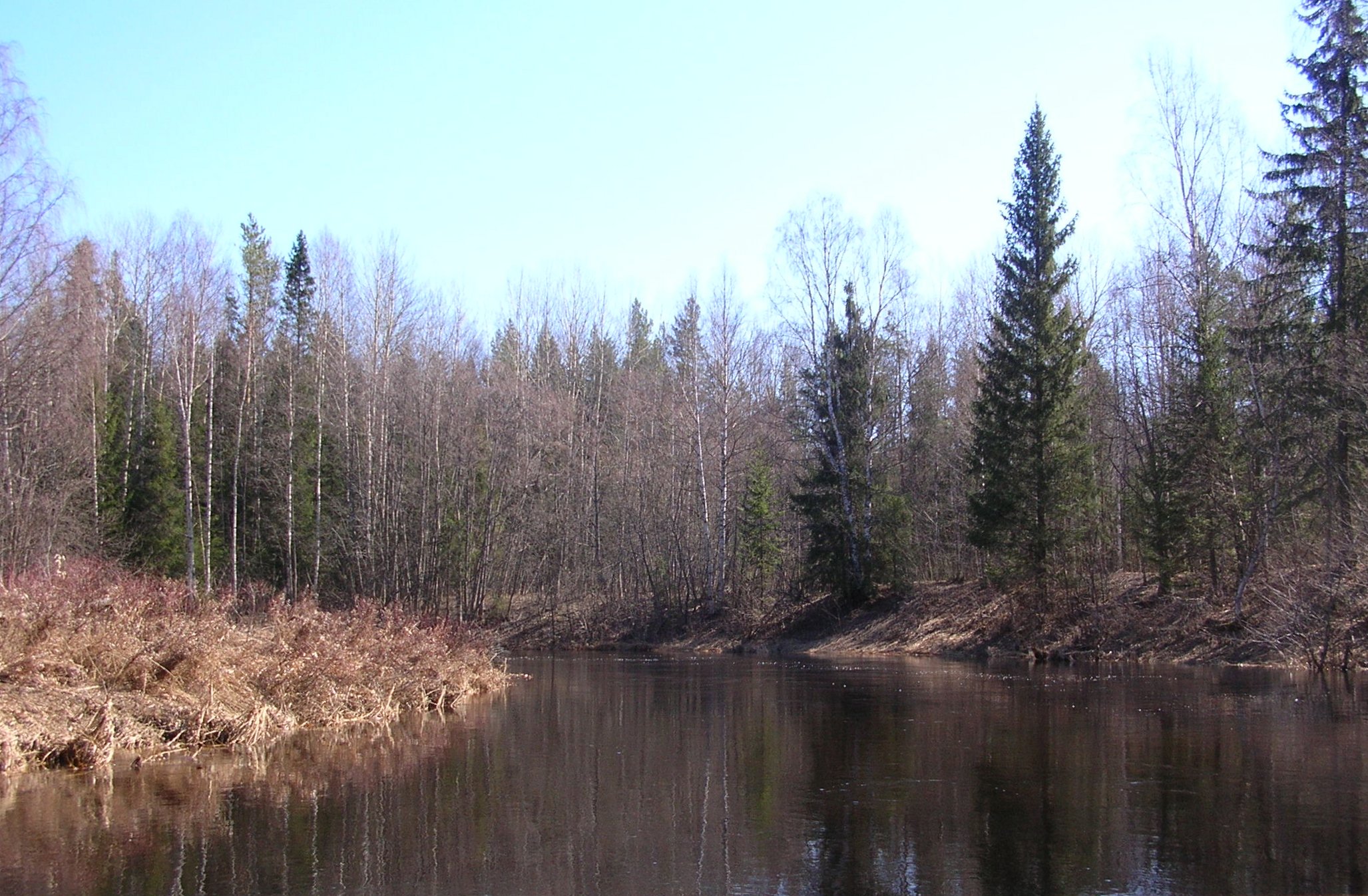
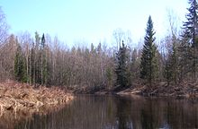 The mouth of the Voya River, seen from the Ikhalitsa River
Mezhdurechensky District is elongated from the west to the east and is organized along the Sukhona River, which in the western part of the district forms the border with Sokolsky District, and to the east enters the district and crosses it in the eastern direction. The biggest tributaries of the Sukhona within the district are the Lezha (right), the Dvinitsa (left), the Shuya (right), and the Ikhalitsa (right). Minor areas in the south of the district drain into the Monza River, which belongs to the river basin of the Kostroma. The district thus lies on the divide between the basins of the Northern Dvina and the Volga, or between the Arctic Ocean and the Caspian Sea.
Considerable areas within the district are covered by coniferous forests.
Swamps cover up to 14% of the area of the district.[11] The biggest one is the Bolshaya Chist Swamp located between the valleys of the Sukhona and the Tolshma and shared by Totemsky, Mezhdurechensky Districts, and Kostroma Oblast. The area of the swamp is about 200 square kilometres (77 sq mi), the major part of it it treeless, and Bolshaya Chist is the largest area swamp in Vologda Oblast.[14]
Economy
Industry
The economy of the district is based on timber industry. There is also food industry, in particular, soft drink production.[11]
Agriculture
As of 2010, there were five state enterprises and twenty farms in the district. They are mostly active in milk production.[11]
Transport
Shuyskoye is connected by an all-seasonal road with Vologda and Gryazovets. There are no bridges over the Sukhona in the district, and in order to get from one bank of the Sukhona to the other bank by car, one needs to detour via Vologda and Kadnikov.
The only railroad in the district is the Monza Railroad, built for timber transport and operated by the timber production authorities, which runs along the border of Vologda and Kostroma Oblasts. The railroad crosses the southern part of Mezhdurechensky District. The plans to extend it further east to Nikolsk were never realized.[15]
The Sukhona is navigable in the district limits, however, there is no passenger navigation.
Culture and recreation
The district contains one archaeological monument of federal significance (the settlement of Chudinovo) and three historical monuments of local significance.[16]
There are two museums in the district, both located in Shuyskoye, the Mezhdurechensky District Museum and Nikolay Rubtsov Memorial museum.[17] Nikolay Rubtsov, the Russian poet, never lived in Shuyskoye, however, he studied and worked in Totma, and his girlfriend at the time was living in Shuyskoye. It is presumed that Rubtsov visited Shuyskoye on at least two occasions.
Aleksandr Korkin, a Russian mathematician, was born in Shuyskoye, but left for Vologda to study in the secondary school and never lived in Shuyskoye afterwards.
References
Notes
- ^ a b Law #371-OZ
- ^ a b c Resolution #178
- ^ a b c Law #1118-OZ
- ^ a b Судаков, Г. В. (2006). Г. В. Судаков. ed (in Russian). Вологодская энциклопедия. Вологда: ВГПУ, Русь. p. 315. ISBN 5-87822-305-8. http://www.booksite.ru/fulltext/sud/ako/vsk/aya/2.pdf. Retrieved 18 October 2011.
- ^ a b Федеральная служба государственной статистики (Federal State Statistics Service) (2011). "Предварительные итоги Всероссийской переписи населения 2010 года (Preliminary results of the 2010 All-Russian Population Census)" (in Russian). Всероссийская перепись населения 2010 года (All-Russia Population Census of 2010). Federal State Statistics Service. http://www.perepis-2010.ru/results_of_the_census/results-inform.php. Retrieved 2011-04-25.
- ^ a b c Федеральная служба государственной статистики (Federal State Statistics Service) (2004-05-21). "Численность населения России, субъектов Российской Федерации в составе федеральных округов, районов, городских поселений, сельских населённых пунктов – районных центров и сельских населённых пунктов с населением 3 тысячи и более человек (Population of Russia, its federal districts, federal subjects, districts, urban localities, rural localities—administrative centers, and rural localities with population of over 3,000)" (in Russian). Всероссийская перепись населения 2002 года (All-Russia Population Census of 2002). Federal State Statistics Service. http://www.perepis2002.ru/ct/doc/1_TOM_01_04.xls. Retrieved 2010-03-23.
- ^ The value of density was calculated automatically by dividing the 2010 Census population by the area specified in the infobox. Please note that this value may not be accurate as the area specified in the infobox does not necessarily correspond to the area of the entity proper or is reported for the same year as the population.
- ^ Правительство Российской Федерации. Постановление №725 от 31 августа 2011 г. «О составе территорий, образующих каждую часовую зону, и порядке исчисления времени в часовых зонах, а также о признании утратившими силу отдельных Постановлений Правительства Российской Федерации». Вступил в силу по истечении 7 дней после дня официального опубликования. Опубликован: "Российская Газета", №197, 6 сентября 2011 г. (Government of the Russian Federation. Resolution #725 of August 31, 2011 On the Composition of the Territories Included into Each Time Zone and on the Procedures of Timekeeping in the Time Zones, as Well as on Abrogation of Several Resolutions of the Government of the Russian Federation. Effective as of after 7 days following the day of the official publication).
- ^ a b c "Справка об изменениях административно-территориального устройства и сети партийных и комсомольских органов на территории Вологодской области (1917-1991)" (in Russian). Архивы России. http://www.rusarchives.ru/guide/voanpi/126sia.shtml. Retrieved 20 September 2011.
- ^ "Всесоюзная перепись населения 1989 г. Численность наличного населения союзных и автономных республик, автономных областей и округов, краёв, областей, районов, городских поселений и сёл-райцентров. (All Union Population Census of 1989. Present population of union and autonomous republics, autonomous oblasts and okrugs, krais, oblasts, districts, urban settlements, and villages serving as district administrative centers.)" (in Russian). Всесоюзная перепись населения 1989 года (All-Union Population Census of 1989). Demoscope Weekly (website of the Institute of Demographics of the State University—Higher School of Economics. 1989. http://demoscope.ru/weekly/ssp/rus89_reg.php. Retrieved 2010-03-23.
- ^ a b c d "О районе" (in Russian). Администрация Междуреченского района. http://www.mr35.ru/%D0%BE-%D1%80%D0%B0%D0%B9%D0%BE%D0%BD%D0%B5.html. Retrieved 25 October 2011.
- ^ "Исторические события" (in Russian). Департамент развития муниципальных образований Вологодской области. http://www.depregion.ru/Default.aspx?mnu=b93e665ffb2942a7b0bc311d82d8fa2f. Retrieved 27 October 2011.
- ^ Кузнецов, А.В. (1997) (in Russian). [cherepovets-kp.ucoz.org/load/0-0-0-62-20 Русские топонимы Тотемского края. In: Тотьма: Краеведческий альманах. Вып. 2.]. Старинные города Вологодской области. Вологда: Русь. pp. 37-83. cherepovets-kp.ucoz.org/load/0-0-0-62-20. Retrieved October 8, 2011.
- ^ "Болото Великая Чисть" (in Russian). turovec.ru. http://turovec.ru/turovec-v-detalyax/boloto-velikaya-chist/. Retrieved 15 October 2011.
- ^ Белихов, А. Б. (2009). А.М. Белов, А.В. Новиков. ed. Развитие железных дорог Костромского края в ХХ веке. II Романовские чтения. Центр и провинция в системе российской государственности: материалы конференции.. Кострома: КГУ им. Н.А. Некрасова.. http://www.hrono.ru/proekty/romanov/2rc17.php. Retrieved September 23, 2011.
- ^ "Памятники истории и культуры народов Российской Федерации" (in Russian). Russian Ministry of Culture. http://kulturnoe-nasledie.ru/. Retrieved 26 October 2011.
- ^ "Культура" (in Russian). Администрация Междуреченского района. http://www.mr35.ru/%D0%BA%D1%83%D0%BB%D1%8C%D1%82%D1%83%D1%80%D0%B0.html. Retrieved 26 October 2011.
Sources
- Законодательное Собрание Вологодской области. Закон №371-ОЗ от 4 июня 1999 г. «О вопросах административно-территориального устройства Вологодской области», в ред. Закона №1452-ОЗ от 30 мая 2006 г «О внесении изменений в Закон области "О порядке решения вопросов административно-территориального устройства Вологодской области"». Вступил в силу со дня официального опубликования. Опубликован: "Красный Север", №124–125, 29 июля 1999 г. (Legislative Assembly of Vologda Oblast. Law #371-OZ of June 4, 1999 On the Matter of the Administrative-Territorial Structure of Vologda Oblast, as amended by the Law #1452-OZ of May 30, 2006 On Amending the Oblast Law "On the Procedures of Handling the Matters of the Administrative-Territorial Structure of Vologda Oblast". Effective as of the day of the official publication).
- Правительство Вологодской области. Постановление №178 от 1 марта 2010 г. «Об утверждении реестра административно-территориальных единиц Вологодской области». (Government of Vologda Oblast. Resolution #178 of March 1, 2010 On Adopting the Registry of the Administrative-Territorial Units of Vologda Oblast. ).
External links
- "Официальный сайт Междуреченского муниципального района / Official website of the district administration" (in Russian). http://www.mr35.ru/. Retrieved October 25, 2011.
Administrative divisions of Vologda Oblast 
Cities and towns Babayevo · Belozersk · Cherepovets · Gryazovets · Kadnikov · Kharovsk · Kirillov · Krasavino · Nikolsk · Sokol · Totma · Ustyuzhna · Veliky Ustyug · Vytegra
Districts Babayevsky District · Babushkinsky District · Belozersky District · Chagodoshchensky District · Cherepovetsky District · Gryazovetsky District · Kaduysky District · Kharovsky District · Kichmengsko-Gorodetsky District · Kirillovsky District · Mezhdurechensky District · Nikolsky District · Nyuksensky District · Sheksninsky District · Sokolsky District · Syamzhensky District · Tarnogsky District · Totemsky District · Ust-Kubinsky District · Ustyuzhensky District · Vashkinsky District · Velikoustyugsky District · Verkhovazhsky District · Vologodsky District · Vozhegodsky District · Vytegorsky DistrictCategories:- Districts of Vologda Oblast


Wikimedia Foundation. 2010.