Basen, Armenia

Basen, Armenia
Basen
Բասեն
—  community  —
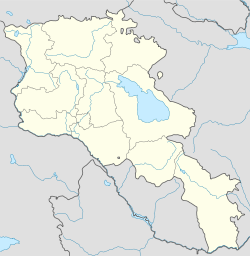
Basen is located in Armenia
Basen
Coordinates: 40°45′55″N 43°59′27″E / 40.76528°N 43.99083°E / 40.76528; 43.99083Coordinates: 40°45′55″N 43°59′27″E / 40.76528°N 43.99083°E / 40.76528; 43.99083
Country  Armenia
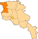
Marz Shirak
Area
 – Total 1.3 km2 (0.5 sq mi)
Population (2010)
 – Total 1,913
 – Density 1,471.5/km2 (3,811.3/sq mi)
Time zone GMT +4 (UTC+4)
 – Summer (DST) GMT+5 (UTC+5)
Basen, Armenia at GEOnet Names Server

Basen (Armenian: Բասեն; formerly Mets Kyapanak until 1935, then Musayelyan) is a village and rural community (municipality) in the Shirak Province of Armenia. The National Statistical Service of the Republic of Armenia (ARMSTAT) reported its population was 1,913 in 2010,[1] up from 1,744 at the 2001 census.[2]

References

  • Kiesling, Brady (2005), Rediscovering Armenia: Guide, Yerevan, Armenia: Matit Graphic Design Studio 


Wikimedia Foundation. 2010.

Игры ⚽ Нужно сделать НИР?

Look at other dictionaries:

  • Basen — 40° 45′ 55″ N 43° 59′ 27″ E / 40.765278, 43.990833 …   Wikipédia en Français

  • Arapi, Armenia — Arapi Առափի   community   …   Wikipedia

  • Keti, Armenia — Coordinates: 40°53′03″N 43°50′56″E / 40.88417°N 43.84889°E / 40.88417; 43.84889 …   Wikipedia

  • Beniamin — Բենիամին   community   …   Wikipedia

  • Akhuryan — For the river of Armenia and Turkey, see Akhurian River. Akhuryan Ախուրյան   community   …   Wikipedia

  • Pemzashen — Coordinates: 40°35′36″N 43°56′24″E / 40.59333°N 43.94°E / 40.59333; 43.94 …   Wikipedia

  • Berdashen — For the village in Nagorno Karabakh, see Berdashen (Nagorno Karabakh). Berdashen Բերդաշեն   community   …   Wikipedia

  • Getk — For the villages in Azerbaijan, see Chaylu. Getk Գետք   community   …   Wikipedia

  • Gtashen — Գտաշեն   community   …   Wikipedia

  • Shirak — 40° 50′ 00″ N 43° 55′ 00″ E / 40.83333333, 43.91666667 …   Wikipédia en Français

Share the article and excerpts

Direct link
Do a right-click on the link above
and select “Copy Link”