- McCoy, Oregon
-
McCoy, Oregon — Unincorporated community — 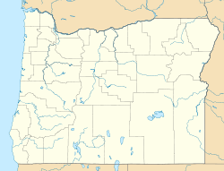
 McCoy, Oregon
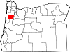
Coordinates: 45°02′31″N 123°12′58″W / 45.042°N 123.216°WCoordinates: 45°02′31″N 123°12′58″W / 45.042°N 123.216°W Country United States State Oregon County Polk Elevation 167 ft (51 m) Time zone Pacific (PST) (UTC-8) - Summer (DST) PDT (UTC-7) ZIP code 97371 Area code(s) 503 and 971 McCoy is an unincorporated community in Polk County, Oregon, United States.[1] It was named after the landowner Isaac McCoy. Its post office was established in 1879 with James A. Sears postmaster, and closed in 1968.[2]
References
- ^ "McCoy". Geographic Names Information System, U.S. Geological Survey. http://geonames.usgs.gov/pls/gnispublic/f?p=gnispq:3:::NO::P3_FID:1166679. Retrieved 2010-12-14.
- ^ McArthur, Lewis A.; McArthur, Lewis L (2003 [1928]). Oregon geographic names. Portland, Oregon: Oregon Historical Society Press. p. 622. ISBN 0-87595-277-1.
Municipalities and communities of Polk County, Oregon Cities Dallas | Falls City | Independence | Monmouth | Salem‡ | Willamina‡
CDPs Eola | Grand Ronde | Rickreall
Unincorporated
communitiesAirlie | Ballston | Bethel | Bridgeport | Brunks Corner | Buena Vista | Lewisville | McCoy | Modeville | Pedee | Perrydale | Salt Creek | Valley Junction | Zena
Indian reservation Ghost towns Footnotes ‡This populated place also has portions in an adjacent county or counties
Categories:- Unincorporated communities in Polk County, Oregon
- Oregon geography stubs


Wikimedia Foundation. 2010.