- Maryland Route 513
-
Maryland Route 513
Route information Maintained by MDSHA Length: 1.77 mi[1] (2.85 km) Major junctions South end: Jackson Road in Fruitland  US 13 in Fruitland
North end:  US 13 Bus. in Fruitland
Location Counties: Wicomico Highway system Maryland highway system
Interstate • US • State • Minor • Former • Turnpikes←  MD 512
MD 514  →
→Maryland Route 513 (MD 513) is a state highway in the U.S. state of Maryland. Known for much of its length as Cedar Lane, the state highway runs 1.77 mi (2.85 km) from Jackson Road just south of the interchange with U.S. Route 13 (US 13) north to US 13 Business within Fruitland. MD 513 was constructed as a county highway around 1980 following the completion of the highway's interchange with the Salisbury Bypass and became a state highway in 1982.
Contents
Route description
MD 513 begins at an intersection with Jackson Road just south of its diamond interchange with US 13 (Salisbury Bypass). St. Lukes Road continues south as a county highway toward MD 12. MD 513 heads north a two-lane road, entering the city of Fruitland at the intersection where St. Lukes Road splits to the northwest. The state highway continues north as Cedar Lane and meets Division Street at a roundabout. After crossing Norfolk Southern Railway's Delmarva Secondary track, the state highway meets its northern terminus at US 13 Business (Fruitland Boulevard). Cedar Lane continues north through Fruitland toward Camden Avenue, the original alignment of US 13.[1][2]
History
Cedar Lane was extended south to St. Lukes Road on the edge of Fruitland in 1979 to provide a more direct connection from US 13 to St. Lukes Road's interchange with the Salisbury Bypass, which was completed in 1981.[3][4] MD 513 was assigned along its present route in 1982.[5]
Junction list
The entire route is in Fruitland in Wicomico County.
Mile
[1]Destinations Notes 0.00 St. Lukes Road south / Jackson Road east Southern terminus 0.20 US 13 (Salisbury Bypass) – Dover, NorfolkDiamond interchange 1.77 US 13 Bus. (Fruitland Boulevard) – Princess Anne, SalisburyNorthern terminus 1.000 mi = 1.609 km; 1.000 km = 0.621 mi References
- ^ a b c "Highway Location Reference: Wicomico County" (PDF). Maryland State Highway Administration. 2009. http://www.marylandroads.com/Location/2009_WICOMICO.pdf. Retrieved 2010-10-21.
- ^ Google, Inc. Google Maps – Maryland Route 513 (Map). Cartography by Google, Inc. http://maps.google.com/maps?f=d&source=s_d&saddr=St+Lukes+Rd&daddr=Cedar+Crossing%2FE+Cedar+Ln&hl=en&geocode=FVd-SAIdWGF--w%3BFUzZSAIdijh--w&mra=ls&sll=38.328681,-75.613562&sspn=0.000966,0.002411&ie=UTF8&t=h&z=14. Retrieved 2010-03-25.
- ^ Maryland State Highway Administration. Maryland: Official Highway Map (Map) (1979-80 ed.).
- ^ Maryland State Highway Administration. Maryland: Official Highway Map (Map) (1981-82 ed.).
- ^ "Traffic Volume Map" (PDF). Maryland State Highway Administration. 1982. http://www.marylandroads.com/Traffic_Volume_Maps/82_Traffic_Volume_Maps.pdf. Retrieved 2010-03-25.
External links
Roads in Wicomico County, Maryland State highways 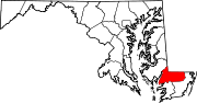
U.S. Highways Categories:- State highways in Maryland
- Roads in Wicomico County, Maryland


Wikimedia Foundation. 2010.