- Dry Creek (Mokelumne River)
-
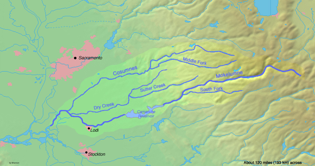
Dry Creek River Country United States State California Regions Amador County, Sacramento County, San Joaquin County Source - coordinates 38°28′13″N 120°48′40″W / 38.47028°N 120.81111°W Mouth Mokelumne River [1] - elevation 13 ft (4 m) - coordinates 38°13′55″N 121°24′42″W / 38.23194°N 121.41167°W 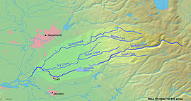 Map of the Mokelumne River watershed
Dry Creek is a 47.1-mile-long (75.8 km)[2] stream in northern California which runs from the Sierra Nevada to the Mokelumne River west of Galt.
Tributaries
- North Fork Dry Creek
- South Fork Dry Creek
- Sutter Creek
- Jackson Creek
See also
References
- ^ U.S. Geological Survey Geographic Names Information System: Dry Creek
- ^ U.S. Geological Survey. National Hydrography Dataset high-resolution flowline data. The National Map, accessed March 11, 2011
Sacramento River Valley Pit River • McCloud River • Mill Creek • Deer Creek • Battle Creek •Stony Creek •Butte Creek • Feather River • Yuba River • Bear River • American River • Cache Creek • Putah CreekSan Joaquin River Valley Tulare Basin Categories:- Tributaries of the San Joaquin River
- Rivers of Amador County, California
- Rivers of San Joaquin County, California
- Rivers of Sacramento County, California
- San Joaquin Valley geography stubs
Wikimedia Foundation. 2010.