Dragoon, Arizona

Dragoon, Arizona
Dragoon, Arizona
—  Unincorporated community  —
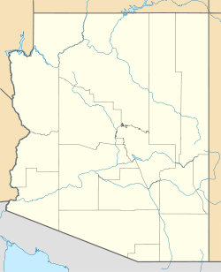
Dragoon, Arizona is located in Arizona
Dragoon, Arizona
Coordinates: 32°01′41″N 110°02′19″W / 32.02806°N 110.03861°W / 32.02806; -110.03861Coordinates: 32°01′41″N 110°02′19″W / 32.02806°N 110.03861°W / 32.02806; -110.03861
Country United States
State Arizona
County Cochise
Elevation 4,632 ft (1,412 m)
Population (2000)
 - Total 297
Time zone Mountain (MST) (UTC-7)
ZIP code 85609
Area code(s) 520
GNIS feature ID 4089[1]

Dragoon is an unincorporated community in Cochise County, Arizona, United States. Dragoon is 15 miles (24 km) east-northeast of Benson. Dragoon has the ZIP Code of 85609; in 2000, the population of the 85609 ZCTA was 297.[2]

References


Wikimedia Foundation. 2010.

Игры ⚽ Нужно решить контрольную?

Look at other dictionaries:

  • Dragoon (disambiguation) — A dragoon is a soldier who fights on foot but relocates on horseback. Dragoon may also refer to: Dragoon AFV, an American armoured fighting vehicle Operation Dragoon, the Allied invasion of Southern France during World War II Dragoon Mountains, a …   Wikipedia

  • Dragoon Mountains — Mountain Range Dragoon Mountains viewed from the south …   Wikipedia

  • Dragoon National Forest — was established in Arizona on May 25, 1907, with 69,120 acres (280 km2). On July 1, 1908, it was combined with Santa Catalina National Forest and Santa Rita National Forest to create Coronado National Forest. The name was discontinued.[1] …   Wikipedia

  • Arizona — Saltar a navegación, búsqueda Para otros usos de este término, véase Arizona (desambiguación). State of Arizona Estado de los Estados Unidos …   Wikipedia Español

  • Arizona Territory (Confederate States of America) — Confederate Territory of Arizona Organized incorporated territory of the Confederate States of America …   Wikipedia

  • Arizona's 8th congressional district — Infobox U.S. congressional district state = Arizona district number = 8 image width = 300 image caption = representative = Gabrielle Giffords party = Democratic english area =9,057 metric area = percent urban = 87.3 percent rural = 12.7… …   Wikipedia

  • List of mountain ranges of Arizona — There are 194 named mountain ranges in Arizona. The extra items listed may include::Mingus Mountain, the high, NW section of the Black Hills:Shiprock:Sierra Madre Occidental (of W continental Mexico) The list*Agua Caliente Mountains ndash;Yuma… …   Wikipedia

  • National Register of Historic Places listings in Cochise County, Arizona — Location of Cochise County in Arizona This is a list of the National Register of Historic Places listings in Cochise County, Arizona. It is intended to be a complete list of the properties and districts on the National Register of Historic Places …   Wikipedia

  • Monts Dragoon — 31° 53′ 00″ N 109° 58′ 59″ W / 31.8833, 109.983 …   Wikipédia en Français

  • Cochise County, Arizona — The art deco county courthouse in Bisbee …   Wikipedia

Share the article and excerpts

Direct link
Do a right-click on the link above
and select “Copy Link”