Al Jahra Governorate

Al Jahra Governorate
Al Jahra
الجهراء
—  Governorate  —
Map of Kuwait with Al Jahra highlighted
Coordinates (Jahra): 29°20′13″N 47°39′29″E / 29.337°N 47.658°E / 29.337; 47.658Coordinates: 29°20′13″N 47°39′29″E / 29.337°N 47.658°E / 29.337; 47.658
Country  Kuwait
Capital Jahra
Districts 3
Area
 – Total 11,230 km2 (4,335.9 sq mi)
Population (2007-12-31)
 – Total 412,053
 – Density 36.7/km2 (95/sq mi)
Time zone EAT (UTC+03)
ISO 3166 code KW-JA
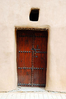
The Red Fort in Al Jahra


Al Jahra is one of the six governorates of Kuwait. It is located to the northwest of the other governorates and houses the city of Jahra among others. It includes Bubiyan Island and is by far the largest governorate in Kuwait. It also contains most of Kuwait's arable land. Al Jahra also has some historic relevance to Kuwait's history. The Red Palace or Al Qasr Al Ahmar is the most important historical landmark there. In and around it the famous battle between Kuwait and the Dweesh army took place. When Jahra was a village it was an oasis and most Jahrans were farmers. Now Jahra is a large city and farming has been reduced to a few small farms.

Contents

Districts

Doha

Doha is a town located in the Al Jahra governorate. The town was the site of a major US military base that closed in 2005 and was returned to the Kuwaiti government.

Mutla

Mutla is a very unpopulated district located in the Al Jahra governorate. The Mutla Ridge is located there.

Jahra

See Jahra.

See also


Wikimedia Foundation. 2010.

Игры ⚽ Нужно решить контрольную?

Look at other dictionaries:

  • Jahra, al- — ▪ Kuwait       town and muḥāfaẓah (governorate) in central Kuwait. Located about 30 mi (50 km) west of Kuwait city, the oasis town is the capital of the muḥāfaẓah. It is the centre of the country s principal agricultural region, producing… …   Universalium

  • Al Jahra — Infobox GCC Governorate name = Al Jahra arabic = الجهراء capital = Jahra country = Kuwait water =0 latitude =29.337 longitude =47.658 area = 11,230 population = 412,053 population as of = 31/12/2007 population density = N/A isocode = KW JA… …   Wikipedia

  • Al Ahmadi Governorate — Al Ahmadi الاحمدي   Governorate   Map of Kuwait with Al Ahmadi highlighted Coordinates …   Wikipedia

  • Mubarak Al-Kabeer Governorate — Mubarak Al Kabeer مبارك الكبير   Governorate   Map of Kuwait with Mubarak Al Kabeer highlighted …   Wikipedia

  • List of FIPS region codes (J-L) — This is a list of FIPS 10 4 region codes from J L, using a standardized name format, and cross linking to articles. JA: Japan * JA01: Aichi Prefecture, Japan * JA02: Akita Prefecture, Japan * JA03: Aomori Prefecture, Japan * JA04: Chiba… …   Wikipedia

  • Kazma — For the football (soccer) club based in this city, see Al Kazma Kuwait; for the village in Azerbaijan, see Qazma. Kazma ( ar. كاظمة) is a city in Kuwait. It is located in Al Jahra governorate, 40 km north of Kuwait City, the capital of Kuwait. It …   Wikipedia

  • Doha (disambiguation) — Doha is the capital city of Qatar. Doha may also refer to: Doha, Kuwait, a town located in the Al Jahra governorate of Kuwait Doha Stadium, a football stadium in Sakhnin, Israel Doha Sports City, Qatar Doha (poetry), a style of Hindi Urdu poetry… …   Wikipedia

  • Camp Virginia — is a sustained U.S. Army post in north Al Jahra governorate, Kuwait.*There is also a summer camp called Camp Virginia in Goshen, Virginia.External links* [http://www.globalsecurity.org/military/facility/camp virginia.htm Description] from… …   Wikipedia

  • Eastern Province, Saudi Arabia — Eastern Province   Province   الشرقية Map of Saudi Arabia with the Eastern Province highlighted …   Wikipedia

  • SOHP — chool Oral Health Program, KuwaitSOHP is School Oral Health Program of Kuwait run by The Forsyth Institute, Boston, U.S.A. and The Ministry of Health of Kuwait. [ [http://www.forsyth.org The Forsyth Institute ] ] Goal and methods of the… …   Wikipedia

Share the article and excerpts

Direct link
Do a right-click on the link above
and select “Copy Link”