Murchison County

Murchison County
Murchison
New South Wales
Murchison NSW.PNG
Location in New South Wales
Lands administrative divisions around Murchison
Courallie Burnett Arrawatta
Jamison Murchison Hardinge
Nandewar Darling Hardinge

Murchison County is one of the 141 Cadastral divisions of New South Wales.

Murchison County is named in honour of Sir Roderick Impey Murchison (1792-1871) First Baronet and geologist.[1]

Parishes

A full list of parishes found within this county; their current LGA and mapping coordinates to the approximate centre of each location is as follows:

Parish LGA Coordinates
Anderson Gwydir Shire 30°07′54″S 150°33′04″E / 30.13167°S 150.55111°E / -30.13167; 150.55111 (Anderson Parish)
Austen Gwydir Shire 29°59′54″S 150°21′04″E / 29.99833°S 150.35111°E / -29.99833; 150.35111 (Austen Parish)
Bangheet Gwydir Shire 29°48′54″S 150°30′04″E / 29.815°S 150.50111°E / -29.815; 150.50111 (Bangheet Parish)
Bingara Gwydir Shire 29°51′54″S 150°32′04″E / 29.865°S 150.53444°E / -29.865; 150.53444 (Bingara Parish)
Boomi Moree Plains Shire 30°12′54″S 150°18′04″E / 30.215°S 150.30111°E / -30.215; 150.30111 (Boomi Parish)
Capel Gwydir Shire 30°08′54″S 150°40′04″E / 30.14833°S 150.66778°E / -30.14833; 150.66778 (Capel Parish)
Caroda Moree Plains Shire 29°59′54″S 150°15′04″E / 29.99833°S 150.25111°E / -29.99833; 150.25111 (Caroda Parish)
Cobbadah Gwydir Shire 30°14′54″S 150°34′04″E / 30.24833°S 150.56778°E / -30.24833; 150.56778 (Cobbadah Parish)
Crawley Gwydir Shire 30°14′54″S 150°28′04″E / 30.24833°S 150.46778°E / -30.24833; 150.46778 (Crawley Parish)
Currangandi Gwydir Shire 30°09′54″S 150°20′04″E / 30.165°S 150.33444°E / -30.165; 150.33444 (Currangandi Parish)
Delingera Gwydir Shire 29°43′54″S 150°39′04″E / 29.73167°S 150.65111°E / -29.73167; 150.65111 (Delingera Parish)
Delungra Inverell Shire 29°36′54″S 150°45′04″E / 29.615°S 150.75111°E / -29.615; 150.75111 (Delungra Parish)
Derra Derra Gwydir Shire 29°52′24″S 150°30′04″E / 29.87333°S 150.50111°E / -29.87333; 150.50111 (Derra Derra Parish)
Dingo Gwydir Shire 29°52′54″S 150°50′04″E / 29.88167°S 150.83444°E / -29.88167; 150.83444 (Dingo Parish)
Dinoga Gwydir Shire 30°00′54″S 150°34′04″E / 30.015°S 150.56778°E / -30.015; 150.56778 (Dinoga Parish)
Drummond Gwydir Shire 30°06′54″S 150°45′04″E / 30.115°S 150.75111°E / -30.115; 150.75111 (Drummond Parish)
Dumboy Gwydir Shire 29°39′54″S 150°41′04″E / 29.665°S 150.68444°E / -29.665; 150.68444 (Dumboy Parish)
Dunnee Gwydir Shire 30°10′54″S 150°30′04″E / 30.18167°S 150.50111°E / -30.18167; 150.50111 (Dunnee Parish)
Durham Gwydir Shire 29°48′54″S 150°44′04″E / 29.815°S 150.73444°E / -29.815; 150.73444 (Durham Parish)
Eulowrie Gwydir Shire 30°03′54″S 150°07′04″E / 30.065°S 150.11778°E / -30.065; 150.11778 (Eulowrie Parish)
Evans Gwydir Shire 29°52′24″S 150°42′04″E / 29.87333°S 150.70111°E / -29.87333; 150.70111 (Evans Parish)
Furber Gwydir Shire 29°56′54″S 150°51′04″E / 29.94833°S 150.85111°E / -29.94833; 150.85111 (Furber Parish)
Glass Gwydir Shire 29°43′54″S 150°20′04″E / 29.73167°S 150.33444°E / -29.73167; 150.33444 (Glass Parish)
Gouron Gwydir Shire 29°59′54″S 150°40′04″E / 29.99833°S 150.66778°E / -29.99833; 150.66778 (Gouron Parish)
Gum Flat Inverell Shire 29°43′54″S 150°59′04″E / 29.73167°S 150.98444°E / -29.73167; 150.98444 (Gum Flat Parish)
Gundamulda Gwydir Shire 30°14′54″S 150°45′04″E / 30.24833°S 150.75111°E / -30.24833; 150.75111 (Gundamulda Parish)
Hall Gwydir Shire 30°04′54″S 150°34′04″E / 30.08167°S 150.56778°E / -30.08167; 150.56778 (Hall Parish)
Horton Gwydir Shire 30°11′54″S 150°24′04″E / 30.19833°S 150.40111°E / -30.19833; 150.40111 (Horton Parish)
Keera Gwydir Shire 30°01′54″S 150°45′04″E / 30.03167°S 150.75111°E / -30.03167; 150.75111 (Keera Parish)
King Gwydir Shire 30°04′54″S 150°28′04″E / 30.08167°S 150.46778°E / -30.08167; 150.46778 (King Parish)
Lindesay Gwydir Shire 30°18′54″S 150°21′04″E / 30.315°S 150.35111°E / -30.315; 150.35111 (Lindesay Parish)
Little Plain Inverell Shire 29°48′54″S 150°54′04″E / 29.815°S 150.90111°E / -29.815; 150.90111 (Little Plain Parish)
Macintyre Gwydir Shire 30°04′54″S 150°41′04″E / 30.08167°S 150.68444°E / -30.08167; 150.68444 (Macintyre Parish)
McKinnon Gwydir Shire 30°06′54″S 150°50′04″E / 30.115°S 150.83444°E / -30.115; 150.83444 (Mckinnon Parish)
Mehi Gwydir Shire 29°59′54″S 150°57′04″E / 29.99833°S 150.95111°E / -29.99833; 150.95111 (Mehi Parish)
Milroy Gwydir Shire 29°49′54″S 150°34′04″E / 29.83167°S 150.56778°E / -29.83167; 150.56778 (Milroy Parish)
Munro Gwydir Shire 30°01′54″S 150°50′04″E / 30.03167°S 150.83444°E / -30.03167; 150.83444 (Munro Parish)
Myall Gwydir Shire 29°49′54″S 150°39′04″E / 29.83167°S 150.65111°E / -29.83167; 150.65111 (Myall Parish)
Paleroo Gwydir Shire 30°06′54″S 150°08′04″E / 30.115°S 150.13444°E / -30.115; 150.13444 (Paleroo Parish)
Pallal Gwydir Shire 29°59′54″S 150°26′04″E / 29.99833°S 150.43444°E / -29.99833; 150.43444 (Pallal Parish)
Piedmont Gwydir Shire 30°14′54″S 150°40′04″E / 30.24833°S 150.66778°E / -30.24833; 150.66778 (Piedmont Parish)
Pringle Gwydir Shire 30°04′54″S 150°16′04″E / 30.08167°S 150.26778°E / -30.08167; 150.26778 (Pringle Parish)
Rider Gwydir Shire 29°51′54″S 150°19′04″E / 29.865°S 150.31778°E / -29.865; 150.31778 (Rider Parish)
Rusden Gwydir Shire 30°13′54″S 150°13′04″E / 30.23167°S 150.21778°E / -30.23167; 150.21778 (Rusden Parish)
Stag Inverell Shire 29°47′54″S 150°50′04″E / 29.79833°S 150.83444°E / -29.79833; 150.83444 (Stag Parish)
Tange Gwydir Shire 29°56′54″S 150°30′04″E / 29.94833°S 150.50111°E / -29.94833; 150.50111 (Tange Parish)
Turrawarra Inverell Shire 29°41′54″S 150°40′04″E / 29.69833°S 150.66778°E / -29.69833; 150.66778 (Turrawarra Parish)
Wyndham Gwydir Shire 29°43′54″S 150°33′04″E / 29.73167°S 150.55111°E / -29.73167; 150.55111 (Wyndham Parish)

References

  1. ^ Geographical Names Board of NSW

Wikimedia Foundation. 2010.

Игры ⚽ Поможем написать курсовую

Look at other dictionaries:

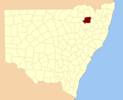
  • Murchison County, New South Wales — Infobox Australian cadastral name = Murchison state = New South Wales caption = Location in New South Wales near nw = Courallie near n = Burnett near ne = Arrawatta near e = Hardinge near se = Hardinge near s = Darling near sw = Nandewar near w …   Wikipedia

  • Murchison — is the name of: Alice Lynne Murchison, the maiden name of Lindy Chamberlain Creighton Carl Murchison (1887–1961), American psychologist Charles Murchison (1872–1952), British politician Charles Murchison (physician) (1830–1879), British physician …   Wikipedia

  • Murchison, Texas —   City   U.S. Post Office in Murchison, Texas …   Wikipedia

  • Murchison Building — General information Type Mixed use Location 201 N. Front Street Wilmington, North Carolina …   Wikipedia

  • Murchison Independent School District — is a public school district based in Murchison, Texas (USA). Murchison ISD has one school that serves area students in grades Kindergarten through eight. In 2009, the school district was rated academically acceptable by the Texas Education Agency …   Wikipedia

  • Murchison Middle School (Austin, Texas) — E.A. Murchison Middle School Location 3700 North Hills Drive, Austin, TX Information Type Public Motto Inspiration Within, Excellence Throughout Established 1967 School district …   Wikipedia

  • County of Rodney — Infobox Australian cadastral name = Rodney state = Victoria caption = Location in Victoria est = 24 Feb 1871 area = 4400 near nw = Gunbower near n = Cadell (NSW) near ne = Moira near e = Moira near se = Moira near s = Dalhousie near sw = Bendigo… …   Wikipedia

  • County of Rodney, Victoria — Rodney Victoria Location in Victoria Established: 24 February 1871 Area: 4400 km² …   Wikipedia

  • Roderick Murchison — Sir Roderick Murchison Sir Roderick Impey Murchison, 1st Baronet KCB DCL FRS FRSE FLS PRGS PBA MRIA (22 February 1792[1] – 22 October 1871) was a Scottish geologist who first described and investigated the Silurian system …   Wikipedia

  • Roderick Murchison — Sir Roderick Murchison Nacimiento 19 de febrero de 1792 Fallecimiento …   Wikipedia Español

Share the article and excerpts

Direct link
Do a right-click on the link above
and select “Copy Link”