Hume County

Hume County
Hume
New South Wales
Hume NSW.PNG
Location in New South Wales
Lands administrative divisions around Hume
Urana Urana Mitchell
Denison Hume Goulburn
Moira (Vic) Bogong (Vic) Benambra (Vic)

Hume County is one of the 141 Cadastral divisions of New South Wales. It contains the town of Culcairn.

Hume County was named in honour of the explorer Hamilton Hume (1797-1873).[1]

Parishes within this county

A full list of parishes found within this county; their current LGA and mapping coordinates to the approximate centre of each location is as follows:

Parish LGA Coordinates
Billabong Forest Corowa Shire Council 35°44′54″S 146°18′04″E / 35.74833°S 146.30111°E / -35.74833; 146.30111 (Billabong Forest)
Brocklesby Greater Hume Shire Council 35°47′54″S 146°39′04″E / 35.79833°S 146.65111°E / -35.79833; 146.65111 (Brocklesby)
Buckargingah Greater Hume Shire Council 35°29′54″S 147°09′04″E / 35.49833°S 147.15111°E / -35.49833; 147.15111 (Buckargingah)
Bulgandry Greater Hume Shire Council 35°35′12″S 146°38′19″E / 35.58667°S 146.63861°E / -35.58667; 146.63861 (Bulgandry)
Bungowannah Greater Hume Shire Council 36°00′54″S 146°48′04″E / 36.015°S 146.80111°E / -36.015; 146.80111 (Bungowannah)
Buraja Corowa Shire Council 35°52′54″S 146°24′04″E / 35.88167°S 146.40111°E / -35.88167; 146.40111 (Buraja)
Burrangong Urana Shire Council 35°27′54″S 146°22′04″E / 35.465°S 146.36778°E / -35.465; 146.36778 (Burrangong)
Burrangong Urana Shire Council 35°29′54″S 146°22′04″E / 35.49833°S 146.36778°E / -35.49833; 146.36778 (Burrangong)
Burrumbuttock Greater Hume Shire Council 35°48′54″S 146°47′04″E / 35.815°S 146.78444°E / -35.815; 146.78444 (Burrumbuttock)
Castlestead Greater Hume Shire Council 35°48′54″S 146°54′04″E / 35.815°S 146.90111°E / -35.815; 146.90111 (Castlestead)
Collendina Corowa Shire Council 35°58′54″S 146°14′04″E / 35.98167°S 146.23444°E / -35.98167; 146.23444 (Collendina)
Comer Greater Hume Shire Council 35°29′54″S 147°01′04″E / 35.49833°S 147.01778°E / -35.49833; 147.01778 (Comer)
Comer Greater Hume Shire Council 35°32′54″S 146°59′04″E / 35.54833°S 146.98444°E / -35.54833; 146.98444 (Comer)
Corowa Corowa Shire Council 35°57′44″S 146°21′44″E / 35.96222°S 146.36222°E / -35.96222; 146.36222 (Corowa)
Creighton Greater Hume Shire Council 35°42′54″S 147°01′04″E / 35.715°S 147.01778°E / -35.715; 147.01778 (Creighton)
Gibson Greater Hume Shire Council 35°39′54″S 146°37′04″E / 35.665°S 146.61778°E / -35.665; 146.61778 (Gibson)
Goombargana Greater Hume Shire Council 35°42′54″S 146°37′04″E / 35.715°S 146.61778°E / -35.715; 146.61778 (Goombargana)
Gordon Corowa Shire Council 35°38′54″S 146°19′04″E / 35.64833°S 146.31778°E / -35.64833; 146.31778 (Gordon)
Granville Urana Shire Council 35°39′54″S 146°25′34″E / 35.665°S 146.42611°E / -35.665; 146.42611 (Granville)
Gray Corowa Shire Council 35°50′54″S 146°16′04″E / 35.84833°S 146.26778°E / -35.84833; 146.26778 (Gray)
Henty Greater Hume Shire Council 35°29′54″S 147°04′04″E / 35.49833°S 147.06778°E / -35.49833; 147.06778 (Henty)
Henty Greater Hume Shire Council 35°35′54″S 147°00′04″E / 35.59833°S 147.00111°E / -35.59833; 147.00111 (Henty)
Hindmarsh Greater Hume Shire Council 35°42′54″S 146°43′04″E / 35.715°S 146.71778°E / -35.715; 146.71778 (Hindmarsh)
Hovell Greater Hume Shire Council 35°52′54″S 146°45′04″E / 35.88167°S 146.75111°E / -35.88167; 146.75111 (Hovell)
Howlong Corowa Shire Council 35°57′54″S 146°39′04″E / 35.965°S 146.65111°E / -35.965; 146.65111 (Howlong)
Kentucky Corowa Shire Council 35°51′54″S 146°32′04″E / 35.865°S 146.53444°E / -35.865; 146.53444 (Kentucky)
Lowes Corowa Shire Council 35°46′54″S 146°25′04″E / 35.78167°S 146.41778°E / -35.78167; 146.41778 (Lowes)
Mahonga Forest Urana Shire Council 35°31′54″S 146°29′04″E / 35.53167°S 146.48444°E / -35.53167; 146.48444 (Mahonga Forest)
Mahonga Urana Shire Council 35°31′54″S 146°33′04″E / 35.53167°S 146.55111°E / -35.53167; 146.55111 (Mahonga)
Moorwatha Greater Hume Shire Council 35°55′00″S 146°44′59″E / 35.9166667°S 146.74972°E / -35.9166667; 146.74972 (Moorwatha)
Morebringer Greater Hume Shire Council 35°53′54″S 146°37′04″E / 35.89833°S 146.61778°E / -35.89833; 146.61778 (Morebringer)
Morven Greater Hume Shire Council 35°44′54″S 147°04′04″E / 35.74833°S 147.06778°E / -35.74833; 147.06778 (Morven)
Osborne Urana Shire Council 35°37′54″S 146°31′04″E / 35.63167°S 146.51778°E / -35.63167; 146.51778 (Osborne)
Piney Range Greater Hume Shire Council 35°44′54″S 146°49′04″E / 35.74833°S 146.81778°E / -35.74833; 146.81778 (Piney Range)
Quat Quatta Corowa Shire Council 35°56′54″S 146°33′04″E / 35.94833°S 146.55111°E / -35.94833; 146.55111 (Quat Quatta)
Rand Urana Shire Council 35°29′54″S 146°27′04″E / 35.49833°S 146.45111°E / -35.49833; 146.45111 (Rand)
Richmond Corowa Shire Council 35°46′54″S 146°32′04″E / 35.78167°S 146.53444°E / -35.78167; 146.53444 (Richmond)
Richmond Urana Shire Council 35°44′54″S 146°30′04″E / 35.74833°S 146.50111°E / -35.74833; 146.50111 (Richmond)
Round Hill Greater Hume Shire Council 35°37′54″S 147°01′04″E / 35.63167°S 147.01778°E / -35.63167; 147.01778 (Round Hill)
Ryan Greater Hume Shire Council 35°35′54″S 146°44′04″E / 35.59833°S 146.73444°E / -35.59833; 146.73444 (Ryan)
Sandy Ridges Corowa Shire Council 35°53′54″S 146°16′04″E / 35.89833°S 146.26778°E / -35.89833; 146.26778 (Sandy Ridges)
Sherwyn Greater Hume Shire Council 35°38′54″S 146°50′04″E / 35.64833°S 146.83444°E / -35.64833; 146.83444 (Sherwyn)
Stitt Greater Hume Shire Council 35°37′54″S 146°56′04″E / 35.63167°S 146.93444°E / -35.63167; 146.93444 (Stitt)
Thugga Greater Hume Shire Council 35°05′54″S 147°07′04″E / 35.09833°S 147.11778°E / -35.09833; 147.11778 (Thugga)
Walbundrie Greater Hume Shire Council 35°39′54″S 146°44′04″E / 35.665°S 146.73444°E / -35.665; 146.73444 (Walbundrie)
Walla Walla Greater Hume Shire Council 35°43′54″S 146°54′04″E / 35.73167°S 146.90111°E / -35.73167; 146.90111 (Walla Walla)
Wilson Urana Shire Council 35°32′54″S 146°19′04″E / 35.54833°S 146.31778°E / -35.54833; 146.31778 (Wilson)

References

  1. ^ Geographical Names Board of NSW

Wikimedia Foundation. 2010.

Игры ⚽ Нужно сделать НИР?

Look at other dictionaries:

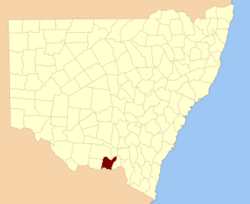
  • Hume County, New South Wales — Infobox Australian cadastral name = Hume state = New South Wales caption = Location in New South Wales near nw = Urana near n = Urana near ne = Mitchell near e = Goulburn near se = Benambra (Vic) near s = Bogong (Vic) near sw = Moira (Vic) near w …   Wikipedia

  • Hume — ( Home is an older variant spelling of Hume, still used for the senior branches of the family) is a surname that originated in the South East of Scotland, of which the senior representatives are the Earls of Home. The name can refer to several… …   Wikipedia

  • Hume, Virginia — Hume is an unincorporated community in Fauquier County, Virginia. Hume is located five miles south of Interstate 66 s Exit 18 and is named for the local Hume family. It runs along Virginia State Route 688. It is located east of the Rappahannock… …   Wikipedia

  • Hume Township — may refer to the following places in the United States:* Hume Township, Whiteside County, Illinois * Hume Township, Michigan …   Wikipedia

  • County Fermanagh — Contae Fhear Manach Coontie Fermanagh Coat of arms …   Wikipedia

  • County of Bourke, Victoria — Bourke Victoria Location in Victoria Lands administrative divisions around Bourke …   Wikipedia

  • Hume, New York — Infobox Settlement official name = Hume, New York settlement type = Town nickname = motto = imagesize = image caption = image |pushpin pushpin label position = pushpin map caption =Location within the state of New York pushpin mapsize = mapsize …   Wikipedia

  • Hume Township, Michigan — Infobox Settlement official name = Hume Township, Michigan settlement type = Township nickname = motto = imagesize = image caption = image |pushpin pushpin label position =left pushpin map caption =Location within the state of Michigan pushpin… …   Wikipedia

  • Hume Lake — Infobox lake lake name = Hume Lake image lake = Hume Lake SNF.jpg caption lake = location = Fresno County, California coords = coord|36.7|N|118.9|W|type:waterbody region:US CA|display=inline,title type = reservoir inflow = Tenmile Creek outflow …   Wikipedia

  • Hume-Fogg High School — Infobox nrhp name =Hume Fogg High School nrhp type = caption = location = 700 Broadway Nashville, Tennessee nearest city = lat degrees = lat minutes = lat seconds = lat direction = long degrees = long minutes = long seconds = long direction =… …   Wikipedia

Share the article and excerpts

Direct link
Do a right-click on the link above
and select “Copy Link”