- County Route 97 (Rockland County, New York)
-
County Route 97
Stony Brook Drive Route information Length: 0.91 mi[1] (1.46 km) Major junctions South end: Johnstown Road in Sloatsburg North end: Cul-de-sac in Harriman State Park Highway system Numbered highways in New York
Interstate • U.S. • N.Y. (former) • Reference • County (Rockland)County Route 97 is a 0.97-mile (1.56 km) long county highway in the western part of Rockland County, New York. CR 97 begins at the Sloatsburg village line, and ends at a dead end in Harriman State Park. CR 97 does not enter the village limits of any town in Rockland County, therefore it is designated in the Town of Ramapo. After CR 97's southern terminus, the road continues as Johnstown Rd, which continues for another half-mile before ending at Seven Lakes Drive.
CR 97 is the most hidden Rockland County Route as there are no indictations that it exists. Johnstown Rd is a small, narrow road that appears to be nothing more than a dead end. However, it quickly changes to a two-lane road, and CR 97 begins. CR 97 runs the southern border of Dater Mountain Nature County Park for most of its route. At the northern terminus of CR 97, there are two hiking trails that lead into Harriman State Park. CR 97 does not intersect any major routes along its run.
Contents
Route description
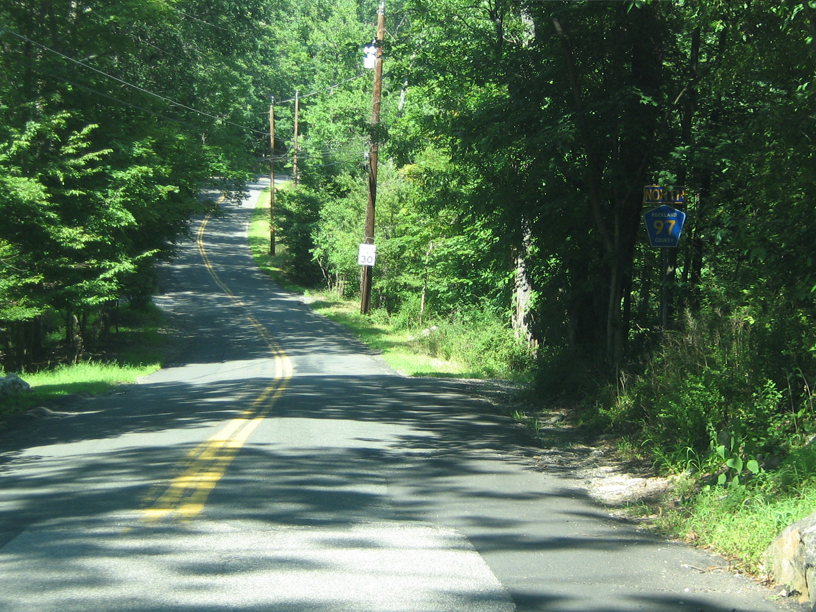
 CR 97 begins here at the start of the yellow lane lines after leaving the village of Sloatsburg.
Johnsontown Road begins just after the overpass for the New York State Thruway on Seven Lakes Drive. The road makes a large curve to the north and begins to parallel Seven Lakes Drive. After a while, a connector road back to Seven Lakes Drive leaves to the right. The road is renamed Stony Brook Drive after this. County Route 97 begins shortly after this point heading parallel to Seven Lakes Drive. No roads intersect CR 97 from this point, as the road goes for a mile, dead ending at a cul-de-sac in Ramapo.[2]
At the northern terminus of CR 97, there are two hiking trails that lead into Harriman State Park. There is the Blue Disc Trail, just before the cul-de-sac and the White Bar Trail, which begins at the northern end of the cul-de-sac.[3]
History
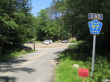 CR 97's northern terminus at the Harriman State Park border
Stony Brook Drive, now Johnsontown Road, begins at Seven Lakes Drive, just after the Thruway underpass.[3] It was once a main park drive that went all the way to Lake Sebago and Little Long Pond. From the 1920s to 1962, maps recognized this street as Stony Brook Drive. The name, after 1962, was changed to Johnsontown Road, named after the old village. The road is now just a 1.6-mile (2.6 km) road that ends at a cul-de-sac.[3]
Major intersections
The entire route is in Rockland County.
Location Mile[1] Destinations Notes Sloatsburg 0.00 Johnsontown Road Southern terminus Ramapo 0.91 White Bar Trail / Blue Disc Trail Cul-de-sac 1.000 mi = 1.609 km; 1.000 km = 0.621 mi See also
References
- ^ a b "Rockland County Inventory Listing" (CSV). New York State Department of Transportation. March 2, 2010. https://www.nysdot.gov/divisions/engineering/technical-services/hds-repository2/INV_2010-03-02_rockland.csv. Retrieved November 6, 2010.
- ^ Google Maps. Overview Map of Rockland CR 97 (Map). http://maps.google.com/maps?f=d&hl=en&geocode=13067224706651141110,41.170901,-74.177113&saddr=Stony+Brook+Dr+%4041.170910,+-74.177140&daddr=41.180204,-74.163465&mrsp=1&sz=15&mra=mi&sll=41.173486,-74.169044&sspn=0.016119,0.029182&ie=UTF8&om=0&ll=41.173486,-74.169044&spn=0.028556,0.058365&z=14. Retrieved September 23, 2007.
- ^ a b c Myles, William J. (1999). Harriman Trails, A Guide and History. New York, New York: The New York-New Jersey Trail Conference.
External links
Categories:- County routes in Rockland County, New York
- Harriman State Park (New York)


Wikimedia Foundation. 2010.